Chatham-Kent Airport
Chatham-Kent Municipal Airport, (IATA: XCM[2], ICAO: CYCK), is located 6 nautical miles (11 km; 6.9 mi) southeast of Chatham-Kent, Ontario, Canada.
Chatham-Kent Airport Chatham-Kent Municipal Airport | |||||||||||
|---|---|---|---|---|---|---|---|---|---|---|---|
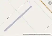 Map of the airport | |||||||||||
| Summary | |||||||||||
| Airport type | Public | ||||||||||
| Owner/Operator | Municipality of Chatham–Kent | ||||||||||
| Location | Chatham-Kent, Ontario | ||||||||||
| Time zone | EST (UTC−05:00) | ||||||||||
| • Summer (DST) | EDT (UTC−04:00) | ||||||||||
| Elevation AMSL | 645 ft / 197 m | ||||||||||
| Coordinates | 42°18′22″N 082°04′54″W | ||||||||||
| Website | www.chatham-kent.ca/.../ChathamAirport | ||||||||||
| Map | |||||||||||
 CYCK Location in Ontario | |||||||||||
| Runways | |||||||||||
| |||||||||||
Source: Canada Flight Supplement[1] | |||||||||||
The Chatham-Kent Municipal Airport is owned and operated by the Municipality of Chatham–Kent. The airport is managed by Z3 Aviation. Several local pilots and businesses are tenants at the airport in the various hangars.
The airport is operational 9 hours per day, 7 days per week and is capable of supporting both VFR) and IFR operations down to 510 ft (160 m) and 1 1⁄2 mi (2.4 km) visibility non-precision approach limits and departures in visibility down to 1⁄2 mi (0.8 km).
Chatham-Kent Municipal Airport was previously identified as CNZ3. This change occurred on September 20, 2012.
References
- Canada Flight Supplement. Effective 0901Z 16 July 2020 to 0901Z 10 September 2020.
- Accident history for XCM at Aviation Safety Network
External links
- Official site
- Page about this airport on COPA's Places to Fly airport directory
- Z3Aviation Chatham-Kent Airport Information and more.
| By name | |
|---|---|
| By location indicator | |
| By province/territory | |
| By area | |
| National Airports System | |
| Related | |
| |
This article is issued from Wikipedia. The text is licensed under Creative Commons - Attribution - Sharealike. Additional terms may apply for the media files.