List of airports in the Edmonton Metropolitan Region

The following active airports serve the Edmonton Metropolitan Region in Alberta, Canada.[1][2] Airports names in italics are part of the National Airports System.[3] Communities in parentheses () indicates the airport is not in a community.

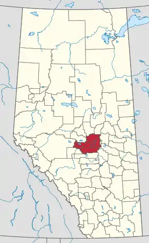
Location of the Edmonton Metropolitan Region in Alberta

Land

Airport name ICAO/TC LID (IATA) Location Coordinates
Edmonton International AirportCYEG (YEG)Nisku, Leduc County53°18′36″N 113°34′46″W
Edmonton/Calmar (Maplelane Farm) AerodromeCMF2Maplelane farm, (Calmar,) Leduc County53°11′04″N 113°44′22″W
Edmonton/Cooking Lake AirportCEZ3South Cooking Lake, Strathcona County53°25′39″N 113°06′58″W
Edmonton/Gartner AirportCFQ7Gartner farm, (Rolly View,) Leduc County53°16′54″N 113°27′18″W
Edmonton/Josephburg AerodromeCFB6(Josephburg,) Strathcona County53°43′41″N 113°05′14″W
Edmonton/Lechelt Field AerodromeCGF2Lechelt farm, (Ardrossan,) Strathcona County53°34′35″N 112°58′51″W
Edmonton/Morinville (Currie Field) AerodromeCCF6Currie farm, (Morinville,) Sturgeon County53°49′11″N 113°45′39″W
Edmonton/Morinville (Mike's Field) AerodromeCMN6Poworoznik farm, (Morinville,) Sturgeon County53°50′13″N 113°33′48″W
Parkland AirportCPL6(Enoch Cree Nation 135,) Parkland County53°28′28″N 113°49′46″W
Edmonton/Twin Island AirparkCEE6Twin Island Air Park, Strathcona County53°28′16″N 113°09′16″W
Edmonton/Villeneuve AirportCZVL(Villeneuve,) Sturgeon County53°40′06″N 113°51′08″W
Edmonton/Villeneuve (Rose Field) AerodromeCRF3Rose farm, (Villeneuve,) Sturgeon County53°38′44″N 113°48′10″W
Stony Plain (Lichtner Farms) AirportCSP3Lichtner farm, (Stony Plain,) Parkland County53°32′15″N 114°04′06″W
Warburg/Zajes AirportCFH8Zajes farm, (Warburg,) Leduc County53°13′04″N 114°20′12″W

Water aerodromes

Airport name ICAO/TC LID (IATA) Location Coordinates
Edmonton/Cooking Lake Water AerodromeCEE7Cooking Lake, (South Cooking Lake,) Strathcona County53°25′22″N 113°06′16″W

Heliports

Airport name ICAO/TC LID (IATA) Location
(by municipality)
Coordinates
Edmonton/BaileyCBY2Bailey's Subdivision, (Sherwood Park,) Strathcona County53°30′28″N 113°14′11″W
Edmonton/Eastport HeliportCEP8Harris estate, Sherwood Park, Strathcona County53°30′18″N 113°19′56″W
Edmonton (City) HeliportCCE7Edmonton53°32′09″N 113°39′49″W
Edmonton/Grey Nuns Community Hospital HeliportCES8Grey Nuns Community Hospital, Edmonton53°27′44″N 113°25′40″W
Edmonton/Kelsonae HeliportCSG6Sunwapta Helicopters, (Devon,) Parkland County53°21′58″N 113°50′16″W
Edmonton/Misericordia (Community Hospital) HeliportCMC2Misericordia Community Hospital, Edmonton53°31′13″N 113°36′40″W
Edmonton/Namao HeliportCYED (YED)CFB Edmonton, Sturgeon County53°40′09″N 113°28′32″W
Edmonton (Royal Alexandra Hospital) HeliportCFH7Royal Alexandra Hospital, Edmonton53°33′28″N 113°29′47″W
Edmonton/St. Albert HeliportCES3Delta Helicopters, (St. Albert,) Sturgeon County53°41′12″N 113°41′14″W
Edmonton/Sturgeon Community HospitalCSA3Sturgeon Community Hospital, St. Albert53°39′16″N 113°37′38″W
Edmonton/University of Alberta (Stollery Children's Hospital) HeliportCEW7University of Alberta Hospital, Edmonton53°31′13″N 113°31′18″W
Fort Saskatchewan (General Hospital) HeliportCSV4Fort Saskatchewan Community Hospital, Fort Saskatchewan53°41′35″N 113°12′37″W
Redwater (Health Centre) HeliportCRW8Redwater Health Centre, Redwater53°56′59″N 113°07′37″W
Redwater (Heliworks) HeliportCRW2Heliworks Aviation, (Redwater,) Sturgeon County53°55′09″N 113°06′15″W
Stony Plain (Westview Health Centre) HeliportCSP2Westview Health Centre, Stony Plain53°32′17″N 113°58′42″W

Former airports

The following airports once served the Edmonton Capital Region, but have since been closed:

Airport name ICAO/TC LID (IATA) Location Coordinates Subsequent use
CFB EdmontonCYED (YED)CFB Edmonton, Sturgeon County53°40′28″N 113°27′41″WAirport was closed in 1994, but continued operation as Edmonton/Namao Heliport
Edmonton City Centre (Blatchford Field) AirportCYXD (YXD)Edmonton53°34′23″N 113°31′1″WAirport closed November 30, 2013. Land to be redeveloped.
Edmonton/St. Albert AirportCES3Snowbird Aviation, (St. Albert,) Sturgeon County53°41′25″N 113°41′37″WAirport was closed in January 2009, but continued operation as Edmonton/St. Albert Heliport
St. Francis AirportCFE6Byrne farm, (St. Francis,) Leduc County53°16′32″N 114°26′59″WAbandoned in 2010

See also

References

  1. Canada Flight Supplement. Effective 0901Z 16 July 2020 to 0901Z 10 September 2020.
  2. Nav Canada's Water Aerodrome Supplement. Effective 0901Z 26 March 2020 to 0901Z 22 April 2021.
  3. National Airports System
This article is issued from Wikipedia. The text is licensed under Creative Commons - Attribution - Sharealike. Additional terms may apply for the media files.