List of airports in the Gulf Islands
This is a list of airports on the Gulf Islands of British Columbia, Canada:[1][2]
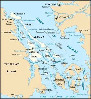
Map showing the location of the Southern Gulf Islands

Gulf Islands
Location in British Columbia
Southern Gulf Islands
The Southern Gulf Islands are those situated between Vancouver Island and the adjoining US and Canadian mainlands.
Northern Gulf Islands
The term Northern Gulf Islands is used for those islands further north within the Gulf of Georgia region, including those close to the mainland to the northwest of Greater Vancouver.
See also
References
- Canada Flight Supplement. Effective 0901Z 16 July 2020 to 0901Z 10 September 2020.
- Nav Canada's Water Aerodrome Supplement. Effective 0901Z 26 March 2020 to 0901Z 22 April 2021.
| By name | |
|---|---|
| By location indicator | |
| By province/territory | |
| By area | |
| National Airports System | |
| Related | |
| |
This article is issued from Wikipedia. The text is licensed under Creative Commons - Attribution - Sharealike. Additional terms may apply for the media files.