List of airports in Yukon

This is a list of airports in Yukon. It includes all Nav Canada certified and registered water and land airports, aerodromes and heliports in the Canadian territory of Yukon.[1][2] Airports names in italics are part of the National Airports System.[3]
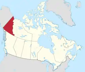
Yukon

List of airports and heliports
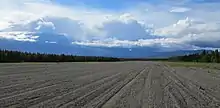
Whitehorse/Cousins Airport
Erik Nielsen Whitehorse International Airport
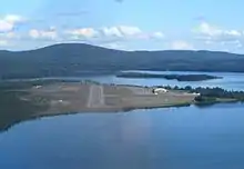
Watson Lake Airport
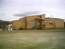
Old Crow Airport
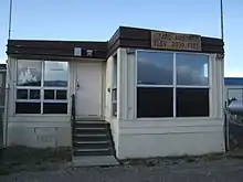
Faro Airport

The list is sorted by the name of the community served, click the sort buttons in the table header to switch listing order.

Community   Airport name   ICAO   TC LID   IATA   Coordinates  
Beaver CreekBeaver Creek AirportCYXQYXQ62°24′37″N 140°52′03″W
Braeburn LodgeBraeburn Airport (Cinnamon Bun Airstrip)CEK261°29′04″N 135°46′35″W
Burwash LandingBurwash AirportCYDBYDB61°22′14″N 139°02′24″W
CarcrossCarcross AirportCFA460°10′27″N 134°41′52″W
CarcrossCarcross Water AerodromeCEB760°11′00″N 134°42′00″W
CarmacksCarmacks AirportCEX462°06′39″N 136°10′42″W
Chapman LakeChapman AerodromeCEZ264°54′13″N 138°16′39″W
Dawson CityDawson City AirportCYDAYDA64°02′32″N 139°07′48″W
Eagle PlainsFinlayson Lake AirportCFT361°41′29″N 130°46′26″W
Eagle PlainsWiley AerodromeCAJ266°29′28″N 136°34′24″W
FaroFaro AirportCZFAZFA62°12′27″N 133°22′33″W
Fort SelkirkFort Selkirk AerodromeCFS362°46′06″N 137°23′05″W
Haines JunctionHaines Junction AirportCYHTYHT60°47′21″N 137°32′44″W
HylandHyland AirportCFT561°31′26″N 128°16′11″W
La Biche RiverLa Biche River AirportCFP660°07′45″N 124°02′55″W
Macmillan PassMacmillan Pass AirportCFC463°10′34″N 130°12′13″W
MayoMayo AirportCYMAYMA63°36′59″N 135°52′06″W
McQuestenMcQuesten AirportCFP463°36′18″N 137°33′49″W
MintoMinto Landing AerodromeCML762°35′38″N 136°52′27″W
Minto MineMinto AerodromeCMN462°36′17″N 137°13′19″W
Ogilvie RiverOgilvie AerodromeCFS465°40′00″N 138°07′00″W
Old CrowOld Crow AirportCYOCYOC67°34′14″N 139°50′21″W
Pelly CrossingPelly Crossing AirportCFQ662°50′15″N 136°31′40″W
Pine LakePine Lake AerodromeCFY560°06′11″N 130°56′01″W
Ross RiverRoss River AirportCYDMYDM61°58′14″N 132°25′20″W
Silver CitySilver City AirportCFQ561°01′44″N 138°24′27″W
TeslinTeslin AirportCYZWYZW60°10′23″N 132°44′30″W
Tincup Wilderness LodgeTincup Lake Water AerodromeCEF961°44′56″N 139°14′45″W
Twin CreeksTwin Creeks AirportCFS762°37′10″N 131°16′13″W
Watson LakeWatson Lake AirportCYQHYQH60°06′59″N 128°49′21″W
Watson LakeWatson Lake Water AerodromeCEJ960°07′00″N 128°47′00″W
WhitehorseErik Nielsen Whitehorse International AirportCYXYYXY60°42′34″N 135°04′08″W
WhitehorseWhitehorse/Cousins AirportCFP860°48′29″N 135°10′38″W
WhitehorseWhitehorse Water AerodromeCEZ560°41′28″N 135°02′13″W

Defunct airports

Community   Airport name   ICAO   TC LID   IATA   Coordinates  
Dawson CityDawson City Water AerodromeCEG764°04′00″N 139°26′00″W
FaroFaro/Johnson Lake Water AerodromeCFC962°12′12″N 133°23′33″W
Haines JunctionHaines Junction/Pine Lake Water AerodromeCFE860°48′10″N 137°29′27″W
TeslinTeslin Water AerodromeCEE960°10′00″N 132°46′00″W

References

  1. Canada Flight Supplement. Effective 0901Z 16 July 2020 to 0901Z 10 September 2020.
  2. Nav Canada's Water Aerodrome Supplement. Effective 0901Z 26 March 2020 to 0901Z 22 April 2021.
  3. National Airports System
This article is issued from Wikipedia. The text is licensed under Creative Commons - Attribution - Sharealike. Additional terms may apply for the media files.