List of airports in the Lower Mainland
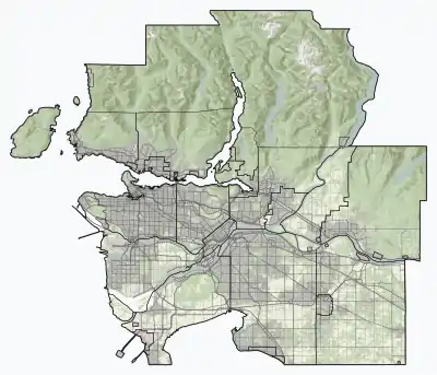
The following active airports serve the Lower Mainland region of British Columbia, Canada, which is to say Greater Vancouver and the Fraser Valley:[1][2]

Lower Mainland
Location in British Columbia

CYVR
CZBB
CAK3
CBQ2
CYNJ
CYPK
CSK8
CAJ8
CYHC
CAM9
CAS4
CBC7
CTK8
CNW9
CAK7
CFR6
CBD2
CSE7
CBK4
CVS3
Locations in Vancouver
Land airports
Scheduled commercial airline service
.jpg.webp)
Vancouver International Airport

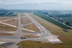
Abbotsford International Airport
_overview.jpg.webp)
Vancouver Harbour Flight Centre

Control tower at Boundary Bay Airport
| Airport name | ICAO/TC LID/IATA | Location | Coordinates |
|---|---|---|---|
| Abbotsford International Airport | CYXX/YXX | Abbotsford | 49°01′31″N 122°21′36″W |
| Vancouver International Airport | CYVR/YVR | Richmond | 49°11′41″N 123°11′02″W |
Other
Former
Water aerodromes
Scheduled commercial airline service
| Airport name | ICAO/TC LID/IATA | Location | Coordinates |
|---|---|---|---|
| Pitt Meadows Water Aerodrome | CAJ8 | Pitt Meadows | 49°12′32.68″N 122°42′31.10″W |
| Vancouver Harbour Flight Centre | CYHC/CXH | Coal Harbour | 49°17′40″N 123°06′41″W |
| Vancouver International Water Airport | CAM9 | Richmond | 49°11′00″N 123°10′00″W |
Other
| Airport name | ICAO/TC LID/IATA | Location | Coordinates |
|---|---|---|---|
| Fort Langley Water Aerodrome | CAS4 | Fort Langley | 49°10′00″N 122°32′00″W |
| Harrison Hot Springs Water Aerodrome | CAE7 | Harrison Hot Springs | 49°18′00″N 121°46′00″W |
Former
| Airport name | ICAO/TC LID/IATA | Location | Coordinates |
|---|---|---|---|
| Mission Water Aerodrome | CAY7 | Mission | 49°08′00″N 122°18′00″W |
Heliports
Scheduled commercial airline service
| Airport name | ICAO/TC LID/IATA | Location | Coordinates |
|---|---|---|---|
| Vancouver/Harbour (Public) Heliport | CBC7 | Downtown Vancouver | 49°17′13″N 123°06′22″W |
Other
See also
References
- Canada Flight Supplement. Effective 0901Z 16 July 2020 to 0901Z 10 September 2020.
- Nav Canada's Water Aerodrome Supplement. Effective 0901Z 26 March 2020 to 0901Z 22 April 2021.
This article is issued from Wikipedia. The text is licensed under Creative Commons - Attribution - Sharealike. Additional terms may apply for the media files.