Chempanthotty
Chempanthotty is a part of Sreekandapuram municipality in Taliparamba tehsil, Kannur district, Kerala state, republic of India. Settlements are said to have started here from 1930s (approximate)
Chempanthotty | |
|---|---|
village | |
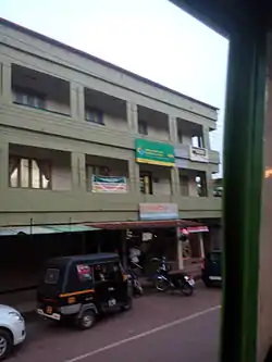 Chempanthotty town | |
 Chempanthotty Location in Kerala, India  Chempanthotty Chempanthotty (India) | |
| Coordinates: 12.089844°N 75.493669°E | |
| Country | |
| State | Kerala |
| District | Kannur |
| Taluk | Taliparamba |
| Government | |
| • Body | Sreekandapuram Municipality |
| • Parish Priest | Rev.Fr.Emmanuel Poovathin |
| Languages | |
| • Official | Malayalam, English |
| Time zone | UTC+5:30 (IST) |
| PIN | 670631 |
| Telephone code | +91460 |
| ISO 3166 code | IN-KL |
| Vehicle registration | KL-59 |
Chempanthotty is located 21 km away from Taliparamba in Kannur district. The geography and landscape of Chempanthotty is featured with terrains and hilly distributions.
People living in Chempanthotty are mostly migrated from Kottayam, Pala and Ernakulam ( Central Travancore) as the part of mass migration (Kudiyettam) took place in 1944.
St. George Syro-Malabar Christian Catholic Church Established in 1954 (blessed by Mar Sebastian Valloppilly) is located in the heart of the village on a small hill. There are also two convents in the village: F. C. Convent (founded 1959) and C. S. N. Convent (founded 2001). Gurukulam is situated at Pallam. A shopping complex opened in Chempanthotty in 1993 operated by Parish. Church Website
Hard working Christian migrants turned chempanthotty to a high crop yielding land. Hard working people of chempanthotty never gives up in giving better education to their children. At least one person from each family has been working abroad and contribute substantial foreign exchange and development to this society.
Chempanthotty means 'Land of red soil' derived from following words " chemman" (red soil) and "Thotty" (land). Land is supporting to grow predominantly rubber, pepper, cashew, coconut, mango and vegetables.,
History
The modern history of this town starts with the arrival of migrants from south Kerala during the 1930s. The hard work of the migrants made Chempanthotty a big town with almost all the facilities to meet the basic needs of its population. Now the town has become a hub of action.
Economy
The mainstay of the people of this place is agriculture. With the hike in price of rubber, the economic condition of most of the families has improved. The main crops grown are rubber, coconut, pepper, cashew, tapioca, arecanut, and other plantation crops.
Rubber occupies the largest area among plantation crops. Next to rubber, coconut is the most popular crop. Cashew is yet another important plantation. Arecanut stands in the fourth place Among spices, pepper occupies an important place. Pepper is mostly grown as an inter-crop with coconut, arecanut and various fruit trees. In the hilly surroundings of Chempanthotty like Sreekandapuram and Naduvil, the inter-cultivation is done with rubber and cashew. But now the scene is slowly changing. Now a number of youngsters seek employment in gulf countries and in other cities of India.
Climate
Chempanthotty has a humid climate with an oppressive hot season from March till the end of May. This is followed by the South-West monsoon which continues till the end of September. October and November are the months for the North East Monsoon or Thulamazha. It is very pleasant in December, January and February.
Villages and Sububrs
- Thopilayi: Thoppilai falls between Chuzhali and Chempenthotty. If you want to travel quickly to Taliparamba the easiest way is to take the Thoppilai route. There are more than 500 families in this area. Mostly, they are Christians and fall under the Chempenthotty Forona Church. Thoppilai is a hilly terrain with rubber, coconut, jackfruit trees, cashew trees and other spices. People are educated and most of the family has at least one member working overseas mostly in the middle east. Kakkandam Para is the tableland towering the Thoppilai gives complete view of neighboring areas and hills at a glance and it consisting many caves believed to be the hiding place of Tippu Sultan during the British era.
- Koronagodu: There is a shrine of Saint Antony at Kokkai. The kokkai river borders the two panchayats of Naduvil and Sreekandapuram. Most inhabitants of kokkai are successful migrants from Mid travancore.
Important Landmarks
- St. George's High School, established in 1979
Transportation
The national highway passes through Taliparamba town. Mangalore, Goa and Mumbai can be accessed on the northern side and Cochin and Thiruvananthapuram can be accessed on the southern side. Taliparamba has a good bus station and buses are easily available to all parts of Kannur district. The road to the east of Iritty connects to Mysore and Bangalore. But buses to these cities are available only from Kannur, 22 km to the south. The nearest railway stations are Kannapuram and Kannur on Mangalore-Palakkad line. Trains are available to almost all parts of India subject to advance booking over the internet. There are airports at Kannur, Mangalore and Calicut. All of them are small international airports with direct flights available only to Middle Eastern countries.