Sreekandapuram
Sreekandapuram is a municipality in Kannur district, in the Indian state of Kerala.[4]
Sreekandapuram | |
|---|---|
Municipality | |
 Sreekandapuram Location in Kerala, India  Sreekandapuram Sreekandapuram (India) | |
| Coordinates: 12.0451°N 75.5074°E | |
| Country | |
| State | Kerala |
| District | Kannur |
| Taluk | Taliparamba |
| Government | |
| • Body | Municipal council |
| Area | |
| • Total | 68.72 km2 (26.53 sq mi) |
| Elevation | 31 m (102 ft) |
| Population | |
| • Total | 33,849 |
| • Density | 490/km2 (1,300/sq mi) |
| Languages | |
| • Official | Malayalam, English |
| Time zone | UTC+5:30 (IST) |
| PIN | 670631 |
| Telephone code | 0460 |
| ISO 3166 code | IN-KL |
| Vehicle registration | KL-59 |
| Assembly constituency | Irikkur |
| Lok Sabha constituency | Kannur |
| Civic Agency | Municipality |
Location
The town is located on the bank of the Valapattanam river which flows into Arabian sea. It is situated 33 kilometres (21 mi) northeast of Kannur, 20 kilometres (12 mi) east of Taliparamba and 27 kilometres (17 mi) northwest of Iritty.
History
Sreekandapuram was historically ruled by the Mushika Kingdom.
The travels of Abraham Ben Yiju, a Jewish merchant who lived in Mangalore in the 1130s and 1140s, included a visit to Sreekandapuram, which he knew as Jurbattan.[5]
Administration
Sreekandapuram established as a Municipality on 1 November 2015 which consist of 30 wards. The municipal office is situated in the town, on the banks of Valapattanam River. The current Municipal chairman is Sri Ragavan.
Geography
The nearest places to Sreekandapuram town are the towns of Taliparamba, Iritty, Irikkur,and Mayyil and the villages of Chempanthotty, Eruvessi, and Chengalayi.
The longest suspended rope bridge in Kannur district is situated at Kanhileri village, crossing the Valapattanam River, a major irrigation project is underway at Madampam. Work on a bridge across the river at Madampam is also in progress.
Religion
The town of Sreekandapuram has a mixed population of Hindus, Muslims and Christian.
A popular Hindu temple in the panchayat is the historic Ammakoottam Mahadevi temple. The temple was looted and destroyed by Tipu Sultan, and nothing remained of it but earth and stones covered by bushes up until the 1970s. The land on which it stood was owned by the local Muslim community leader, and when people living around the temple claimed to have witnessed the Devi's presence, it was handed over to local Hindu community leaders and a new temple was built.
Another important temple is the Sree Mahavishnu Temple located at Kottoor, 18 kilometres (11 mi) away from Sreekandapuram near Iritty-Taliparamba state highway. This temple is said to be over 600 years old and is also said to have been destroyed by Tipu Sulthan. It was later rebuilt. It is one among the rare Lord Vishnu temples which face the west direction with 'vatta sreekovil'.'Punarprathishta Mahotsava' is celebrated every year in the first week of March.
Thrikkadamba Sri.mahavishnu temple was also destroyed by Tippu and it is under reconstruction now. It is 4 kilometres (2.5 mi) away from Sreekandapuram town in Taliparamba-Iritty highway. LordShiva and Vishnu are equally worshiped here. Vayakkara KAVUis another important place to visit in Sreekandapuram municipality. It is one of the important ecological places in the area. Vana sasthav is the idol of the 'kavu' and people pay their offerings there in high devotion.
The Malik Dinar mosque is situated at Pazhayangadi, 18 kilometres (11 mi) from the town, and the Pazhayangadi Manna is 2 kilometres (1.2 mi) out of town on the Payyavoor Road.
Kunnathoorpadi Temple
Kunnathur Padi is the historic center for the folk Hindu deity Sree Muthappan. The center stands in the Kannur District of the Kerala state of India, 3,000 feet (910 m) above sea level, on top of Udumbumala in the Sahyadri mountains. The Kunnathur Padi festival is conducted here, but no temple exists for Sree Muthappan. The festival takes place in a natural setting, as it is believed that Sree Muthappan said, "Fallen leaves, a spring, a large mountain, a round stone, forest and palm trees are enough for me." During the festival season, a temporary Madappura is erected, called Sreekovil, in the middle of the forest. There are a glade and a cave in the middle of the forest. On the west side of the Madappura are a stone, a rock stand, and a mud platform. On each side of the cave, there is a palm tree. On the north side, there is a spring called Thiruvankadavu. Beyond that is Aadipadi.
Educational Organizations

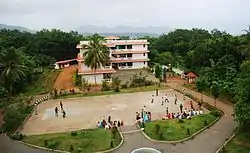
- Madampam P.K.M college
- Government Higher Secondary School Nedungome, 6 km from Sreekandapuram town, 5 km from Payyavoor town
- Marygiri Senior Secondary School at Podikalam, 2 kilometres (1.2 mi) from Sreekandapuram town
- Maryland High School, at Madampam
- S.E.S College, Sreekandapuram
- Government Higher Secondary School Sreekandapuram
- Sal Sabeel Public School Sreekandapuram [CBSE]; 1.5 kilometres (0.93 mi) from Sreekandapuram town
- Vimal Jyothi Engineering and MBA college Chemperi
- Mapila A.L.P School Sreekandapuram
Transportation
State Highway SH 36 passes through Sreekandapuram town which connects Taliparamba and Iritty. The road towards the east connects to Mysore and Bangalore and other parts of Karnataka.
National Highway (NH 66) passes through Taliparamba town. Mangalore and Mumbai can be accessed on the northern side and Cochin and Thiruvananthapuram can be accessed on the southern side.
The nearest railway station is 34 kilometres (21 mi) away Kannur railway station on Mangalore-Palakkad line.
The nearest airport is Kannur International Airport of about 25 kilometres (16 mi) South.
Suburbs and Villages
- Nediyanga
- Chempanthotty
- Kaniyarvayal
- Madampam
- Nedungome
- Kavumbayi
- Kottur
References
- http://www.kudumbashree.org ›
- https://elevationmap.net ›
- http://www.kudumbashree.org ›
- http://www.trend.kerala.gov.in
- Amitav Ghosh, In an Antique Land (Gurgaon: Penguin Random House India, 2009) [first publ. Ravi Dayal 1992); ISBN 9780143066491, pp. 233-35.
| Wikimedia Commons has media related to Sreekandapuram. |