Mayyil
Mayyil is a Grama Panchayat in Kannur District of Kerala State, established in 1962 by merging the villages of Kayaralam, Mayyil and Kandakkai. It belongs to Irikkur block and Taliparamba assembly constituency.[1]
Mayyil | |
|---|---|
Town | |
 Mayyil Location in Kerala, India  Mayyil Mayyil (India) | |
| Coordinates: 12.04°N 75.46°E | |
| Country | |
| State | Kerala |
| District | Kannur |
| Taluk | Taliparamba |
| Government | |
| • Body | Grama panchayat |
| Area | |
| • Total | 33.08 km2 (12.77 sq mi) |
| Elevation | 45 m (148 ft) |
| Population (2011)[1] | |
| • Total | 29,649 |
| • Density | 900/km2 (2,300/sq mi) |
| Languages | |
| • Official | Malayalam, English |
| Time zone | UTC+5:30 (IST) |
| PIN | 670602 |
| ISO 3166 code | IN-KL |
| Vehicle registration | KL59 |
| Nearest city | Kannur |
| Assembly constituency | Taliparamba |
| Lok Sabha constituency | Kannur |

Location
Mayyil is situated 20 km North East of District HQ Kannur, 13 km South East of Taliparamba, 20 km North West of Mattannur, 13 km South West of Sreekandapuram and 16 km West of Irikkur.
Educational institutions
- IMNS GHSS, Mayyil
- MAYYIL ALP School, Mayyil
- Institute of Technology, Mayyil
- ITM Arts & Science College, Mayyil
- Kayaralam AUP School
- Kayaralam North ALP School
- ITM Public School, Mayyil
- Mayyil Teacher Training Institute, Mayyil
- Mullakkodi AUP School, Arimbra, Mullakkodi
- Mullakkodi LP School, Mullakkodi
- Kandakkai K V A L P school, Kandakkai
- Kandakai LP School, Kandakai
- Thayampoyil ALP School, Thayampoyi
- Perumachery AUP school, Perumachery
- Pavannur ALP School, Pavannur
- Peruvangoor ALP School, Peruvangoor
- Spangle Academy, Professional Training, Kambil
- Cherupazhassi ALP School, Cherupazhassi
Temples
- Velam maha ganapathi temple
- Chekiyattu sree darmashata temple
- Chekiyattu sree maha vishnu temple
- Nechikottu kavu, Kayaralam
- Chalagottu kavu, Kandakkai
- Arimbra Subhramanya Temple
- Sree Puthiya Bhagavathi Kaavu, Kaavinmoola
- Kandanaar Poyil Sree Muchilott Bhagavathi Kshethram, Cherupazhassi
- Kadoor Sree Ganapathi Shethram, Kadoor
- Udayam kottam shiva kshethram, kadoor ambalam
- Nambram Sree Muchilott Bhagavathi Kshethram, Naniyoor Nambram
- Kandakkai Kunnummal Muthappan Madappura
- Karonnan Kottam, Kayaralam
- Thalakkott Muchilott Kavu
- Thrikapaleswaram Sree Durga Devi Kshethram, Cherupazhassi
Transportation
The national highway(NH 66) passes through Puthiyatheru (15km South West), Dharmasala (11Km West), Taliparamba (13Km North West) away from Mayyil Town. Goa and Mumbai can be accessed on the northern side and Cochin and Thiruvananthapuram can be accessed on the southern side. The road to the east of Iritty connects to Mysore and Bangalore. The nearest railway station is Kannur on Mangalore-Palakkad line. Trains are available to almost all parts of India subject to advance booking over the internet. There are airports at Mattanur, Mangalore and Calicut. All of them are international airports but direct flights are available only to Middle Eastern countries. Newly inaugurated Kannur International Airport (Mattannur) is 22 kms away from Mayyil, and the proposed 4 line airport road from Taliparamba to Mattannur passes through Mayyil.
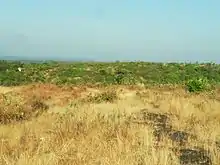
Geography
Mayyil is surrounded by around half of its boundary by Valapattanam river.
Libraries
Almost every road in this grama panchayat in Kerala’s Kannur district leads to or ends with a library. The panchayat, which has a population of a little over 30,000 people in 33.08 sq km with a literacy rate of 97.93 percent, boasts 34 functioning libraries, arguably the highest for a local body in the country.
References
- "പഞ്ചായത്ത് വകുപ്പ് | പഞ്ചായത്ത് വകുപ്പ്". dop.lsgkerala.gov.in.