Farkhar District
Farkhar District is a district of Takhar Province, Afghanistan. It is located southeast of Taloqan. The Khanabad River flows inside this valley. Around 99% of the people in Farkhar speak Persian. Farkhar has about 50000 people and 75 villages.
Farkhar District | |
|---|---|
 Location of Farkhar in Takhar Province | |
| Coordinates: 36.57°N 69.857°E | |
| Country | |
| Province | Takhār Province |
| Government | |
| • Governor | Abdul Rashad Asfeia |
| Area | |
| • District | 1,214 km2 (469 sq mi) |
| Population (2019)[3] | |
| • District | 52,117 |
| • Density | 43/km2 (110/sq mi) |
| • Urban | 3,023 |
| • Rural | 49,094 |
| Ethnicity | |
| • Tajik | 94% |
| • Hazara | 5% |
| • Other | 1% |
| Time zone | UTC+4:30 (Afghanistan Standard Time) |
| Post code | 3752 [5] |
Etymology
The name Farkhār is generally believed to be the Sogdian (and possibly also Khwarazmian) βṛγʾr, the equivalent of the Sanskrit word vihāra (a Buddhist monastery), which it renders in translations of Buddhist texts.[6][7] Another view is that it is not etymologically connected with vihāra but is a Persian word, originally *paru-khuvāthra "full of happiness".[8]
Although Buddhism was eventually replaced by Islam in northern Afghanistan around the 8th century,[9] as late as the 11th-century the Khwarazmian scholar al-Biruni was able to write in a discussion of Buddhists: "their monuments, the bahārs of their idols and their farkhārs, are visible on the borders of Khorasan adjacent to India".[10]
Geography
Farkhar has an area of 1214 kilometers, comparatively equivalent to the area of South Andaman Island.[11] The district has no major roadways. The Farkhar River is the main river of Farkhar, with other tributaries flowing into it.
Farkhar is surrounded by Kalafgan District to the north, Kishim District to the northeast, Tagab District to the east, Warsaj District to the south, Namak Ab District to the west, and Taluqan District to the northeast. Kishim is located in Badakhshan Province, with all other districts in Takhar Province.[12]
Climate
| Climate data for Farkhar | |||||||||||||
|---|---|---|---|---|---|---|---|---|---|---|---|---|---|
| Month | Jan | Feb | Mar | Apr | May | Jun | Jul | Aug | Sep | Oct | Nov | Dec | Year |
| Average high °C (°F) | 6.4 (43.5) |
8.2 (46.8) |
13.7 (56.7) |
18.9 (66.0) |
24.4 (75.9) |
31.9 (89.4) |
34.2 (93.6) |
33.5 (92.3) |
28.8 (83.8) |
22.0 (71.6) |
14.5 (58.1) |
8.4 (47.1) |
20.4 (68.7) |
| Average low °C (°F) | −3.7 (25.3) |
−1.6 (29.1) |
3.1 (37.6) |
7.7 (45.9) |
11.1 (52.0) |
15.8 (60.4) |
18.2 (64.8) |
17.1 (62.8) |
12.0 (53.6) |
7.4 (45.3) |
2.0 (35.6) |
−1.7 (28.9) |
7.3 (45.1) |
| Average precipitation mm (inches) | 43 (1.7) |
83 (3.3) |
110 (4.3) |
121 (4.8) |
74 (2.9) |
4 (0.2) |
4 (0.2) |
1 (0.0) |
1 (0.0) |
19 (0.7) |
30 (1.2) |
42 (1.7) |
532 (20.9) |
| Source: Climate data | |||||||||||||
Demographics
Farkhar has a population of 52117, with a sex ratio of 26 males for every 25 females. The district has a large Uzbek majority with a small Hazara minority.[4] The median age is 15.8 and about 42% of the population is working. About 18% of the unemployed are seeking work. There are about 8000 households in the district, with an average size of 6.5 people.[13]
Villages
The villages of this district include and are not limited to: Shaktan, Shingan, Nahr Ab, Dasht e Robat, Abi Dara, Kurani, Pire Farkhar, Shori, Dehak, Jangle Gaza, Dasht e Konj, Chashma e Garmuk, Shahre Farkhar, Kundal, Mazre Shikh, Khanaqa, Khurmab, Ardishan, Kashan, Sare Kham, Singan, Pyani, Dahne Zure, Khafdara, Sang e Atash, Khawaki, Farhangurd, Khusdeh, Darbaho, Huti, Warook, Ghashob, Yookh, Lujdeh and Mashtan.[12]
In Persian poetry
In Persian poetry, the phrase بت فرخار bot-e Farxār "buddha of a temple" or "idol from Farkhar" became proverbial for a beautiful person. One of the earliest poets to use it was Manuchehri, an 11th-century poet at the court of Mas'ud I of Ghazni, who wrote:[14]
- هنگام بهارست و جهان چون بت فرخار
- hengām-e bahār ast o jahān čun bot-e farxār
- "It is springtime and the world is like an buddha of Farkhar"
In another example the poet Khwaju (or Khaju) (d. 1352), praising a handsome Turk, writes:[15]
- شیراز ترکستان شده کان بت ز فرخار آمده
- Šīrāz Torkestān šode k'ān bot ze Farxār āmade
- "Shiraz has become Turkistan since that "buddha" came from Farkhar"
References
- Hedayatullah (11 September 2020). "Development projects in Takhar improve access to public services". Salaam Times. Retrieved 6 October 2020.
- "Summary of the District Development Plan: Farkhar District" (PDF). mrrd-nabdp.org. Retrieved 19 July 2020.
- "Estimated Population of Afghanistan 19-20" (PDF). nsia.gov.af. p. 29.
- "Farkhar District Profile" (PDF). aims.org.af. June 2002. Archived from the original (PDF) on 4 March 2016. Retrieved 5 September 2020.
- "Farkhar, Afghanistan Postal Codes". worldpostalcode.com. Retrieved 19 July 2020.
- Buddhism in Islamic times Encyclopaedia Iranica.
- Émile Benveniste, Études sogdiennes (Wiesbaden 1979), pp. 22–23 (cited in Anna Akasoy, Charles S. F. Burnett, Ronit Yoeli-Tlalim (eds.) Islam and Tibet: Interactions Along the Musk Routes p. 68).
- V. F. Minorsky, V. V. Barthol'd, C. E. Bosworth (1982), Hudud al-'Alam 'The Regions of the World' - A Persian Geography 372 A.H ..., p. 263, citing Benveniste, Bull. Soc. Ling, 1928, xxi, 7–8.
- Buddhism i. In Pre-Islamic Times/ Encyclopaedia Iranica.
- Quoted in Anna Akasoy, Charles S. F. Burnett, Ronit Yoeli-Tlalim (eds.) Islam and Tibet: Interactions Along the Musk Routes p. 68.
- "Islands by Land Area". islands.unep.ch. 1998. Retrieved 5 September 2020.
1210.7 sq.km. South Andaman
- "Afg: Takhar Province - Reference Map | HumanitarianResponse". www.humanitarianresponse.info. Retrieved 5 September 2020.
- "Takhar Socio-Demographic and Economic Survey". UNFPA Afghanistan. 5 January 2017. Retrieved 5 September 2020.
- Manuchehri, "A description of spring, in praise of Khwaje Ali ibn Mohammad". (Ganjur).
- See further Domenico Ingenito (2018): "Hafez’s "Shirāzi Turk": A Geopoetical Approach" (also ), Iranian Studies, p. 17.
Further reading
- Grötzbach, Erwin F. (1999). Farḵār. Encyclopaedia Iranica online.
| Districts | 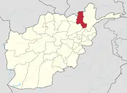 | |
|---|---|---|
| Populated Places | ||
| Other | ||