Genlis, Côte-d'Or
Genlis (French pronunciation: [ʒɑ̃.lis]) is a commune in the Côte-d'Or department in eastern France. The 20th-century archaeologist Jean Charbonneaux (1895–1969) was born in Genlis.
Genlis | |
|---|---|
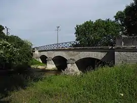 Bridge over the Tille | |
.svg.png.webp) Coat of arms | |
Location of Genlis 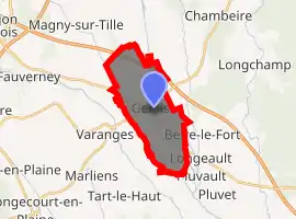
| |
 Genlis  Genlis | |
| Coordinates: 47°14′30″N 5°13′26″E | |
| Country | France |
| Region | Bourgogne-Franche-Comté |
| Department | Côte-d'Or |
| Arrondissement | Dijon |
| Canton | Genlis |
| Intercommunality | Plaine Dijonnaise |
| Government | |
| • Mayor (2020-2026) | Martial Mathiron |
| Area 1 | 12.08 km2 (4.66 sq mi) |
| Population (2017-01-01)[1] | 5,315 |
| • Density | 440/km2 (1,100/sq mi) |
| Time zone | UTC+01:00 (CET) |
| • Summer (DST) | UTC+02:00 (CEST) |
| INSEE/Postal code | 21292 /21110 |
| Elevation | 193–205 m (633–673 ft) |
| Website | www.mairie-genlis.fr |
| 1 French Land Register data, which excludes lakes, ponds, glaciers > 1 km2 (0.386 sq mi or 247 acres) and river estuaries. | |
Geography
The city of Genlis is located in the Côte-d'Or department in Bourgogne-Franche-Comté region and belongs to the Dijon arrondissement and Genlis canton. Genlis is situated 10 miles (16 km) southeast of Dijon. The closest villages are: Varanges at 1.41 mi (2.27 km), Beire-le-Fort at 1.77 mi (2.85 km), Labergement-Foigney at 1.80 mi (2.90 km), Longeault at 2.10 mi (3.38 km), Tart-le-Bas at 2.37 mi (3.81 km). All villages are in Côte-d'Or. Genlis has an elevation of 653 ft (199 m). Its area is 4.66 sq mi (12.1 km2), its population density is about 439.98/km2, and the geographical coordinate are 47.241°N 5.221°E.
The Tille and Norges rivers are the main waterways crossing Genlis. There is also the Creux-Jacques stream.
Population
|
|
Twinning
Genlis is twinned with two other European cities:
 Sprendlingen, in Germany
 Bogdanesti, in Romania[2]
History
Etymology and toponymy of Genlis
In 867, Genlis was written Gediacensis finis, a spelling which probably originates from the Gallo-Roman name Aegidius or Genelius, the ancestor of the French first name Gilles because the Greek "D" often turns into an "L" in Latin.[3]
The city of Genlis was not historically referred to by its modern name. Cartularies, including those of the Saint-Bénigne abbeys (future cathedrals), Tart, Clairvaux, and Cîteaux; chronicles, such as those of Bèze and Saint-Bénigne; and departmental archives all give details on the name's evolution over time. During Carolingian times, Genlis was called Getliacus. It was then called Gediacnesis finis in 867, Gliniacensis finis (868), Janlint (~1060), Genliacensis finis (11th century), Genlé/Genleium (1132), Genleio (1180), Janlée (1191), Jamleium (1234), Genlliacum (1235), Janli (1236), Genllé (1238), Janleium (1248), Genlerum (1249), Janlé (1260), Janleyum (1297), Genleyum (1285), Janley (1290), Jenlleium (1297), Jamley (1360), Jamleyum (14th century), Janly (1498), Janlis (1637), Jenlis (1666), Janlys (1679), Jeanlis (1685), Jeanly (1728), and Genlis/Janly in 1783. The name Genlis seems to have disappeared by the end of the 18th century.[4]
First written account
The first written account that mentions Genlis dates back to approximately 866. It is referred to as Finis Genliacensis (area of Genlis) in the chronicles of Saint Bénigne during a "malle" or "placite" held in Lux. A placite was a public political assembly gathering the main civil servants, such as bishops, counts, and abbots, who were the King's advisors. These events were held in May or October.[5]
The second oldest reference to Genlis was made around 1060. Berno, from Genlis, gives Saint-Pierre de Bèze a property he owns in the Coriant village (which has since disappeared), keeping incomes for him all his life. He is a farm owner (villicus Janlint Villae), not a lord, as emphasized in the Latin deed:
Notum sit omnibus praesentibus et futuris, quod Berno villicus Janlint Villae, quoddam alodum juris sui, quod jacet in villa Coriaut dicta, ea condicione dedit S. Petro, et propria manu super altare misit, ut ipsius alodi usuarium fructum retineret tempore vitae suae : post discessum vero vitae ad locum sancti Petri rediret cum omni integritate. Hujus donationis, quam viva voce fecit, vivos testes adhibuit; quorum nomina haec sunt : Odilo Praepositus, Rodulfus, Dado, Aldo, Ewardu.[6]
Roman and Gallo-Roman eras
The Genlis site has been occupied since the time of the Romans. A hidden post that would be the starting point of a Roman road, also called Chemin des Romains or Brunehau roads, proves the Romans had a military presence in the area.[7] In 1973, a Gallo-Roman villa was found by aerial search.
"Inside of the Gallo-Roman castrum, recognized thanks to its angle towers and its double surrounding walls, singular buildings disseminated marks, most of them composed of a unique room, appeared into irregular lines from modern times. These buildings would be rural establishments close to the fortress".[8]
The Chemin des Romains linked Genlis to Arceau. On this part of the road, several archaeological discoveries were made, such as at Izier, Cessey-sur-Tille, Bressey-sur-Tille and Arc-sur-Tille.[9] Arc-sur-Tille was the intersection of the Roman road coming from Genlis and the road leading from Besançon-Alise-Sainte-Reine to Alise. A bronze statuette of the high-empire and two statuettes of Mercury were found during excavations. Bressey-sur-Tille was located on the road to Arcelot to the north and Genlis to the south.[10] Finally, the Chemin des Romains linked the nearby Arceau village to Dijon and Mirebeau.[11]
Archaeological digs of the areas "le Johannot" and "la Voie Romaine" (located between Genlis and Izier) revealed artifacts dating from the Final Tène.[12] The Gallo-Roman period is represented by remains of a cremation necropolis (1 AD) located on "le Johannot". Several vases and pieces of Gaulish currency were found at the edge of "la Voie romaine".[13] Gaulish ceramic and amphora shards from 1 AD were discovered in a ditch between the sites, and the remains of a Merovingian village were also found nearby.[14]
Merovingian Genlis
In the early 1990s, the planning works of Highway A39 Dijon-Dole unearthed the ruins of a Merovingian village in "le Johannot" and "la Borde". These digs revealed the existence of twenty-nine wooden semi-buried rectangular buildings called "bottoms of huts". Their sizes vary from 1.80 to 3.30 meters (5.9 to 10.8 feet) in length, 1.70 to 3.60 meters (5.5 to 11.8 feet) in width and areas approximately 4 to 8 m2 (43 to 86 sq ft). They served a variety of purposes, including "storehouses, storages, shelters for small animals" and "handmade workshops (weaving, metalworking, bronze or bones works)".[15]
Other kinds of buildings were identified as houses by the remains of several pole holes. These homes differed in shapes and dimensions. Additional small structures are thought to be granaries on stakes, silos that "showed samples of rye, wheat seeds, elderberries, pear tree, millet, cabbage, [and] black nightshade but also wild plants, reflecting pictures of cultivated and meadow (fodder crops) surfaces". These Genlisians from the 7th century were growers and farmers, confirmed by barns of cows, pigs, goats, poultry and horses. The last structures visible are ditches, fences and pathways.
Three graves were found during the digs. The first contained the skeleton of a "young male adult measuring approximately 1.66 meters (5.4 feet). [...] The second individual was buried in the same position, about 30 to 40 meters (98 to 131 feet) from the first one. He was an old adult [...]. Several degenerative wounds of a kind of arthrosis was observed, mostly in the vertebras. [...] The subject was wearing a plated iron buckle which seems to be dating from the early 7th century. A third person was pulled out [...]. He was a young male teenager [...] and was wearing a bronze buckle from the 6th century."
"Within the excavated items, we could have found ceramic shards of tumblers, bowls, cooking pots, jugs and vases. Metallic furnitures included nails, a small bell, a twisted poker, knives, etc."
Feudal era
From the feudal era until the French Revolution, which would remove its benefits, the territory of Genlis was a seigneury. In the 18th century, Abbott Courtépée, in his Description générale et particulière du Duché de Bourgogne, narrates that under the Old Regime, Genlis was also a parish of the Châlon-sur-Saône diocese under the archpriest of Mailly, the patronage of Saint Martin and patronage of Saint-Vivant priory. From a feudal point of view, the Genlis seigneury was a back-fiefdom because it was part of the Mirebeau seigneury, then marquisate, where lords pledged homage to the Duke of Burgundy. Huchey was part of Genlis, and Athée and Magny close to Auxonne were attached to Genlis.[16] In the 18th century, Genlis counted 80 burners and 400 communicants, as well as Huchey. The market was held on Thursday and two fairs per year.[16]
Feudal marks are, for instance, the fortified manor house – then castle – of Genlis, as well as many rights and privileges that lords were benefiting. Janly lords and the people that owned properties in Genlis were also benefiting rights and privileges.
Homage
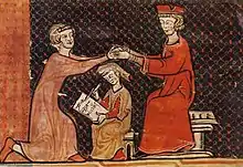
The hommage[17] was demanded between the suzerain and the vassal to ensure stability and peace. So in 1340, the venerable Father Pouçard, abbott of Saint-Étienne de Dijon and owner in Genlis, got the homage of Symon, along with Raymond de Chailly and Jean Cultivier, of the Dijon church and tabellion juror, who admitted he "owned a fief by his wife name, of the aforementioned abbott the meadows he owns in an isle of the Janley area, which are linking fields of the abbott, and about these meadows as monastery fiefdom, Symon, as vassal and man of the abbott on behalf of the monastery, pledged faith and homage of the kiss that the abbott gave to him on the mouth, in accordance with the tradition, promising him loyalty. Done, the abbott asked to establish an official act that would be sealed with the Langres church seal".
Transportation
The commune has a railway station, Genlis, on the Dijon–Vallorbe line.
Notes
See also
References
- "Populations légales 2017". INSEE. Retrieved 6 January 2020.
- http://www.annuaire-mairie.fr/ville-genlis.html
- Taverdet, Gérard. Les Noms de lieux de Bourgogne. La Côte-d'Or. Fontaine-les-Dijon: Centre Régional de Documentation Pédagogique de Dijon et l'Association Bourguignonne de Dialectologie et d'Onomastique (A.B.D.O.), 1976.
- Roserot, Alphonse. Dictionnaire topographique du département de la Côte-d'Or comprenant les noms de lieux anciens et modernes. Paris: Librairie Nationale, 1924. 181-82.
- Baldou, Maurice (1958). Genlis (Côte-d'Or) : monographie du village, découvertes gallo-romaines, l'église, le château, Uchey, Jeanniot (in French). Dijon, Bibliothèque Municipale de Dijon.
- Bougaud, E et Garnier, Joseph. Les Chroniques de l'abbaye de Saint-Bénigne de Dijon. Dijon : Darantière, 1875. 357.
- Liénard, Félix. Voies romaine du département de la Côte d’Or et Répertoire archéologique des Arrondissements de Dijon et de Beaune publiés par la commission des Antiquités du Département de la Côte d’Or. Dijon et Paris : Lamarche & Didron, 1872. 80
- David J. et Goguey René. "Les Villas gallo-romaines de la vallée de la Saône découvertes par prospection aérienne". Revue archéologique de l'Est et du Centre-Est. XXXIII. 2-3-4. (décembre 1982) : 161.
- Voies Romaines du département de la Côte d’Or et Répertoire Archéologique des Arrondissements de Dijon et de Beaune publiés par la commission des Antiquités du Département de la Côte d’Or. Dijon et Paris : Lamarche & Didron, 1872. xli.
- Voies romaines du département de la Côte d’Or et Répertoire Archéologique des Arrondissements de Dijon et de Beaune publiés par la commission des Antiquités du Département de la Côte d’Or. Dijon et Paris : Lamarche & Didron, 1872. 57.
- Voies romaines du département de la Côte d’Or et Répertoire archéologique des Arrondissements de Dijon et de Beaune publiés par la commission des Antiquités du Département de la Côte d’Or. Dijon et Paris : Lamarche & Didron, 1872. 114.
- Catteddu, Isabelle, Clavel, Benoît, Ruas, Marie-Pierre. 'L'Habitat rural mérovingien de Genlis (Côte d'Or). Revue archéologique de l'Est et du Centre-Est. 43. Dijon : Eds. du CNRS, 1992. 42.
- Catteddu 42.
- Catteddu 43.
- Cette entrée est majoritairement basée sur l'article L'Habitat rural mérovingien de Genlis (Côte d'Or) par Isabelle Catteddu, avec la collaboration de Benoît Clavel et Marie-Pierre Ruas.Revue archéologique de l'Est et du Centre-Est. 43 (1992).
- Courtépée, Claude. Description générale et particulière du duché de Bourgogne. Vol 2. Dijon : Victor Lagier, 1847. 200.
- Cette entrée est basée sur l'essai de P. Moreau, trouvé dans la monographie de Maurice Baldou. Les autres sources seront mises en notes.
External links
| Wikimedia Commons has media related to Genlis. |
| Look up Genlis in Wiktionary, the free dictionary. |
- (in French) Official website
| Authority control |
|---|
