Horokiwi
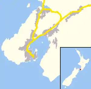
Horokiwi is an outer northern suburb of Wellington.[1] The area is semi-rural and there are no schools; most children attend schools in nearby Lower Hutt, and Primary School zoning is for Korokoro. The only feature other than houses and farms is Horokiwi Quarry.
Horokiwi | |
|---|---|
Suburb | |
 Horokiwi  Horokiwi | |
| Coordinates: 41°12′25″S 174°50′56″E | |
| Country | New Zealand |
| Local authority | Wellington City Council |
| Electoral ward | Northern |
| Takapu Valley | ||
| Grenada North, Woodridge, Newlands |
|
Lower Hutt |
| Wellington Harbour |
Access and roads
The only access to Horokiwi is via Horokiwi Road, a road that climbs up a hill and branches off the Petone-Wellington motorway. There are only five streets/roads; Horokiwi Road, Hillcroft Road, Lincolnshire Road, Woollaston Way and Van Der Velden Way. The former runs for approximately 6.5km, and the final kilometer eventually reaches Belmont Regional Park and becomes much more narrow. It also provides scenic views of Lower Hutt, Wellington Harbour, and other northern suburbs of Wellington such as Tawa and Grenada North.
Since 2010 the only access to Horokiwi is from the northbound lane of the State Highway (SH1), causing around 8km detours for residents traveling from North.[2]
The Caribbean Avenue Reserve can be accessed from Horokiwi Road.
Earliest history of Horokiwi
The Horokiwi/Korokoro area has historically been used for travel between the Hutt Valley and Porirua. European settlers in the district in the early part of the 19th century travelled for the most part on well-used old Maori tracks. In the 1880s, prominent Wellington settler James Coutts Crawford wrote about his journey from the Kapiti Coast to Port Nicholson following his arrival in New Zealand in late 1839:
"Passing Titahi Bay, and the pretty shores of Porirua, we entered the main bush, and travelled up the stream, in a line with whose course the present road stretches. We crossed and recrossed the stream about seventy times, until at length the path ascended and led us over the summit of the range overlooking Korokoro. The whole distance traversed, with the exception of some few patches of cultivation at Porirua, was through dense and uncleared forest. The Hutt Valley presented a dense forest of gigantic trees, and a large pa was visible at Pitone. As we descended the hill, our advance was hindered by a mass of newly-felled forest, which was cleared and ready for burning off. Our escort now commenced firing guns to attract the attention of the fishermen; and as we descended the hill the canoes approached the shore, so that when we reached it, they were there to meet us" (Coutts 1880: pp 27-28).
Elsdon Best also reports that many of the first journeys by Europeans through the district were made using 'old Maori trails', the main one running over the hills from the Korokoro Stream to Tawa Flat and on to Porirua. Best describes the Korokoro track as beginning on the south side of the Korokoro Stream, close to the mouth. It then ascended through bush up a steep hill and followed the ridge line to the Takapu Valley to the Kenepuru Stream and on to Porirua.
After the Petone settlement was removed and relocated to its current site of Wellington City, the track from Kaiwharawhara across Paerau hill was used more. This track joined with the Korokoro track at Takapu and then carried on to Porirua.
References
- "Wellington City Suburbs" (PDF). Wellington City Council. Retrieved 4 December 2013.
- Kopp, Michael (12 January 2010). "Residents furious at Horokiwi road closure". Hutt News. Retrieved 5 December 2013.
