Tawa, New Zealand
Tawa is the northernmost suburb within the Wellington city boundary, located roughly 15 km north of Wellington's CBD between Churton Park and Porirua in the North Island of New Zealand. It takes its name from the broadleaf tree, which was once prolific throughout the area, although its most famous tree is the Bucket Tree, a large macrocarpa with the topiary of an upside-down bucket.[2] Tawa is also known for its large number of churches, representing a wide range of Christian denominations.[3]
Tawa | |
|---|---|
Suburb | |
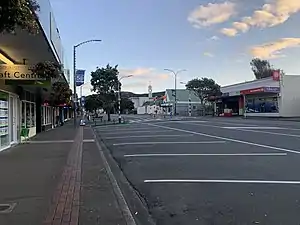 Tawa's main shopping centre, photographed in April 2020 | |
 Tawa  Tawa | |
| Coordinates: 41°10′17.64″S 174°49′29.23″E | |
| Country | New Zealand |
| Local authority | Wellington City |
| Electoral ward | Ohariu, Mana |
| Population (2006)[1] | |
| • Total | 13,764 |
| Railway station(s) | Takapu Road, Redwood, Tawa, Linden, Kenepuru |
| Porirua | ||
| Ohariu |
|
|
| Churton Park | Grenada Village |
Within Tawa, there are a number of named areas: Lindenvale, Westhaven, Redwood and Southgate to the west and Linden, Greenacres and Sundale to the east of the central Tawa area.
Geography and transportation
Tawa lies in a wide section of a roughly north/south valley which opens up on the north into the Porirua Basin. The valley is about 4.5 km in length (north-south) and 2.5 km wide (east-west). The Belmont range, to the east, separates the Tawa valley from the Hutt Valley, while the Ohariu Valley is located to the west of Tawa. The northern entrance to Tawa is where Kenepuru Drive becomes Main Road, and its southern entrance is the Tawa exit of the Johnsonville-Porirua Motorway (State Highway 1). The Porirua Stream flows northwards along the valley, fed by a number of tributaries, including the Takapu Stream.
Loosely following the path of the Porirua Stream through the valley is the North Island Main Trunk line; the Kapiti Line of the Wellington suburban railway, operated by Tranz Metro. Slightly to the east, the Johnsonville-Porirua Motorway, a dual-carriageway section of State Highway 1, follows a similar path. Both have played an important role in the suburb's development and in providing access. The literally named Main Road runs down the centre of the suburb and provides access to the smaller suburban streets. Main Road and Kenepuru Drive were part of State Highway 1 before the building of the motorway in the 1950s.
Tawa has five suburban passenger railway-stations: Kenepuru, Linden, Tawa, Redwood and Takapu Road. A significant number of commuters travel daily by train into the Wellington CBD to work. As a result, trains are a significant component of Tawa's public transport, but the suburb is also served by a bus route linking Porirua and Johnsonville. Despite these bus and train services, a substantial area on Tawa's fringes remains over 400 metres from public transport, particularly in Redwood, Greenacres and Linden.[4] Measured this way, while the parts of Tawa near the railway and Main Road are among the best-served suburbs in Wellington in terms of public transport, these areas on the fringes are among the worst served.[5] As a result, park-and-ride facilities provided at Takapu Road, Redwood, and Tawa railway stations are normally full on weekdays and parking near Linden station is at a premium, with all on-street parks close to the station occupied.
In 2009 the Wellington City Council commenced work on a shared pedestrian/cycle trail through Tawa to Porirua City Centre. The trail comprises a combination of new paths following the Porirua Stream and rail corridor, and some widened existing footpaths. The Wellington City section of the trail, between Takapu Road railway station in the south and Kenepuru railway station in the north, was completed in 2013. The Porirua City section of the trail was built on an existing unsealed trail and completed about March 2014.[6][7]
Name origin and local government
Before 1959, "Tawa" was known as "Tawa Flat", a reference to the flat and arable floor of the valley as it widened out in the Tawa area. The first known use of the name "Tawa Flat" was by John Woodman who used it as his address in the Electoral Roll for the Wellington Country District, published in the Wellington Provincial Gazette of 28 August 1854. As others living in the area gave their address in the 1854 roll as "Porirua Road", it is possible that John Woodman was the originator of the name.[8]
When New Zealand became a separate Colony from New South Wales in 1841, the Royal Charter established three provinces. The Tawa area became part of New Munster which included that part of the North Island south of the Patea River and the whole of the South Island. In 1846 the British Parliament passed the first New Zealand Constitution Act which reformed the provinces and the Tawa area became part of New Ulster which now included all of the North Island. The provinces were reformed again with the New Zealand Constitution Act of 1852 which established six provinces with Tawa included in the Wellington Province. Provincial Government was abolished in 1876 and replaced with 36 borough councils and 63 county councils. The Tawa area became part of the Porirua Riding of the Hutt County, formed in 1877. The Hutt County covered all the area south of the Waikanae River and West of the Remutaka Ranges that lay outside of Wellington City. As the population of local areas grew, a number of local boroughs were split off from the Hutt County. In 1908, a smaller Makara County with offices in Porirua was formed from the Mākara and Porirua Ridings or the south-western part of the Hutt County. The new Makara County included Porirua, Titahi Bay, and Tawa Flat, and all of the area to the south lying to the west of Wellington City outside the areas covered by Wellington City and the new and independent boroughs of Miramar, Karori, Onslow, and Johnsonville.[9]
In 1939, northern Tawa valley residents seeking to give a separate name to the northern part of the Tawa district met. They chose "Linden", from "Linden Vale", the name of the home of Mr Stuart Duncan, but originally named by Mr. Charles Duncan, a nurseryman. The name "Linden" was adopted in 1940 and the first Linden railway station was opened on 30 April 1941. In 1948, the Tawa Flat and Linden Progressive Associations and Porirua interests, led by Arthur Carman and Percy Clark, made a representation to the Local Government Commission asking for a single borough covering the whole of the Porirua Basin.[8][10]
The Commission did not accept this proposal but responded by giving the Tawa Flat-Linden area the status of a Town District able to elect its own Town Board. A roll of 1,700 electors was compiled and on 16 May 1951 the first Town board was elected. Urbanisation and population growth continued in the Tawa valley and in 1953 the population had reached 3,900, sufficient for an upgrade of the Town District to a borough. The upgrade to the Borough of Tawa Flat was approved in October 1953.[10]
Starting at the time of the Tawa Flat School and Tawa Flat District Centennial in 1955, there was a popular move to change the name of the "Borough of Tawa Flat" to the "Borough of Tawa" as more people now lived in the hilly areas on the sides of the valley or in Linden and only a minority lived in the area previously known as Tawa Flat. The New Zealand Geographic Board decided on 24 November 1958 "that on and after the 23rd of February 1959 the name of the Borough of Tawa Flat shall be Borough of Tawa."[8] From 1959, the area became known as Tawa and usage of Tawa Flat has been discontinued.[11][12]
In 1988 the Local Government Commission proposed that Tawa amalgamate with Porirua City or Wellington City with no option to remain an independent borough allowed. The proposal was opposed by the Tawa Borough Council and a majority of residents. Despite efforts by Porirua City to entice Tawa residents to amalgamate with Porirua City many Tawa citizens indicated a preference for amalgamation with Wellington City. On 3 October 1988, the Local Government Commission decreed that the Borough of Tawa would amalgamate with Wellington City. The Tawa Community Board was set up in 1989 to replace the Borough Council.[13][14]
Tawa now contributes, as part of Wellington city's Northern Ward, to elect three Wellington city councillors. Tawa retains a Community Board, which represents the suburb in matters of local and community affairs. The former Mayor of Wellington, Kerry Prendergast, originally came on to the Wellington City Council following time as a Tawa Borough councillor.
History
Settlement
Tawa Flat was first settled by Pākehā in the mid-19th century under the direction of Edward Gibbon Wakefield of the New Zealand Company. It was divided into 100-acre blocks, providing some of the 100-acre "in the country" blocks that accompanied the one-acre "in town" (i.e., central Wellington) blocks, similar to other New Zealand Company settlements. Much of the eastern side of the Tawa valley came to be owned by a single family until the demand for housing land overtook the benefits of farming the land. In 1951, a Town District was established covering Tawa and Linden. Within two years this had become Tawa Flat Borough.
Development
The development of Tawa, like many population centres, has been strongly tied with the development of transportation networks. Tawa was on the Old Porirua Road, developed from a Māori track to a road in the 1840s.
A single track railway line built by the Wellington and Manawatu Railway Company connected Tawa to Wellington from September 1885, and to Palmerston North from November 1886. It followed a circuitous route from Wellington via the Ngaio Gorge and Johnsonville. This line was incorporated into the New Zealand Railways Department network in December 1908. Tawa's first railway station, Tawa Flat station, opened on 24 September 1885 on what is now Duncan Street on the straight section of road about 180 metres north of the intersection of Duncan Street with the junction of Tawa Street and Tawa Terrace.
1930s and 40s: The Tawa Flat deviation
From June 1937, the double-tracked Tawa Flat deviation diverted the North Island Main Trunk railway from Thorndon through Kaiwharawhara and two significant new tunnels to the Tawa valley to provide a shorter faster rail route with easier grades and higher speed curves. The old and new routes diverged in Thorndon and merged again north of the present day Tawa Railway Station near the front entrance to Tawa College. Part of the old rail route through Tawa, from Tawa Street to Tawa College, became the southern part of Duncan Street and the old railway alignment from Tawa Street to Takapu Road remained as a pleasant walking track.
The new deviation provided two new railway stations that opened on 20 June 1937, one at Takapu Road and a new Tawa Flat Railway Station on an island platform built on the flat, below and 400 metres north of the old railway station. A crossing loop was provided at Tawa Flat with crossovers north and south of the station that allowed trains to terminate at Tawa Flat and return to Wellington or Porirua. A siding was provided to support local businesses. The new Tawa Flat station was equipped with an enclosed waiting room, toilets for men and women, and a stationmaster's office with a ticket sale window opening to the waiting room. A miniature lever frame allowed signals to be locally controlled. Trains between Kaiwharawhara and Tawa ran on double line automatic signalling and the tablet system remained in use on the single line section from Tawa to Porirua.
With the completion of the deviation, the Johnsonville line from Wellington to Johnsonville was electrified and reopened as the Johnsonville Branch. The railway connection between Johnsonville and Tawa was severed on 19 June 1937.[15] The railway line from Tawa to Porirua remained single track with no stations between Tawa and Porirua until the new Linden station opened on 28 July 1940.
Electrification of the North Island Main Trunk was completed from Wellington to Paekakariki in 1940 and a modern automatic signalling system installed to enable trains to operate at frequent intervals. From 1940, the shorter and faster train service to Wellington using passenger cars hauled by electric locomotives made Tawa a more desirable place to live.
Arohata Women's Prison, located at the southern end of Tawa, was built in 1944 and was originally a women's borstal. It became a youth prison in 1981 and a women's prison in 1987.
1950s and 60s: improved train service, motorway opening, rapid population growth
A much improved, faster, and more frequent, rail service resulted from the Tawa Flat deviation in the late 1930s, electrification of the railway line with an automatic signalling system in 1940, and the arrival of additional electric multiple units in the late 1940s and early 1950s. The first multiple units operated on the line on 5 September 1949 but electric locomotive hauled trains continued to operate in peak periods as there were insufficient multiple units. It was now quicker and easier for residents of Tawa to commute to Wellington to work in the central Wellington area.[10] Travel time by rail from Tawa to central Wellington was now shorter than from many Wellington City suburbs and the fares were competitive. On 15 December 1957, duplication of the railway line from Tawa to Porirua was completed and a new railway station on an island platform was opened at Linden. With the duplication to Porirua, double line automatic signalling was extended to Porirua and the miniature lever frame controlling the signalling in Tawa could now be "switched-in" when required for shunting of goods trains or other movements requiring the use of the crossovers or "switched-out" to automatic double track operation. This meant that Tawa station did not require manning for most through train movements. Two new railway stations were built in the 1960s to meet the growing demand for rail services: Kenepuru station opening on 8 April 1963 and Redwood station on 15 December 1963. Tawa was now served by five railway stations. A feature of the new Redwood station was the staggering of the platforms north and south of the level crossing at Tawa Street to avoid the excessive operation of the warning lights and bells and barrier arms at the Tawa Street level crossing.
During the 1950s, the high-speed Johnsonville–Porirua Motorway was built through Tawa on the eastern side of the valley. The first section that broadly followed the line of the old North Island Main Trunk railway from Johnsonville to the Tawa turnoff at Takapu Road at the southern entrance to Tawa was opened on 15 December 1951.[10] The second section, from Takapu Road to Porirua, was opened about five years later and the Johnsonville bypass connecting the south end of the motorway to the top of Ngauranga Gorge about the same time. The first section reduced road travel times and considerably improved access to Wellington by eliminating the need to use the narrow winding road through the bottom of the valley and Glenside. The second section allowed through traffic to bypass Tawa reducing traffic on the Main Road in Tawa. The southern and northern accesses to Tawa were improved by straightening and widening narrow sections of the Main Road at Takapu Road and Kenepuru Drive between Linden and Porirua.
Demand for new housing diminished in the 1930s and early 1940s, but from the mid-1940s a country-wide surge in marriage and birth rates occurred. With a shortage of suitable new housing areas in Wellington City, and with Tawa now more accessible with improved road and rail access, Tawa became a popular place for new private housing. Land was at a premium in the steep terrain of the Wellington region and the flat areas and moderate hills of Tawa were attractive. The Tawa microclimate, sometimes up to five degrees Celsius warmer than Wellington when the foehn effect occurs at the tail end of a southerly wind, was an added attraction. It could be fine and warm in Tawa when Wellington was cold and overcast. New subdivisions followed and the population expanded rapidly, and Tawa became one of the fastest-growing areas in the country. State housing subdivisions at Kenepuru and Hampton Hill in the late 1950s and early 1960s added to the population growth.
Population growth and a need to ensure primary schools were within walking distance for children led to the opening of new schools. A new public primary school was opened at Linden in 1952 to take the pressure off the long-established Tawa School. Tawa College was opened in 1960 eliminating the need for Tawa students to travel to Porirua or into Wellington for Secondary Education. Tawa College was built on land that straddles the motorway, with the main school campus west of the motorway and additional playing fields to the east. A subway under the motorway links the two parts of Tawa College and provides public access. St. Francis Xavier School, a Catholic primary school, opened in Redwood in 1960. The demand for new primary schools continued in the 1960s: Hampton Hill School was opened in 1965 and Redwood School in 1966.[10]
1970s to present day
During the 1970s, Tawa experienced significant residential growth, Redwood and parts of Sundale in particular expanded outward. To meet the growth, Greenacres primary school opened in 1972 and Tawa Intermediate in 1975. The opening of Tawa Intermediate took pressure off the primary schools by catering for year 7 and 8 education that was previously provided by the primary schools.
Since the 1990s, Tawa has been expanding more slowly. By the turn of the 21st Century, most of the green field residential growth in Tawa has been occurring to the east of the Motorway, mainly spreading eastward up toward the parallel Takapu Valley in the direction of the Belmont Range.
Whilst green field residential growth has slowed, there has been significant infill housing as property owners, particularly owners of older quarter acre sections, subdivide their properties. Along with infill housing, the turn of the 21st century has seen the redevelopment of some of Tawa's previously industrial area including the development of Dress Smart - an outlet shopping centre - and the retirement village, Redwood village. Tawa's latest retail development is located on what is colloquially known as "Takapu Island"; a site located alongside the Tawa motorway off-ramp where a new supermarket was opened in September 2012. Conversely, one of Tawa's other shopping centres, Tawa Junction, closed in 2008 after a lengthy period with few occupants and has since been mooted as a location for another retirement village.
On 27 November 1999 Tawa, along with Mount Eden and Mount Roskill, became the last place in New Zealand to vote in favour of becoming "wet" in local restoration polls. Voting to become "wet" allowed the purchase of alcohol within the suburb for the first time and since then several pubs and bars have opened.[16]
Demography
New Zealand census results gave Tawa's population as around 12,700 in 2001, 13,200 in 2006 and 13,500 in 2013.[17] In June 2011, the Wellington City Council's estimate of Tawa's population was 14,900.
Education
Primary schools
Tawa School is a co-educational state primary school for Year 1 to 8 students,[18] with a roll of 360 as of March 2020.[19][20]
Hampton Hill School is a co-educational state primary school for Year 1 to 8 students,[21] with a roll of 223.[22] It was founded in 1965.[23]
Greenacres School is a co-educational state primary school for Year 1 to 6 students,[24] with a roll of 194.[25] It was founded in 1972.[26]
Intermediate and secondary schools
Tawa Intermediate is a co-educational state intermediate school for Year 7 to 8 students,[27] with a roll of 552.[28] It was founded in 1975.[29]
Tawa College is a co-educational state secondary school for Year 9 to 13 students,[30] with a roll of 1447.[31] It was founded in 1961.[32]
Churches and other religious groups
Churches in Tawa include:
- Tawa-Linden Anglican Church
- Tawa Baptist Church
- Our Lady of Fatima Catholic Church
- Church of Jesus Christ of Latter Day Saints
- Gospel Hall
- Samoan Methodist Parish
- New Life Church
- Salvation Army
- Tawa Samoan Assembly of God
- Tawa Union Church
In 2011 the Exclusive Brethren in Wellington relocated to Tawa from Crofton Downs and a number of their membership moved into the area. The Samoan Methodist Parish now occupies the property previously occupied by the Free Presbyterian Church of Scotland.
There is also a Christadelphian Ecclesia in Linden, as well as a traditional Catholic chapel, run by priests from the Society of St. Pius X, who are based in Whanganui.
A Buddhist Dhamma Gavesi Meditation Centre was established in Tawa in 2011.
Facilities
Community facilities
Tawa has a number of community facilities. Upgraded in 2002 at a cost of NZ$1.6 million, the Mervyn Kemp Library is located on the corner of the Main Rd and Cambridge St. Also on Cambridge St is the Tawa Community Centre, which now also occupies the space vacated by the ANZ Bank when it closed its Tawa Branch. On November 13, 2004 the $2.4 million Tawa Recreation Centre was opened. The Centre is located at Tawa College and is a partnership between the College and the Wellington City Council.[33] Located on Davies St is the Tawa Pool, which features a 25-metre heated indoor swimming pool, learner pool, toddler pool, spa and sauna.[34]
Retail facilities
Along with Outlet City, much of Tawa's current retail and manufacturing businesses are located along the Main Road. The section of the Main Road between Lyndhurst Road and Lincoln Ave forms the village center of Tawa and provides day-to-day retail services including supermarket, mail, and pharmacy services. Also present in along the Main Road are the Mervyn Kemp Library, medical centre, dentists, banks, many restaurants and takeaway shops. A secondary retail center is located alongside Linden Station.
Sporting facilities
Tawa is also home to a number of other community run sporting facilities. Alongside the Tawa pool is the Tawa Bowls club. Tawa St is home to the North Wellington Badminton Association, which boasts a 6 court tournament class stadium. Also on Tawa St is the Tawa-Lyndhurst Tennis Club, which has 8 plexipave tennis courts. Tawa-Lyndhurst Tennis Club is also where Tennis Inc coaching academy is based. There are a number of Rugby Union grounds in Tawa, with Tawa Rugby located at Lyndhurst park. There are a number of Cricket ovals in Tawa, including Linden Park. The Tawa Squash club is located on the Main Rd. There are several Football grounds for different grades in Tawa, including the use of the College grounds, the clubroom is shared with the Tawa Softball Club. Tawa is also home to the Tawa Mah Jong Club, which hosts the Wellington Mah Jong Tournament each June,[35] as well as the Kapi Mana Bridge Club.[36]
Parks
Along with built facilities, Tawa also boasts a large number of landscaped and natural parks, many of which contain play areas and open spaces. The Porirua Stream flows through a number of these parks. Community groups in Tawa, including the Friends of Tawa Bush Reserves, have increasingly worked in partnership with the local council to take interest and ownership of protecting Tawa's bush-clad environment, waterways and community parks.
Notable residents and former residents
- Elsdon Best - Māori ethnologist
- Arthur Carman - bookseller, sports writer and local historian
- Jerry Collins - All Blacks captain
- Sophie Devine - cricket and hockey player, White Fern and Black Sticks women
- Mark Gillespie - former Black Caps medium pace bowler
- Blair Hilton - Black Sticks Men, national field hockey representative and 2010 CommonWealth Games bronze medalist
- Amelia Kerr - White Fern
- Graham Mexted - All Black
- Murray Mexted - All Black captain
- Bruce Murray - former Black Caps opening batsman and historian of Tawa
- Kerry Prendergast - former Mayor of Wellington
- Lee Tamahori - film director
- Hugh Templeton - politician
In fiction
Comedian Ginette McDonald created the iconic character Lyn of Tawa, who became a "household name" in New Zealand in the 1970s. McDonald's characterisation was a parody and satire of New Zealand's middle-class suburban values. (see http://www.teara.govt.nz/en/video/13446/lynn-of-tawa )
See also
Sources
- Carman, Arthur H (1956, 1970, 1982) Tawa Flat and the Old Porirua Road, ASIN B0007K64LC
- K. R. Cassells (1988) TAWA Enterprise and Endeavour, Tawa Borough Council, ISBN 0-473-00715-0
- Murray, Bruce (2005) The Streets of Tawa, ISBN 0473101882
References
- "Population highlights | Wellington City | profile.id". Profile.idnz.co.nz. 2013-06-30. Retrieved 2015-03-08.
- "Heritage : Tawa". Wcl.govt.nz. Archived from the original on 2011-09-27. Retrieved 2015-03-08.
- "Tawa Churches". TawaLink. Retrieved 2015-03-08.
- Archived August 20, 2009, at the Wayback Machine
- "Restoring Wellington's transport links after a major earthquake" (PDF). Wellington Lifelines Group.
- Cycle & Walking Track Nearly Complete, 5 December 2013 Wellington City Council. Retrieved 30 December 2016
- $4.2m cycle and walking track nearing completion between Tawa and Porirua Wellington.scoop. Retrieved 30 December 2016.
- Carman, A. H. (1956). Tawa Flat and the Old Porirua Road. Wright and Carman. p. 235.
- The break-up of Hutt County Te Ara The Encyclopedia of New Zealand. Retrieved 22 August 2016
- Cassells, K. R. (1988). Tawa - Enterprise and Endeavour. Tawa Borough Council. p. 65.
- Tawa Heritage, Wellington City Libraries. Retrieved 22 August 2016
- A little about the Tawa Borough Council, tawalink.com. Retrieved 22 August 2016
- Tawa Link
- Tawa's amalgamation angst in 1989 The Dominion May 16, 2016. Retrieved 23 August 2016
- John Yonge (editor), New Zealand Railway and Tramway Atlas, fourth edition (Essex: Quail Map Company, 1993), 16.
- "Tawa ditches prohibition a century after banning alcohol". Stuff (Fairfax). 4 September 2015.
- 2013 Census Usually Resident Population Counts Statistics New Zealand. Retrieved December 2016
- "Tawa School Education Review Office Report". ero.govt.nz. Education Review Office.
- "Tawa School Ministry of Education School Profile". educationcounts.govt.nz. Ministry of Education.
- "Tawa School Official School Website". tawa.school.nz.
- "Hampton Hill School Education Review Office Report". ero.govt.nz. Education Review Office.
- "Hampton Hill School Ministry of Education School Profile". educationcounts.govt.nz. Ministry of Education.
- "Hampton Hill School Official School Website". hamptonhill.school.nz.
- "Greenacres School Education Review Office Report". ero.govt.nz. Education Review Office.
- "Greenacres School Ministry of Education School Profile". educationcounts.govt.nz. Ministry of Education.
- "Greenacres School Official School Website". greenacres.school.nz.
- "Tawa Intermediate Education Review Office Report". ero.govt.nz. Education Review Office.
- "Tawa Intermediate Ministry of Education School Profile". educationcounts.govt.nz. Ministry of Education.
- "Tawa Intermediate Official School Website". tawaint.school.nz.
- "Tawa College Education Review Office Report". ero.govt.nz. Education Review Office.
- "Tawa College Ministry of Education School Profile". educationcounts.govt.nz. Ministry of Education.
- "Tawa College Official School Website". tawacol.school.nz.
- "Tawa's community website". TawaLink. Retrieved 2015-03-08.
- Archived October 14, 2008, at the Wayback Machine
- "Wellington Mah Jong Tournament". Mahjongnz.com. Retrieved 2015-03-08.