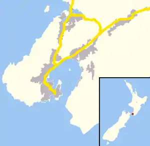
Wilton, New Zealand
Wilton is a small suburb in Wellington. It is best known for Otari-Wilton's Bush, a large reserve that is situated in the suburb. Otari-Wilton's bush is the only public botanic garden in New Zealand dedicated solely to native plants. It features 14 km of walking tracks and a 'canopy walkway'. The canopy walkway is a raised walkway that provides a unique chance to view life in, and from, the top level of trees such as mature tawa, rewarewa and hinau.
Wilton | |
|---|---|
Suburb | |
 Wilton  Wilton | |
| Coordinates: 41°16′05″S 174°45′25″E | |
| Country | New Zealand |
| Local authority | Wellington City |
| Area | |
| • Land | 246 ha (608 acres) |
| Population (2013)[1] | |
| • Total | 2,052 |
| Postcode(s) | 6012 |
| Crofton Downs | ||
|
|
Wadestown, Thorndon | |
| Karori |
Education
School enrollment zone
Wilton is within the enrollment zones for Wellington College, Wellington Girls' College, Wellington High School, Onslow College, St Oran's College and the Otari School.[2]
Primary schools
Otari School (Te Kura o Otari) is a decile 10[3] state-funded full-primary school nestled next to the Otari-Wilton's Bush. The school encompass's three teaching styles. Montessori, Maori Immersion and the standard New Zealand curriculum. In 2014 it had a roll of 211.[4]
Cardinal McKeefry Catholic Primary School (which opened in 1970, but has origins back to 1876) is a decile 10[3] co-educational primary school for Year 1 to Year 8 (5 to 13 years old). In 2014 it had a roll of 100.[4]
History
Job Wilton was a sheep farmer; in 1861 he had a flock of 165 sheep, to be washed in the Kaiwharawhara Stream before shearing.[5] He subdivided his farm in 1915, but Wilton was semi-rural to the 1930s with little housing development until after World War II. A Sunday trip to Wilton's Bush and Chapman's Gardens (now the Otari Plant Museum) required walking from the Wadestown tram terminus. From 1944 a feeder bus ran from the terminus. A school opened in 1956. Wilton House in Blackbridge Road was built for Courtenay Place chemist Mr O'Connor and his sister in 1925.[6]
Further reading
References
- "Community Profile: Wilton". Wellington City Council.
- "eLearning Schools Search". Ministry of Education.
- "Decile Change 2014 to 2015 for State & State Integrated Schools". Ministry of Education. Retrieved 15 March 2015.
- "Ministry of Education School Rolls". Ministry of Education.
- Bremner 1983, p. 28.
- Bremner 1987, pp. 22,36,67.