Kanpur Dehat district
Kanpur Dehat district is a district in Uttar Pradesh state in northern India. The administrative headquarters of the district are at Mati-Akbarpur. This district is part of Kanpur division. Kanpur was formerly spelled Cawnpore.
Kanpur Dehat district | |
|---|---|
District of Uttar Pradesh | |
 Location of Kanpur Dehat district in Uttar Pradesh | |
| Coordinates (Akbarpur, Kanpur Dehat): 26.3443°N 79.96718°E | |
| Country | India |
| State | Uttar Pradesh |
| Division | Kanpur |
| Headquarters | Mati, Kanpur Dehat |
| Tehsils | 1. Akbarpur, 2. Bhognipur, 3. Rasulabad, 4. Derapur, 5. Sikandara, 6. Maitha |
| Government | |
| • Lok Sabha constituencies | 1. Akbarpur (Lok Sabha constituency)- Akbarpur-Raniya 2. Kannauj (Lok Sabha constituency)- Rasulabad 3. Etawah (Lok Sabha constituency)- Sikandra 4. Jalaun (Lok Sabha constituency)- Bhognipur |
| • Vidhan Sabha constituencies | 1. Rasulabad 2. Akbarpur-Raniya 3. Sikandra 4. Bhognipur |
| Area | |
| • Total | 3,021 km2 (1,166 sq mi) |
| Population (2011) | |
| • Total | 1,796,184.[1] |
| Demographics | |
| • Literacy | 65.15% |
| Time zone | UTC+05:30 (IST) |
| Vehicle registration | UP, 77 |
| Website | https://kanpurdehat.nic.in/ |
History
The site of the Battle of Madarpur, fought between the Bhumihar zamindars and the Mughal Empire in 1528CE took place within the present-day Kanpur Dehat district.
Kanpur District was divided into two districts, namely Kanpur Nagar and Kanpur Dehat in year 1977. The two were reunited again in 1979 and again separated in 1981. Uttar Pradesh government decided to rename Kanpur Dehat district as Ramabai Nagar district on 1 July 2010.[2] In July 2012, it was returned to Kanpur Dehat.
Political representatives
Legislative Council
| Name | Member[3] | Party |
|---|---|---|
| Kanpur Graduate Constituency | Arun Pathak | Bharatiya Janata Party |
Legislative Assembly
| Name | Member[4] | Party |
|---|---|---|
| Akbarpur-Raniya | Pratibha Shukla[5] | Bharatiya Janta Party |
| Bhognipur | Vinod Kumar Katiyar[6] | Bharatiya Janta Party |
| Sikandra | Ajit Pal[7] | Bharatiya Janta Party |
| Rasulabad | Nirmala Sankhwar[8] | Bharatiya Janta Party |
Parliamentary constituencies
| Name | Member[9] | Party |
|---|---|---|
| Akbarpur | Devendra Singh Bhole | Bharatiya Janta Party |
| Kannauj | Subrat pathak | Bhartiya Janta party |
| Etawah | Dr RAM Shankar katheriya | Bharatiya Janta Party |
| Jalaun | Bhanu Pratap Singh Verma | Bharatiya Janta Party |
Transport
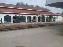
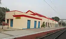
The district is well connected by railways. Three rail tracks run through Kanpur Dehat district. The railway route connecting Delhi to Hawrah belonging to North Central zone of Indian Railways is passing through centre of the district. This railway track is broad gauge and fully electrified. The railway stations on this route through the district are Bhaupur, Maitha, Roshan Mau Halt, Rura, Ambiyapur, Jhinjhak and Parjani Halt. Rura Railway Station is the main railway Station of Kanpur Dehat District.
The second track is Kanpur to Jhansi railway line. The railway stations on this route are Binaur, Rasulpur Gogumau, Tilaunchi, Paman, Lalpur, Malasa, Pukhrayan and Chaunrah. This broad gauge railway track is electrified also belongs to North Central zone.
The third railway line converted to broad gauge belongs to North Eastern Railway zone. The track runs parallel to the Ganges river. This track is also electrified.
Notable residents
- Ram Nath Kovind, ex-governor of Bihar and current President of India[10]
Historical places
- Shukla Talab (Akbarpur)was built by Sheetal Shukla, Deewan of Emperor Akbar.[11]
.JPG.webp) Shukla Talab (dry view)
Shukla Talab (dry view)
Religious places
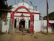
- Waneshwar Mahadev Temple:Banipara[11]
- Kapalehwar Temple:Derapur[11]
 Kapaleshwar Temple
 - Parhul Devi Temple:near Rura[11]
.jpg.webp) Parhul Devi Temple (west view)
Parhul Devi Temple (west view) - Mukta Devi Temple:near Musanagar[11]
- Katyani Devi (Kathari Devi) Temple: 6 km towards south of village Shahjahanpur in uneven land[11]
- Durvasa Rishi Ashram: In near village NIGOHI Bank of segur river[11]
- Jageshwar Temple:Shivli[11]
- Dharma Garh Baba Temple:Rasulabad, Kanpur Dehat [11]
- Bajrangbali Baba Temple :Raraunkh Kanpur Dehat.
Educational institutions
- RSGU Post Graduate College Pukhrayan
- Akbarpur Degree College Akbarpur Kanpur Dehat
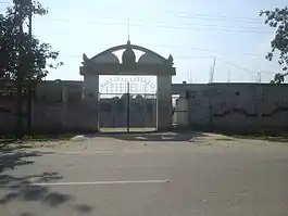 Akbarpur Degree College
 - Govt.Degree College,Akbarpur,Kanpur Dehat
- R P S Inter College, Rura
- Akbarpur Inter College Akbarpur
 Akbarpur Inter College Akbarpur
 - Kendriya Vidyalaya, Mati
- Jawahar Navodaya Vidyalaya Kanpur Dehat
- Galuapur Inter College Galuapur
 Galuwapur Inter College
 - Patel Vidyapeeth Inter College Baraur
- Gram Vikas Inter College Budhauli
 Gram Vikas Inter College Budhauli
 - C.D.Girls Inter College Rura
- Akbarpur Girls Inter College Akbarpur
- Shri Ram Janki Sanskrit Mahavidyalaya Gauriyapur
- Pt.Triyugi Narayan Mahavidyalaya Mangalpur
Demographics
According to the 2011 census Kanpur Dehat district has a population of 1,795,092,[1] roughly equal to the nation of The Gambia[12] or the US state of Nebraska.[13] This gives it a ranking of 268th in India (out of a total of 640 districts).[1] The district has a population density of 594 inhabitants per square kilometre (1,540/sq mi).[1] Its population growth rate over the decade 2001-2011 was 14.82%.[1] Kanpur Dehat has a sex ratio of 862 females for every 1000 males,[1] and a literacy rate of 77.52%.[1]
At the time of the 2011 Census of India, 98.99% of the population in the district spoke Hindi (or a related language) and 0.94% Urdu as their first language.[14]
| Kanpur Dehat district: mother-tongue of population, according to the 2011 Census.[14] | |||
|---|---|---|---|
| Mother tongue code | Mother tongue | People | Percentage |
| 002007 | Bengali | 1,069 | 0.06% |
| 006125 | Bundeli/Bundel khandi | 142 | 0.01% |
| 006240 | Hindi | 1,777,683 | 98.97% |
| 022015 | Urdu | 16,829 | 0.94% |
| – | Others | 461 | 0.03% |
| Total | 1,796,184 | 100.00% | |
| Year | Pop. | ±% p.a. |
|---|---|---|
| 1901 | 398,550 | — |
| 1911 | 361,641 | −0.97% |
| 1921 | 363,659 | +0.06% |
| 1931 | 383,790 | +0.54% |
| 1941 | 492,694 | +2.53% |
| 1951 | 614,143 | +2.23% |
| 1961 | 734,347 | +1.80% |
| 1971 | 897,068 | +2.02% |
| 1981 | 1,087,032 | +1.94% |
| 1991 | 1,303,232 | +1.83% |
| 2001 | 1,563,336 | +1.84% |
| 2011 | 1,796,184 | +1.40% |
| source:[15] | ||
Kos Minars
Since the Mughal road passes through Kanpur Dehat district, there are many Kos Minar (mile pillars) in the district. Some of them are protected monuments, notable ones are at Bhognipur, Chapar Ghata, Deosar, Gaur, Halia, Jallapur Sikandara, Pailwaru, Pitampur, Raigawan, Rajpur, Sankhiln Buzurg, Sardarpur.
International airport proposal
An international airport named Rasoolabad International Airport was proposed in 2015 to be constructed in Kanpur Dehat district about 50 km from Kanpur.[16] The airport will serve the region from Agra division, Jhansi division, Kanpur division, Aligarh division, Allahabad division, Banda division and Lucknow division. It would have direct link road with Agra Lucknow Expressway.[17][18]
Gallery
.jpg.webp) Starling (मैना)
Starling (मैना)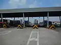 Bara Toll Plaza
%253D%253D.jpg.webp) Banyan tree
Banyan tree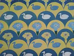 Water Colors Design
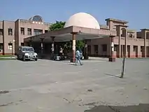 District Hospital
.jpg.webp) Kapaleshwr Temple (North view)
Kapaleshwr Temple (North view).JPG.webp) Waneshwar Mahadev Mandir (worshipping view)
Waneshwar Mahadev Mandir (worshipping view).JPG.webp) Waneshwar mahadev (internal view)
Waneshwar mahadev (internal view) Durga Devi Temple Rura
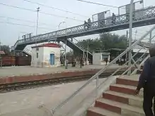 Over bridge Rura
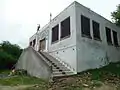 Parhul Devi Temple
 Kalika Devi Mandir
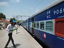 Pukhrayan Railway Station
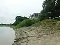 Parhul Devi Temple-1
 Lucknow -Jhansi Road
 Dharma Garh Temple
 Dharma Garh Temple Rasulabad
References
- "District Census 2011". Census2011.co.in. 2011. Retrieved 30 September 2011.
- "Kanpur Dehat". District administration. Archived from the original on 21 July 2011. Retrieved 18 August 2010.
- भाजपा के अरुण पाठक ने तोड़ी स्वरूप परिवार की विरासत [BJP's Arun Pathak ends the dynasty of Swaroop Faimly] (in Hindi). Dainik Jagran. Retrieved 1 January 2017.
- "STATISTICAL REPORT ON GENERAL ELECTION, 2012 TO THE LEGISLATIVE ASSEMBLY OF UTTAR PRADESH" (PDF). Election Commission of India. Retrieved 1 January 2017.
- http://myneta.info/uttarpradesh2017/candidate.php?candidate_id=2669
- http://myneta.info/uttarpradesh2017/candidate.php?candidate_id=2697
- http://myneta.info/uttarpradesh2017/candidate.php?candidate_id=2682
- http://myneta.info/uttarpradesh2017/candidate.php?candidate_id=2662
- "Sixteenth Lok Sabha". Lok Sabha. Retrieved 1 January 2017.
- "Ram Nath Kovind elected Indias 14th President, to take oath on July 25". Retrieved 20 July 2017.
- http://kanpurdehat.nic.in/f_profile.html
- US Directorate of Intelligence. "Country Comparison:Population". Retrieved 1 October 2011.
Gambia, The 1,797,860 July 2011 est.
- "2010 Resident Population Data". U. S. Census Bureau. Archived from the original on 23 August 2011. Retrieved 30 September 2011.
Nebraska 1,826,341
- C-16 Population By Mother Tongue – Uttar Pradesh (Report). Office of the Registrar General & Census Commissioner, India. Retrieved 15 July 2020.
- Decadal Variation In Population Since 1901
- http://m.timesofindia.com/city/kanpur/International-airport-proposed-near-Kanpur/articleshow/46156622.cms
- http://www.ufhnews.in/kanpur-dehat-7489-a
- http://hindi.eenaduindia.com/State/UttarPradesh/2015/03/25223153/kanpur-to-abroad-has-gone-soon.vpf