Manitoba Highway 16
Provincial Trunk Highway 16 (PTH 16) is a provincial highway in the Canadian province of Manitoba. It is the Manitoba section of the Yellowhead Highway, and also the Trans-Canada Highway Yellowhead section. The main purpose of this highway is to connect Winnipeg with other Canadian cities such as Saskatoon and Edmonton. The highway runs from Bloom at an intersection with the Trans-Canada Highway and Provincial Road 305 10 km west of Portage la Prairie to the Saskatchewan boundary 16 km west of Russell, where it continues as Saskatchewan Highway 16.
| ||||
|---|---|---|---|---|
| Trans-Canada Highway Yellowhead Highway | ||||
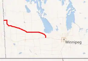
PTH 16 highlighted in red. | ||||
| Route information | ||||
| Maintained by Manitoba Infrastructure | ||||
| Length | 266.5 km[1] (165.6 mi) | |||
| Existed | 1928–present | |||
| Major junctions | ||||
| West end | Saskatchewan border near Harrowby continues west as | |||
| East end | ||||
| Location | ||||
| Rural municipalities | ||||
| Towns | ||||
| Highway system | ||||
| Manitoba provincial highways Winnipeg City Routes
| ||||


The highway is two lanes through Manitoba, with two small divided sections at the north and south junctions with PTH 10 around Minnedosa, which it runs in concurrence with just west of the town. Twinning and upgrading to expressway status is being planned in the future.
Alternate routes
- Minnedosa - Highway 16A
History
The route was known as PTH 4 until 1977, when it was renumbered to allow the entire length of the Yellowhead Highway to retain the number 16 designation across all four provinces of western Canada.
Between 1966 and 1979, PTH 16 was the designation of the route connecting Fisher Branch to PTH 7 near Fraserwood.[2] This route became part of PR 231 and PR 228 in 1977. (This section of PR 228 would be transferred to PTH 17 in 1983).
The highway has had some reconfigurations in its time. When the highway first appeared on the 1928 Manitoba Highway Map,[3] the highway's eastern terminus with PTH 1 was located in Portage la Prairie. From Portage la Prairie, the road traveled north following the current PR 240 to Mile 71N (formerly PR 249). The highway would then turn west and rejoin its current configuration just south of Macdonald.[4] The junction was moved to its current location in 1950,[5] and the old section was designated as PTH 4A between 1953 and 1965.[6]
In the Minnedosa area, the section of highway from PTH 16A and PR 262 to Franklin Road (formerly PR 466 north) was constructed and opened to traffic in 1948. Prior to this, the highway turned north for two kilometres and then west past the hamlet of Franklin to Minnedosa, meeting PTH 10 south at the town limits. It then shared the highway to a point three kilometres north of its current junction with PTH 10 north at what is now the turnoff to the Ski Valley Recreation Area. PTH 4 would then turn west and rejoin the current configuration just east of Basswood.[7] The current section of PTH 16 between its current northbound/westbound junction with PTH 10 and Basswood was constructed and opened to traffic in 1953.[8]
After these reconfigurations, PTH 4 met southbound PTH 10 two kilometres south of Minnedosa and then shared the highway through the town along what is now PTH 16A to its current northbound/westbound junction. The highway was extended two kilometres farther west in 1971 to its current junction with southbound PTH 10 with the construction of the Minnedosa bypass.[9]
The current section between Shoal Lake and the southbound junction of PTH 83 was constructed and opened to traffic in 1958. Prior to this, PTH 4 would meet PTH 21 in Shoal Lake (northbound PTH 21 ended at this point). The highway would continue west along what is now PTH 42 to meet PTH 83 south at Birtle. The two highways would then run in concurrence from Birtle to the current junction seven kilometres east of Foxwarren, where it would then rejoin its current configuration.[10] Prior to 1990, PTH 16 used to be cosigned with PTH 1 between its junction west of Portage La Prairie and Winnipeg;[11] however, when PTH 16 was incorporated as part of the Trans-Canada Highway, the PTH 16 designation was dropped in favour of the current unnumbered Yellowhead Highway designation.[12]
Major intersections
| Division | Location | km[1] | mi | Destinations | Notes | ||
|---|---|---|---|---|---|---|---|
| Russell – Binscarth | | 0.0 | 0.0 | Saskatchewan boundary | |||
| | 5.2 | 3.2 | Crosses the Assiniboine River | ||||
| Russell | 15.6 | 9.7 | West end of PTH 83 overlap | ||||
| 16.6 | 10.3 | ||||||
| | 19.9 | 12.4 | |||||
| | 23.1 | 14.4 | Road 116 N | Former PR 479 east | |||
| Binscarth | 33.0 | 20.5 | |||||
| | 35.0 | 21.7 | |||||
| Ellice – Archie / Russell – Binscarth | | 36.5 | 22.7 | ||||
| Prairie View | Foxwarren | 48.0 | 29.8 | ||||
| | 54.5 | 33.9 | East end of PTH 83 overlap | ||||
| | 57.8 | 35.9 | |||||
| | 65.7 | 40.8 | Former PR 474 south | ||||
| | 74.4 | 46.2 | West end of PR 264 overlap; former PR 254 north | ||||
| Yellowhead | | 77.7 | 48.3 | East end of PR 264 overlap; former PR 254 south | |||
| | 81.1 | 50.4 | Road 141 W – Vista | Former PR 472 north | |||
| Shoal Lake | 89.8 | 55.8 | |||||
| 91.3 | 56.7 | ||||||
| | 98.7 | 61.3 | Menzie Road / Green Bluff Road (Road 131 W) | Former PR 470 | |||
| Strathclair | 106.7 | 66.3 | West end of PR 354 overlap | ||||
| | 109.7 | 68.2 | East end of PR 354 overlap | ||||
| Harrison Park | Newdale | 120.4 | 74.8 | West end of PR 250 overlap | |||
| | 122.0 | 75.8 | East end of PR 250 overlap | ||||
| | 123.3 | 76.6 | Road 91 N | Former PR 473 east | |||
| Oakview | | 135.4 | 84.1 | Former PTH 27 south | |||
| Minto – Odanah | | 147.9 | 91.9 | PTH 16 branches south; west end of PTH 10 overlap | |||
| Town of Minnedosa | 150.5 | 93.5 | |||||
| Minto – Odanah | | 154.0 | 95.7 | PTH 16 branches east; east end of PTH 10 overlap | |||
| | 156.0 | 96.9 | |||||
| | 164.4 | 102.2 | |||||
| North Cypress – Langford | | 166.0 | 103.1 | Franklin Road (Road 96 W) – Franklin | Former PR 466 north | ||
| | 172.5 | 107.2 | |||||
| Town of Neepawa | 179.0 | 111.2 | West end of PTH 5 overlap | ||||
| 180.4 | 112.1 | East end of PTH 5 overlap; former PR 258 south | |||||
| Glenella – Lansdowne | | 195.6– 195.8 | 121.5– 121.7 | Intersections offset; 200 m (660 ft) PR 352 overlap | |||
| WestLake – Gladstone | | 207.5 | 128.9 | ||||
| Gladstone | 217.0 | 134.8 | Former PR 460 north | ||||
| | 229.5 | 142.6 | |||||
| | 238.3 | 148.1 | |||||
| Westbourne | 245.7 | 152.7 | |||||
| | 248.0 | 154.1 | |||||
| Portage la Prairie | | 249.8 | 155.2 | ||||
| | 258.3 | 160.5 | Road 71 N – Poplar Point | Former PR 249 east | |||
| | 266.5 | 165.6 | PTH 16 eastern terminus; interchange proposed[13] | ||||
| | 274.1 | 170.3 | Interchange | ||||
| City of Portage la Prairie | 281.9 | 175.2 | Interchange | ||||
| Portage la Prairie | | 285.9 | 177.7 | Interchange; no eastbound exit | |||
| | 287.1 | 178.4 | |||||
| Cartier | | 339.1 | 210.7 | ||||
| City of Winnipeg | 352.2 | 218.8 | Interchange; signed as exits 318A (east) and 318B (north). | ||||
| West end of | |||||||
| 356.9 | 221.8 | ||||||
| 361.2 | 224.4 | Interchange; no direct eastbound exit to Route 90 north (signed via Empress Street). | |||||
| 364.2 | 226.3 | East end of PTH 1 overlap; no eastbound entrance from Portage Avenue | |||||
| 364.4– 364.5 | 226.4– 226.5 | Parallel one-way streets | |||||
| 365.8– 365.9 | 227.3– 227.4 | Parallel one-way streets | |||||
| 366.2 | 227.5 | see Portage and Main Mile Zero Yellowhead Highway[14] | |||||
1.000 mi = 1.609 km; 1.000 km = 0.621 mi
| |||||||
References
- Google (February 27, 2018). "PTH 16 in Manitoba" (Map). Google Maps. Google. Retrieved February 27, 2018.
- Infrastructure and Transportation. The Province of Manitoba Official Highway Map (Map) (1968 ed.). Province of Manitoba. §§ E-4, F-4.
- Infrastructure and Transportation. The Province of Manitoba Official Highway Map (Map) (1928 ed.). Province of Manitoba.
- Infrastructure and Transportation. The Province of Manitoba Official Highway Map (Map) (1947-1948 ed.). Province of Manitoba.
- Infrastructure and Transportation. The Province of Manitoba Official Highway Map (Map) (1950 ed.). Province of Manitoba.
- Infrastructure and Transportation. The Province of Manitoba Official Highway Map (Map) (1960 ed.). Province of Manitoba.
- Infrastructure and Transportation. The Province of Manitoba Official Highway Map (Map) (1948-1949 ed.). Province of Manitoba.
- Infrastructure and Transportation. The Province of Manitoba Official Highway Map (Map) (1953 ed.). Province of Manitoba.
- Infrastructure and Transportation. The Province of Manitoba Official Highway Map (Map) (1961 ed.). Province of Manitoba.
- Infrastructure and Transportation. The Province of Manitoba Official Highway Map (Map) (1971 ed.). Province of Manitoba.
- Infrastructure and Transportation. The Province of Manitoba Official Highway Map (Map) (1989-1990 ed.). Province of Manitoba. §§ L-9, M-9.
- Infrastructure and Transportation. The Province of Manitoba Official Highway Map (Map) (1990-1991 ed.). Province of Manitoba. §§ L-9, M-9.
- Manitoba’s Highway Renewal Plan 2011-2015 (PDF). Government of Manitoba (Report). pp. 12–13. Archived from the original (PDF) on 24 September 2015. Retrieved 27 July 2016.
- "Manitoba > PTH 16". Curtis Walker's Road Photos. Retrieved 27 July 2016.
| Yellowhead Highway | ||
|---|---|---|
| Previous province: Saskatchewan |
Manitoba | Next province: Terminus |
| British Columbia | ||
|---|---|---|
| Alberta | ||
| Saskatchewan | ||
| Manitoba | ||
| Ontario | ||
| Quebec | ||
| New Brunswick | ||
| Prince Edward Island | ||
| Nova Scotia | ||
| Newfoundland | ||
| ||