Montigny-l'Allier
Montigny-l'Allier is a commune in the Aisne department in Hauts-de-France in northern France.
Montigny-l'Allier | |
|---|---|
.JPG.webp) Templar Commandery | |
Location of Montigny-l'Allier 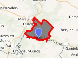
| |
 Montigny-l'Allier  Montigny-l'Allier | |
| Coordinates: 49°06′44″N 3°06′14″E | |
| Country | France |
| Region | Hauts-de-France |
| Department | Aisne |
| Arrondissement | Château-Thierry |
| Canton | Villers-Cotterêts |
| Government | |
| • Mayor (2008–2014) | Françoise Martini |
| Area 1 | 10.14 km2 (3.92 sq mi) |
| Population (2017-01-01)[1] | 274 |
| • Density | 27/km2 (70/sq mi) |
| Time zone | UTC+01:00 (CET) |
| • Summer (DST) | UTC+02:00 (CEST) |
| INSEE/Postal code | 02512 /02810 |
| Elevation | 55–151 m (180–495 ft) |
| 1 French Land Register data, which excludes lakes, ponds, glaciers > 1 km2 (0.386 sq mi or 247 acres) and river estuaries. | |
Population
| Year | Pop. | ±% |
|---|---|---|
| 1962 | 220 | — |
| 1968 | 203 | −7.7% |
| 1975 | 178 | −12.3% |
| 1982 | 187 | +5.1% |
| 1990 | 202 | +8.0% |
| 1999 | 239 | +18.3% |
| 2008 | 271 | +13.4% |
See also
References
- "Populations légales 2017". INSEE. Retrieved 6 January 2020.
| Wikimedia Commons has media related to Montigny-l'Allier. |
This article is issued from Wikipedia. The text is licensed under Creative Commons - Attribution - Sharealike. Additional terms may apply for the media files.