National Register of Historic Places listings in Bernalillo County, New Mexico
This is a list of the National Register of Historic Places listings in Bernalillo County, New Mexico.
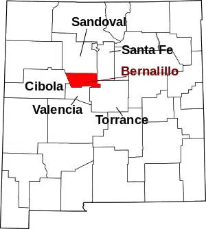
Location of Bernalillo County in New Mexico
This is intended to be a complete list of the properties and districts on the National Register of Historic Places in Bernalillo County, New Mexico, United States. Latitude and longitude coordinates are provided for many National Register properties and districts; these locations may be seen together in a map.[1]
There are 154 properties and districts listed on the National Register in the county, including 1 National Historic Landmark. Another 5 properties were once listed but have been removed.[2]
- This National Park Service list is complete through NPS recent listings posted January 29, 2021.[3]
| Bernalillo – Catron – Chaves – Cibola – Colfax – Curry – De Baca – Doña Ana – Eddy – Grant – Guadalupe – Harding – Hidalgo – Lea – Lincoln – Los Alamos – Luna – McKinley – Mora – Otero – Quay – Rio Arriba – Roosevelt – San Juan – San Miguel – Sandoval – Santa Fe – Sierra – Socorro – Taos – Torrance – Union – Valencia |
Current listings
| [4] | Name on the Register[5] | Image | Date listed[6] | Location | City or town | Description |
|---|---|---|---|---|---|---|
| 1 | Old Albuquerque Municipal Airport Building | 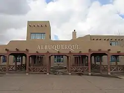 Old Albuquerque Municipal Airport Building |
May 5, 1989 (#89000348) |
2920 Yale Boulevard, SE. 35°02′52″N 106°37′14″W |
Albuquerque | |
| 2 | Albuquerque Veterans Administration Medical Center | 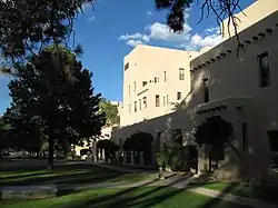 Albuquerque Veterans Administration Medical Center |
August 19, 1983 (#83001614) |
2100 Ridgecrest, SE. 35°03′18″N 106°35′02″W |
Albuquerque | |
| 3 | Aldo Leopold Neighborhood Historic District | Aldo Leopold Neighborhood Historic District |
October 16, 2002 (#02001164) |
105-135 14th St., SW. 35°05′15″N 106°39′45″W |
Albuquerque | |
| 4 | Gavino Anaya House | Gavino Anaya House |
February 9, 1984 (#84002840) |
2939 Duranes Rd., NW. 35°06′32″N 106°40′57″W |
Albuquerque | |
| 5 | Juan Cristobal Armijo Homestead | September 30, 1982 (#82003309) |
207 Griegos Rd., NE. 35°07′42″N 106°37′59″W |
Albuquerque | Hacienda hidden by shrubberies. | |
| 6 | Salvador Armijo House |  Salvador Armijo House |
October 8, 1976 (#76001191) |
618 Rio Grande Boulevard, NW. 35°05′58″N 106°40′10″W |
Albuquerque | |
| 7 | Art Annex | 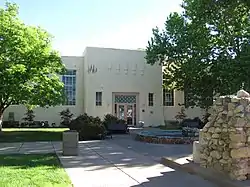 Art Annex |
September 22, 1988 (#88001540) |
Northeastern corner of Central Ave. and Terrace St., University of New Mexico 35°04′53″N 106°37′27″W |
Albuquerque | |
| 8 | AT & SF Freight Office | 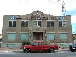 AT & SF Freight Office |
December 24, 2013 (#13000971) |
314 1st St. 35°04′54″N 106°38′54″W |
Albuquerque | Part of the Central Albuquerque MPS |
| 9 | Atchison, Topeka and Santa Fe Railway Locomotive Shops | 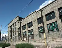 Atchison, Topeka and Santa Fe Railway Locomotive Shops |
October 15, 2014 (#14000859) |
Roughly bounded by BNSF RR, 1st & 2nd Sts. 35°04′33″N 106°39′01″W |
Albuquerque | |
| 10 | ATSF Locomotive No. 2926 | 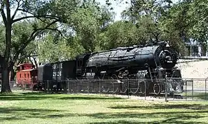 ATSF Locomotive No. 2926 |
October 1, 2007 (#07000388) |
1600 12th St., NW. 35°06′11″N 106°39′15″W |
Albuquerque | |
| 11 | Aztec Auto Court | 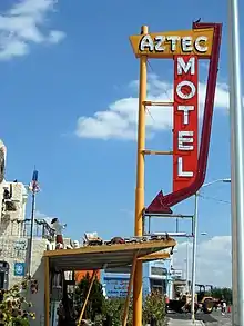 Aztec Auto Court |
November 22, 1993 (#93001217) |
3821 Central Ave., NE. 35°04′46″N 106°36′03″W |
Albuquerque | Demolished in 2011 |
| 12 | Adrian Barela House | 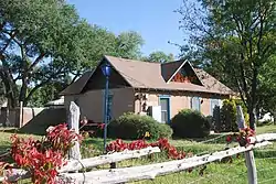 Adrian Barela House |
February 9, 1984 (#84002843) |
7618 Guadalupe Trail, NW. 35°10′15″N 106°38′24″W |
Los Ranchos de Albuquerque | |
| 13 | Barela-Bledsoe House | Barela-Bledsoe House |
March 12, 1979 (#79001534) |
7017 Edith Boulevard, NE. 35°09′32″N 106°37′14″W |
Albuquerque | |
| 14 | Barelas-South Fourth Street Historic District |  Barelas-South Fourth Street Historic District |
July 24, 1997 (#97000774) |
4th St. from Stover Ave. to Bridge St. 35°04′26″N 106°39′10″W |
Albuquerque | |
| 15 | Charles A. Bottger House |  Charles A. Bottger House |
March 7, 1983 (#83001615) |
110 San Felipe, NW. 35°05′41″N 106°40′08″W |
Albuquerque | |
| 16 | Building at 701 Roma NW | 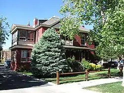 Building at 701 Roma NW |
February 28, 1985 (#85000375) |
701 Roma, NW. 35°05′23″N 106°39′14″W |
Albuquerque | |
| 17 | Carlisle Gymnasium | 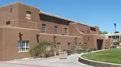 Carlisle Gymnasium |
September 22, 1988 (#88001541) |
University of New Mexico campus, west of Yale Boulevard 35°05′01″N 106°37′19″W |
Albuquerque | |
| 18 | Chester Carnes House | 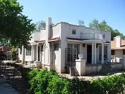 Chester Carnes House |
December 1, 1980 (#80002529) |
701 13th St., NW. 35°05′38″N 106°39′36″W |
Albuquerque | |
| 19 | Castle Apartments |  Castle Apartments |
February 13, 1986 (#86000219) |
1410 Central, SW. 35°05′17″N 106°39′50″W |
Albuquerque | Demolished in 2010 after fire |
| 20 | Juan de Dios Chavez House | 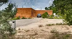 Juan de Dios Chavez House |
February 9, 1984 (#84002847) |
205 Griegos Rd., NW. 35°07′42″N 106°37′58″W |
Albuquerque | |
| 21 | Juan Chavez House | 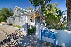 Juan Chavez House |
February 9, 1984 (#84002849) |
7809 4th St., NW. 35°09′46″N 106°38′04″W |
Albuquerque | |
| 22 | Rumaldo Chavez House | 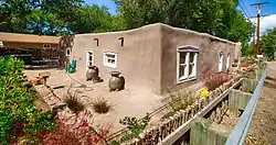 Rumaldo Chavez House |
November 24, 1980 (#80002530) |
10023 Edith Boulevard, NE. 35°11′35″N 106°36′11″W |
Alameda | |
| 23 | Congregation B'nai Israel | 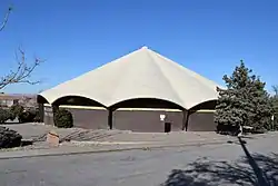 Congregation B'nai Israel |
May 2, 2019 (#100003674) |
4401 Indian School Rd. 35°06′07″N 106°35′41″W |
Albuquerque | |
| 24 | Coronado School | Coronado School |
November 22, 1996 (#96001383) |
601 4th St., SW. 35°04′44″N 106°39′08″W |
Albuquerque | |
| 25 | Cottage Bakery | 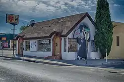 Cottage Bakery |
November 22, 1993 (#93001218) |
2000 Central Ave., SE. 35°04′51″N 106°37′25″W |
Albuquerque | |
| 26 | Davis House | 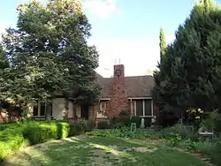 Davis House |
November 17, 1980 (#80002531) |
704 Parkland Circle, SE. 35°04′11″N 106°36′10″W |
Albuquerque | |
| 27 | De Anza Motor Lodge |  De Anza Motor Lodge |
April 30, 2004 (#04000375) |
4301 Central Ave., NE. 35°04′48″N 106°35′44″W |
Albuquerque | Mostly demolished in 2018 |
| 28 | Tomasa Griego De Garcia House | June 19, 1979 (#79001535) |
6939 Edith Boulevard, NE. 35°09′29″N 106°37′18″W |
Albuquerque | ||
| 29 | Robert Dietz Farmhouse | 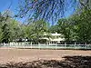 Robert Dietz Farmhouse |
February 9, 1984 (#84002852) |
4117 Rio Grande Boulevard, NW. 35°08′23″N 106°40′04″W |
Albuquerque | |
| 30 | Downtowner Motor Inn | 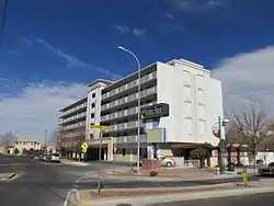 Downtowner Motor Inn |
November 4, 2020 (#100005731) |
717 Central Ave. NW 35°05′07″N 106°39′22″W |
Albuquerque | |
| 31 | Eighth Street-Forrester District |  Eighth Street-Forrester District |
December 1, 1980 (#80002532) |
Roughly bounded by Mountain Rd., Lomas Boulevard, and Forrester and 7th Sts. 35°05′37″N 106°39′17″W |
Albuquerque | |
| 32 | El Campo Tourist Courts |  El Campo Tourist Courts |
January 13, 1994 (#93001465) |
5800 Central Ave., SW. 35°04′52″N 106°42′10″W |
Albuquerque | |
| 33 | El Vado Auto Court | El Vado Auto Court |
November 22, 1993 (#93001214) |
2500 Central Ave., SW. 35°05′39″N 106°40′36″W |
Albuquerque | |
| 34 | Eller Apartments | 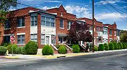 Eller Apartments |
January 12, 1984 (#84002855) |
113-127 8th St., SW. 35°05′04″N 106°39′22″W |
Albuquerque | |
| 35 | Employees' New Dormitory and Club | 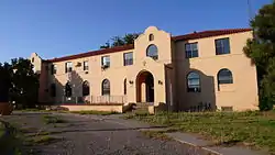 Employees' New Dormitory and Club |
July 26, 1982 (#82003310) |
Albuquerque Indian School campus 35°06′26″N 106°39′18″W |
Albuquerque | |
| 36 | Enchanted Mesa Trading Post | 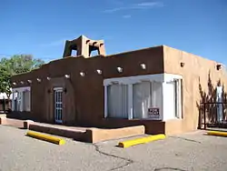 Enchanted Mesa Trading Post |
January 9, 1998 (#97001595) |
9612 Central Ave., SE. 35°04′15″N 106°32′25″W |
Albuquerque | |
| 37 | Estufa | 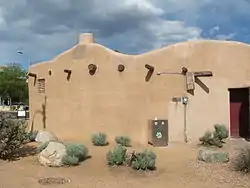 Estufa |
September 22, 1988 (#88001542) |
Southeastern corner of University Boulevard and Grand Ave., University of New Mexico 35°05′02″N 106°37′31″W |
Albuquerque | |
| 38 | Federal Building | 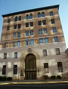 Federal Building |
November 22, 1980 (#80002533) |
421 Gold Ave., SW. 35°05′02″N 106°39′08″W |
Albuquerque | |
| 39 | First Methodist Episcopal Church | 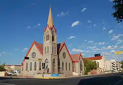 First Methodist Episcopal Church |
November 7, 1976 (#76001192) |
3rd St. and Lead Ave. 35°04′52″N 106°39′02″W |
Albuquerque | |
| 40 | First National Bank Building | 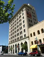 First National Bank Building |
February 2, 1979 (#79003127) |
217-233 Central Ave., NW. 35°05′05″N 106°38′58″W |
Albuquerque | |
| 41 | C. M. Foraker Farmhouse | February 9, 1984 (#84002858) |
905 Menaul Boulevard, NW. 35°06′46″N 106°39′12″W |
Albuquerque | Demolished c. 2009 | |
| 42 | Fourth Ward District |  Fourth Ward District |
December 1, 1980 (#80002534) |
Roughly bounded by Central Ave., Lomas Boulevard, and 8th and 15th Sts. 35°05′26″N 106°39′27″W |
Albuquerque | |
| 43 | Juan Antonio Garcia House |  Juan Antonio Garcia House |
September 28, 1982 (#82003311) |
7442 Edith Boulevard, NE. 35°09′48″N 106°37′05″W |
Albuquerque | |
| 44 | James N. Gladding House | 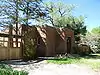 James N. Gladding House |
November 17, 1980 (#80002535) |
643 Cedar St., NE. 35°05′17″N 106°37′50″W |
Albuquerque | |
| 45 | Refugio Gomez House | February 9, 1984 (#84002864) |
7604 Guadalupe Trail, NW. 35°10′13″N 106°38′24″W |
Los Ranchos de Albuquerque | ||
| 46 | Charles Grande House | 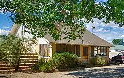 Charles Grande House |
February 9, 1984 (#84002866) |
4317 Grande St., NW. 35°07′46″N 106°39′17″W |
Albuquerque | |
| 47 | Delfina Gurule House | 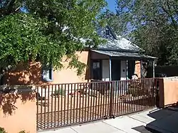 Delfina Gurule House |
December 1, 1980 (#80002536) |
306 16th St., NW. 35°05′32″N 106°39′48″W |
Albuquerque | |
| 48 | Harwood School | 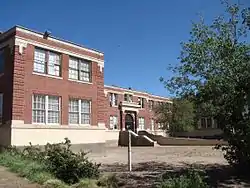 Harwood School |
December 1, 1980 (#80002537) |
1114 7th St., NW. 35°05′42″N 106°39′10″W |
Albuquerque | |
| 49 | A. W. Hayden House | 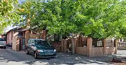 A. W. Hayden House |
December 1, 1980 (#80002538) |
609 Marble St., NW. 35°05′37″N 106°39′07″W |
Albuquerque | |
| 50 | Hendren Building | 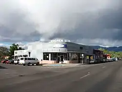 Hendren Building |
January 27, 2000 (#99001678) |
3001 Monte Vista Boulevard, NE. 35°05′00″N 106°36′43″W |
Albuquerque | |
| 51 | Hilltop Lodge | 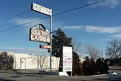 Hilltop Lodge |
January 9, 1998 (#97001597) |
5410 Central Ave. SW. 35°04′56″N 106°41′47″W |
Albuquerque | Demolished in 2003 |
| 52 | Hodgin Hall | 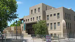 Hodgin Hall |
January 30, 1978 (#78001803) |
University of New Mexico campus 35°04′54″N 106°37′29″W |
Albuquerque | |
| 53 | Hoffmantown Baptist Church | 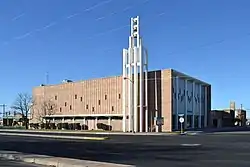 Hoffmantown Baptist Church |
October 25, 2019 (#100004492) |
2335 Wyoming Blvd. NE 35°06′39″N 106°33′04″W |
Albuquerque | |
| 54 | Holy Child Church | 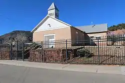 Holy Child Church |
March 8, 1978 (#78001810) |
Off Interstate 40 35°04′47″N 106°23′23″W |
Tijeras | |
| 55 | Hope Building | 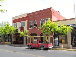 Hope Building |
August 29, 1980 (#80002539) |
220 Gold St., SW. 35°04′27″N 106°38′58″W |
Albuquerque | |
| 56 | James Lawrence and Juliana Gutierrez y Chavez Hubbell House | 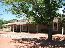 James Lawrence and Juliana Gutierrez y Chavez Hubbell House |
August 3, 2015 (#15000491) |
6029 Isleta Blvd. SW. 34°59′21″N 106°41′45″W |
Albuquerque | |
| 57 | Hudson House | 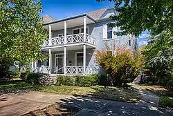 Hudson House |
February 24, 1982 (#82003313) |
817 Gold Ave., SW. 35°05′04″N 106°39′24″W |
Albuquerque | |
| 58 | Huning Highlands Conoco Service Station | 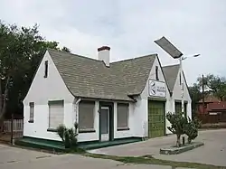 Huning Highlands Conoco Service Station |
July 19, 2006 (#06000633) |
601 Coal Ave., SE. 35°04′52″N 106°38′30″W |
Albuquerque | |
| 59 | Huning Highlands Historic District |  Huning Highlands Historic District |
November 17, 1978 (#78001804) |
Bounded by Grand Ave., Interstate 25, Iron Ave., and the former Santa Fe railroad line 35°04′51″N 106°38′31″W |
Albuquerque | |
| 60 | Immanuel Presbyterian Church | 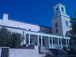 Immanuel Presbyterian Church |
February 22, 2011 (#11000032) |
114 Carlisle Boulevard SE 35°04′43″N 106°36′15″W |
Albuquerque | Buildings Designed by John Gaw Meem MPS |
| 61 | Isleta Pueblo | 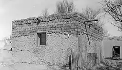 Isleta Pueblo |
September 5, 1975 (#75001162) |
U.S. Route 85 34°54′31″N 106°41′30″W |
Isleta Pueblo | |
| 62 | Jones Motor Company | 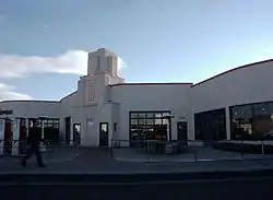 Jones Motor Company |
November 22, 1993 (#93001219) |
3226 Central Ave., SE. 35°04′38″N 106°37′09″W |
Albuquerque | |
| 63 | Jonson Gallery and House | 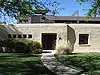 Jonson Gallery and House |
February 22, 2002 (#02000050) |
1909 Las Lomas Rd., NE. 35°05′13″N 106°37′15″W |
Albuquerque | |
| 64 | Kimo Theater | 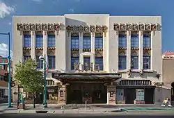 Kimo Theater |
May 2, 1977 (#77000920) |
421 Central Ave. 35°05′06″N 106°39′07″W |
Albuquerque | |
| 65 | S. H. Kress Building | 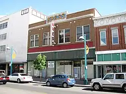 S. H. Kress Building |
April 19, 1984 (#84002871) |
414-416 Central Ave., SW. 35°05′04″N 106°39′07″W |
Albuquerque | |
| 66 | Kromer House | 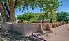 Kromer House |
October 4, 1982 (#82001048) |
1024 El Pueblo Rd., NW. 35°10′44″N 106°38′27″W |
Los Ranchos de Albuquerque | |
| 67 | La Mesa Motel | November 22, 1993 (#93001220) |
7407 Central Ave., NE. 35°04′32″N 106°33′51″W |
Albuquerque | Demolished in 2003 | |
| 68 | La Puerta Lodge | 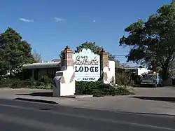 La Puerta Lodge |
January 9, 1998 (#97001596) |
9710 Central Ave., SE. 35°04′09″N 106°32′22″W |
Albuquerque | |
| 69 | La Glorieta House | 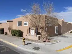 La Glorieta House |
August 19, 1983 (#83001616) |
1801 Central Ave., NW. 35°05′34″N 106°39′56″W |
Albuquerque | |
| 70 | Las Imagines Archeological District-Albuquerque West Mesa Escarpment | November 19, 1986 (#86003142) |
Address Restricted |
Albuquerque | ||
| 71 | Charles LeFeber House | December 1, 1980 (#80002540) |
313 15th St. NW 35°05′28″N 106°39′49″W |
Albuquerque | ||
| 72 | Lembke House | Lembke House |
November 25, 1980 (#80002541) |
312 Laguna Blvd. SW 35°05′18″N 106°40′05″W |
Albuquerque | |
| 73 | William J. Leverett House |  William J. Leverett House |
February 13, 1986 (#86000221) |
301 Dartmouth, NE. 35°05′08″N 106°36′44″W |
Albuquerque | |
| 74 | Charles W. Lewis Building |  Charles W. Lewis Building |
July 3, 1979 (#79001533) |
1405-1407 2nd St., SW. 35°04′18″N 106°39′05″W |
Albuquerque | |
| 75 | Hilario Lopez House | 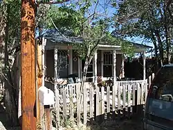 Hilario Lopez House |
December 1, 1980 (#80002542) |
208 16th St., NW. 35°05′28″N 106°39′48″W |
Albuquerque | |
| 76 | Los Candelarias Chapel-San Antonio Chapel | 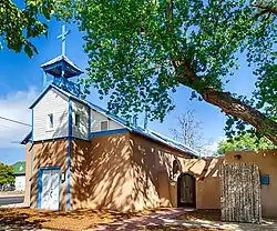 Los Candelarias Chapel-San Antonio Chapel |
February 9, 1984 (#84002844) |
1934 Candelaria Rd., NW. 35°07′17″N 106°40′00″W |
Albuquerque | |
| 77 | Los Duranes Chapel | 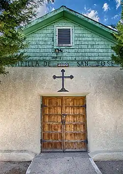 Los Duranes Chapel |
February 9, 1984 (#84002854) |
2601 Indian School Rd., NW. 35°06′39″N 106°40′28″W |
Albuquerque | |
| 78 | Los Griegos Historic District | 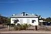 Los Griegos Historic District |
February 9, 1984 (#84002874) |
Griegos Rd. and Rio Grande Boulevard 35°08′09″N 106°39′46″W |
Albuquerque | |
| 79 | Los Poblanos Historic District | 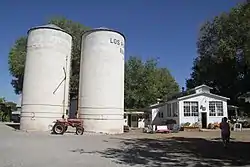 Los Poblanos Historic District |
May 27, 1982 (#82003321) |
State Road 194 35°08′46″N 106°40′05″W |
Los Ranchos de Albuquerque | |
| 80 | Los Tomases Chapel | 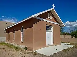 Los Tomases Chapel |
February 9, 1984 (#84002876) |
3101 Los Tomases, NW. 35°06′56″N 106°38′55″W |
Albuquerque | |
| 81 | Francisco Lucero y Montoya House | February 9, 1984 (#84002880) |
9742 4th St., NW. 35°11′32″N 106°36′56″W |
Alameda | ||
| 82 | Luna Lodge | 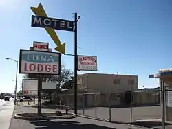 Luna Lodge |
June 11, 1998 (#98000600) |
9119 Central Ave., NE. 35°04′25″N 106°32′43″W |
Albuquerque | |
| 83 | Main Library | 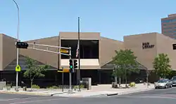 Main Library |
June 13, 2019 (#100003217) |
501 Copper Ave. NW. 35°05′09″N 106°39′12″W |
Albuquerque | |
| 84 | Maisel's Indian Trading Post | 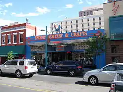 Maisel's Indian Trading Post |
November 22, 1993 (#93001215) |
510 Central Ave., SW. 35°05′04″N 106°39′10″W |
Albuquerque | |
| 85 | Henry Mann House | 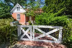 Henry Mann House |
December 1, 1980 (#80002543) |
723 14th St., NW. 35°05′44″N 106°39′38″W |
Albuquerque | |
| 86 | Manzano Court Addition Historic District | 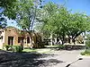 Manzano Court Addition Historic District |
October 14, 2004 (#03001234) |
1000-1025 Manzano Court, NW. 35°05′43″N 106°39′29″W |
Albuquerque | |
| 87 | McCanna-Hubbell Building | 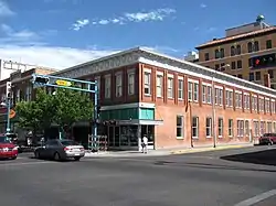 McCanna-Hubbell Building |
May 13, 1982 (#82003314) |
418-424 Central, SW. 35°05′04″N 106°39′07″W |
Albuquerque | |
| 88 | Menaul School Historic District | 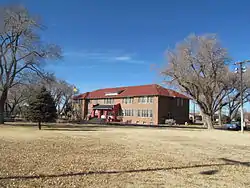 Menaul School Historic District |
February 14, 1983 (#83001617) |
Roughly bounded by Broadway, Claremont, Edith, and Menaul Aves., and 301 Menaul Boulevard, NE. 35°06′44″N 106°38′14″W |
Albuquerque | |
| 89 | John Milne House | 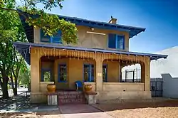 John Milne House |
February 13, 1986 (#86000223) |
804 Park Ave., SW. 35°05′06″N 106°39′23″W |
Albuquerque | |
| 90 | Modern Auto Court | 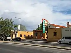 Modern Auto Court |
November 22, 1993 (#93001221) |
3712 Central Ave., SE. 35°04′44″N 106°36′08″W |
Albuquerque | |
| 91 | Monte Vista and College View Historic District |  Monte Vista and College View Historic District |
August 3, 2001 (#01000770) |
Roughly bounded by Girard and Lomas Boulevards, Morningside Dr., Copper Ave., and Campus and Monte Vista Boulevards. 35°05′02″N 106°36′23″W |
Albuquerque | |
| 92 | Monte Vista Fire Station | 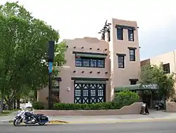 Monte Vista Fire Station |
March 19, 1987 (#87001121) |
3201 Central Ave., NE. 35°04′51″N 106°36′31″W |
Albuquerque | |
| 93 | Monte Vista School | 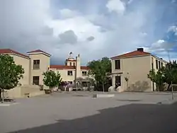 Monte Vista School |
August 12, 1981 (#81000399) |
3211 Monte Vista Boulevard, NE. 35°04′58″N 106°36′35″W |
Albuquerque | |
| 94 | National Humane Alliance Animal Fountain | 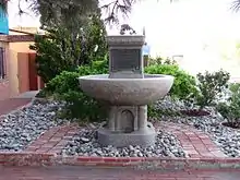 National Humane Alliance Animal Fountain |
September 30, 1986 (#86003120) |
615 Virginia Ave., SE. 35°04′02″N 106°33′09″W |
Albuquerque | |
| 95 | New Mexico Madonna of the Trail | 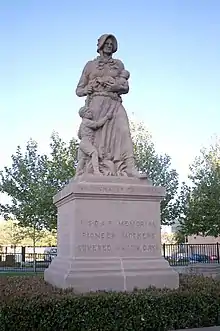 New Mexico Madonna of the Trail |
March 21, 2006 (#06000151) |
Junction of Marble Ave. and 4th St. 35°05′41″N 106°38′59″W |
Albuquerque | |
| 96 | New Mexico-Arizona Wool Warehouse | 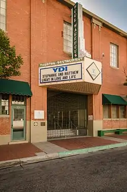 New Mexico-Arizona Wool Warehouse |
July 23, 1981 (#81000400) |
520 1st St., NW. 35°05′19″N 106°38′48″W |
Albuquerque | |
| 97 | Newlander Apartments |  Newlander Apartments |
January 27, 2000 (#99001677) |
616 Coal Ave. SW 35°04′58″N 106°39′20″W |
Albuquerque | |
| 98 | Nob Hill Business Center |  Nob Hill Business Center |
March 18, 1994 (#84004143) |
3500 Central Ave., SE. 35°04′46″N 106°36′16″W |
Albuquerque | |
| 99 | Robert Nordhaus House |  Robert Nordhaus House |
February 9, 1984 (#84002883) |
6900 Rio Grande Boulevard, NW. 35°09′47″N 106°39′00″W |
Albuquerque | |
| 100 | J. H. O'Rielly House | 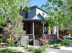 J. H. O'Rielly House |
January 29, 1979 (#79003442) |
220 9th St., NW. 35°05′13″N 106°39′23″W |
Albuquerque | |
| 101 | Occidental Life Building | 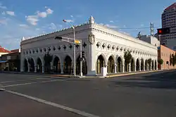 Occidental Life Building |
January 30, 1978 (#78001805) |
119 3rd Ave., SW. 35°05′01″N 106°39′01″W |
Albuquerque | |
| 102 | Old Armijo School |  Old Armijo School |
September 16, 1982 (#82003315) |
1021 Isleta Boulevard, SE. 35°03′22″N 106°40′11″W |
Albuquerque | |
| 103 | Old Hilton Hotel | 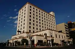 Old Hilton Hotel |
March 2, 1984 (#84002868) |
125 2nd St., NW. 35°05′06″N 106°38′56″W |
Albuquerque | |
| 104 | Old Post Office | 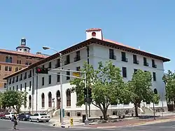 Old Post Office |
November 17, 1980 (#80002544) |
123 4th St., SW. 35°05′01″N 106°39′08″W |
Albuquerque | |
| 105 | Our Lady of Mt. Carmel Church | 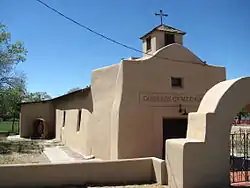 Our Lady of Mt. Carmel Church |
February 9, 1984 (#84002884) |
7813 Edith Boulevard, NE. 35°10′08″N 106°37′03″W |
Albuquerque | |
| 106 | Our Lady of the Angels School | 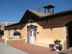 Our Lady of the Angels School |
November 29, 1984 (#84000426) |
320 Romero St., NW. 35°05′49″N 106°40′11″W |
Albuquerque | |
| 107 | Pacific Desk Building | 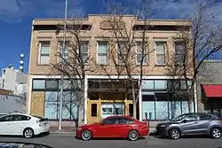 Pacific Desk Building |
September 30, 1980 (#80002545) |
213-215 Gold Ave., SW. 35°05′00″N 106°38′58″W |
Albuquerque | |
| 108 | Parkland Hills Historic District | June 7, 2019 (#100004034) |
Roughly bounded by Zuni Rd., Garfield and Smith Aves, Valverde Dr., and Carlisle Blvd. 35°04′16″N 106°36′00″W |
Albuquerque | ||
| 109 | John Pearce House | 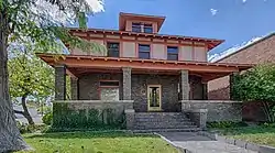 John Pearce House |
November 22, 1980 (#80002546) |
718 Central Ave., SW. 35°05′05″N 106°39′18″W |
Albuquerque | |
| 110 | Petroglyph National Monument | Petroglyph National Monument |
June 27, 1990 (#01000279) |
6001 Unser Boulevard, NW. 35°09′46″N 106°43′18″W |
Albuquerque | |
| 111 | Piedras Marcadas Pueblo (LA 290) | 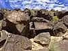 Piedras Marcadas Pueblo (LA 290) |
March 2, 1990 (#90000160) |
Address Restricted |
Albuquerque | |
| 112 | Pig 'n Calf Lunch |  Pig 'n Calf Lunch |
February 15, 1994 (#93001222) |
2106 Central Ave., SE. 35°04′51″N 106°37′21″W |
Albuquerque | |
| 113 | President's House | 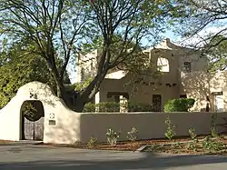 President's House |
September 22, 1988 (#88001543) |
Northeastern corner of Roma Ave. and Yale Boulevard, University of New Mexico 35°05′11″N 106°37′15″W |
Albuquerque | Now called University House. |
| 114 | Ernie Pyle House | 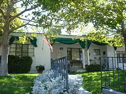 Ernie Pyle House |
September 22, 1997 (#97001103) |
900 Girard Boulevard, SE. 35°04′13″N 106°36′45″W |
Albuquerque | |
| 115 | Rancho de Carnue Site | May 4, 1977 (#77000921) |
Address Restricted |
Albuquerque | ||
| 116 | Sara Raynolds Hall | 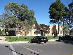 Sara Raynolds Hall |
September 22, 1988 (#88001544) |
University of New Mexico campus on Terrace St., north of Central Ave. 35°04′53″N 106°37′24″W |
Albuquerque | |
| 117 | Rio Puerco Bridge | 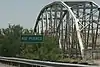 Rio Puerco Bridge |
July 15, 1997 (#97000735) |
Interstate 40 over the Rio Puerco 35°02′00″N 106°56′29″W |
Albuquerque | |
| 118 | Felipe Romero House |  Felipe Romero House |
February 9, 1984 (#84002885) |
7522 Edith Boulevard, NE. 35°09′55″N 106°37′03″W |
Albuquerque | |
| 119 | Roosevelt Park | 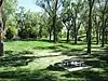 Roosevelt Park |
November 22, 1996 (#96001384) |
Junction of Coal and Spruce Aves., SE. 35°04′35″N 106°37′49″W |
Albuquerque | |
| 120 | Rosenwald Building | 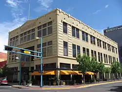 Rosenwald Building |
June 29, 1978 (#78001806) |
320 Central Ave., SW. 35°05′03″N 106°39′03″W |
Albuquerque | |
| 121 | Route 66, State maintained from Albuquerque to Rio Puerco | 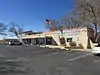 Route 66, State maintained from Albuquerque to Rio Puerco |
November 19, 1997 (#97001396) |
Former U.S. Route 66 west central exit at Interstate 40 to the Rio Puerco bridge 35°02′55″N 106°52′04″W |
Albuquerque | |
| 122 | St. John's Cathedral | .jpg.webp) St. John's Cathedral |
October 19, 2018 (#100003029) |
318 Silver Ave. 35°04′56″N 106°39′06″W |
Albuquerque | |
| 123 | Saint Joseph 1930 Hospital | 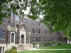 Saint Joseph 1930 Hospital |
May 27, 1982 (#82003316) |
715 Grand, NE. 35°05′09″N 106°38′18″W |
Albuquerque | |
| 124 | San Antonito Church and Cemetery | 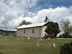 San Antonito Church and Cemetery |
January 16, 1997 (#96001607) |
Northwestern corner of the junction of State Roads 14 and 536 35°09′50″N 106°20′46″W |
San Antonito | |
| 125 | San Felipe de Neri Church | 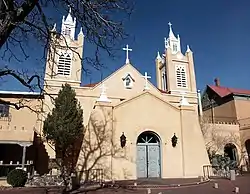 San Felipe de Neri Church |
October 1, 1969 (#69000140) |
Old Town Plaza, NW. 35°05′47″N 106°40′09″W |
Albuquerque | |
| 126 | San Ignacio Church | 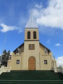 San Ignacio Church |
August 21, 1979 (#79001536) |
1300 Walter St., NE. 35°05′43″N 106°38′15″W |
Albuquerque | |
| 127 | Santa Barbara School | 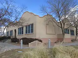 Santa Barbara School |
September 28, 1989 (#89001590) |
1420 Edith Boulevard, NE. 35°05′51″N 106°38′17″W |
Albuquerque | |
| 128 | Scholes Hall | 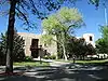 Scholes Hall |
September 22, 1988 (#88001545) |
University of New Mexico campus, south of Roma Ave. 35°05′08″N 106°37′23″W |
Albuquerque | |
| 129 | Second United Presbyterian Church | 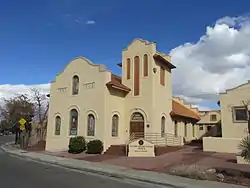 Second United Presbyterian Church |
December 6, 1984 (#84000563) |
812 Edith Boulevard, NE. 35°05′26″N 106°38′21″W |
Albuquerque | |
| 130 | Samuel Shalit House | February 9, 1984 (#84002888) |
5209 4th St., NW. 35°08′06″N 106°38′30″W |
Albuquerque | ||
| 131 | Shoup Boardinghouse | February 17, 1983 (#83001618) |
707 1st St., SW. 35°04′40″N 106°38′56″W |
Albuquerque | Demolished | |
| 132 | Silver Hill Historic District | 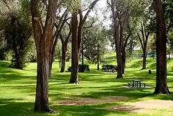 Silver Hill Historic District |
September 18, 1986 (#86002414) |
Roughly bounded by Central Ave., Yale Boulevard, Lead Ave., and Sycamore St. 35°04′46″N 106°37′33″W |
Albuquerque | |
| 133 | Simms Building | 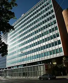 Simms Building |
February 2, 1998 (#97001653) |
400 Gold Ave., SW. 35°05′00″N 106°39′06″W |
Albuquerque | |
| 134 | Skinner Building | 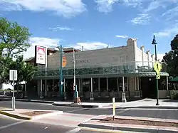 Skinner Building |
November 22, 1980 (#80004485) |
722-724 Central Ave. and 108 8th St., SW. 35°05′06″N 106°39′20″W |
Albuquerque | |
| 135 | Solar Building | 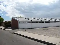 Solar Building |
October 10, 1989 (#89001589) |
213 Truman St., NE. 35°04′51″N 106°35′13″W |
Albuquerque | |
| 136 | Southern Union Gas Company Building | 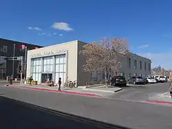 Southern Union Gas Company Building |
March 31, 2004 (#04000252) |
723 Silver Ave., SW. 35°05′06″N 106°39′23″W |
Albuquerque | |
| 137 | Southwestern Brewery and Ice Company | 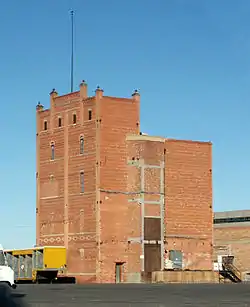 Southwestern Brewery and Ice Company |
March 30, 1978 (#78001807) |
601 Commercial St., NE. 35°05′20″N 106°38′42″W |
Albuquerque | |
| 138 | Berthold Spitz House | 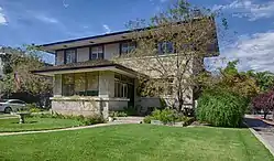 Berthold Spitz House |
December 22, 1977 (#77000922) |
323 N. 10th St. 35°05′19″N 106°39′28″W |
Albuquerque | |
| 139 | Springer Building | 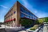 Springer Building |
November 18, 1980 (#80002547) |
121 Tijeras Ave., NE. 35°05′09″N 106°38′43″W |
Albuquerque | |
| 140 | Spruce Park Historic District | Spruce Park Historic District |
July 6, 1982 (#82003317) |
Roughly bounded by University Boulevard, Grand Ave., Las Lomas Rd., and Cedar St. 35°05′13″N 106°37′48″W |
Albuquerque | |
| 141 | Superintendent's House, Atlantic & Pacific Railroad | 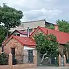 Superintendent's House, Atlantic & Pacific Railroad |
January 20, 1978 (#78001808) |
1023 2nd St. SW 35°04′29″N 106°39′03″W |
Albuquerque | |
| 142 | Domingo Tafoya House | November 17, 1980 (#80002528) |
10021 Edith Boulevard, NE. 35°11′35″N 106°36′12″W |
Alameda | ||
| 143 | Tewa Lodge | 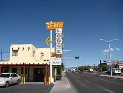 Tewa Lodge |
June 11, 1998 (#98000599) |
5715 Central Ave. NE. 35°04′40″N 106°34′53″W |
Albuquerque | |
| 144 | Tijeras Pueblo Archeological Site | 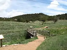 Tijeras Pueblo Archeological Site |
November 17, 2005 (#05001294) |
South of central Tijeras off State Road 337 35°04′30″N 106°23′00″W |
Tijeras | |
| 145 | Tower Court | Tower Court |
November 22, 1993 (#93001216) |
2210 Central Ave., SW. 35°05′42″N 106°40′26″W |
Albuquerque | |
| 146 | Antonio Vigil House | 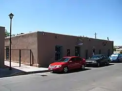 Antonio Vigil House |
May 5, 1978 (#78001809) |
413 Romero St. 35°05′52″N 106°40′12″W |
Albuquerque | |
| 147 | Vista Larga Residential Historic District | April 12, 2016 (#16000160) |
Roughly bounded by Indian School Rd., Columbia Dr., Hannett Ave., and University of New Mexico North Golf Course 35°06′02″N 106°37′09″W |
Albuquerque | ||
| 148 | Washington Apartments | Washington Apartments |
February 19, 1982 (#82003319) |
1002-1008 Central Ave., SW. 35°05′11″N 106°39′31″W |
Albuquerque | |
| 149 | Werner-Gilchrist House | 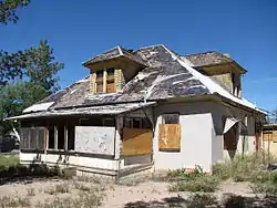 Werner-Gilchrist House |
August 2, 1982 (#82003320) |
202 Cornell, SE. 35°04′44″N 106°37′07″W |
Albuquerque | Demolished in 2011 |
| 150 | West San Jose School |  West San Jose School |
November 22, 1996 (#96001385) |
1701 4th St., SW. 35°04′06″N 106°39′06″W |
Albuquerque | |
| 151 | Whitcomb Springs | October 7, 2019 (#100004498) |
82 Carlito Springs Rd. 35°05′15″N 106°24′01″W |
Tijeras | ||
| 152 | J. R. Willis House and La Miradora Apartments | September 1, 2005 (#05000942) |
310 Rio Grande Boulevard, SW. 35°05′36″N 106°40′16″W |
Albuquerque | ||
| 153 | Charles Zeiger House | April 27, 1984 (#84002889) |
3200 Edith Boulevard, NE. 35°07′02″N 106°38′01″W |
Albuquerque | Demolished | |
| 154 | Zimmerman Library |  Zimmerman Library |
August 22, 2016 (#16000549) |
1900 Roma Ave., NE. 35°05′09″N 106°37′17″W |
Albuquerque |
Former listings
| [4] | Name on the Register | Image | Date listed | Date removed | Location | City or town | Summary |
|---|---|---|---|---|---|---|---|
| 1 | Alvarado Hotel Complex | Alvarado Hotel Complex |
March 3, 1970 (#70000902) | August 4, 1970 | 110 1st Street SW |
Albuquerque | |
| 2 | Gymnasium-Auditorium Building | July 26, 1982 (#82003312) | November 21, 1988 | Albuquerque Indian School Campus |
Albuquerque | ||
| 3 | Charles Ilfeld Company Warehouse |  Charles Ilfeld Company Warehouse |
June 10, 1975 (#75002130) | January 1, 1978 | 200 1st St. NW |
Albuquerque | |
| 4 | Horn Oil Co. and Lodge | January 9, 1998 (#97001591) | September 6, 2007 | 1720 Central Avenue |
Albuquerque | Demolished in 2006. | |
| 5 | University of New Mexico Lodge, Building 219 | July 26, 1982 (#82003318) | July 23, 1990 | Albuquerque Indian School Campus |
Albuquerque |
See also
| Wikimedia Commons has media related to National Register of Historic Places in Bernalillo County, New Mexico. |
References
- The latitude and longitude information provided in this table was derived originally from the National Register Information System, which has been found to be fairly accurate for about 99% of listings. Some locations in this table may have been corrected to current GPS standards.
- National Register of Historic Places Withdrawn Properties Finding Aid. National Park Service. August 2018. pp. 634–636. Retrieved June 4, 2020.
- "National Register of Historic Places: Weekly List Actions". National Park Service, United States Department of the Interior. Retrieved on January 29, 2021.
- Numbers represent an alphabetical ordering by significant words. Various colorings, defined here, differentiate National Historic Landmarks and historic districts from other NRHP buildings, structures, sites or objects.
- "National Register Information System". National Register of Historic Places. National Park Service. April 24, 2008.
- The eight-digit number below each date is the number assigned to each location in the National Register Information System database, which can be viewed by clicking the number.
Municipalities and communities of Bernalillo County, New Mexico, United States | ||
|---|---|---|
| Cities | Map of New Mexico highlighting Bernalillo County | |
| Town | ||
| Villages | ||
| CDPs | ||
| Other unincorporated communities | ||
| Indian reservations | ||
| Footnotes | ‡This populated place also has portions in an adjacent county or counties | |
| ||
| Topics | |
|---|---|
| Lists by state |
|
| Lists by insular areas | |
| Lists by associated state | |
| Other areas | |
| Related | |
| |
This article is issued from Wikipedia. The text is licensed under Creative Commons - Attribution - Sharealike. Additional terms may apply for the media files.