National Register of Historic Places listings in Lea County, New Mexico
This is a list of the National Register of Historic Places listings in Lea County, New Mexico.
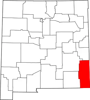
Location of Lea County in New Mexico
This is intended to be a complete list of the properties and districts on the National Register of Historic Places in Lea County, New Mexico, United States. Latitude and longitude coordinates are provided for many National Register properties and districts; these locations may be seen together in a map.[1]
There are 6 properties and 1 district listed on the National Register in the county. All of the places within the county on the National Register are also listed on the State Register of Cultural Properties.
- This National Park Service list is complete through NPS recent listings posted January 29, 2021.[2]
| Bernalillo – Catron – Chaves – Cibola – Colfax – Curry – De Baca – Doña Ana – Eddy – Grant – Guadalupe – Harding – Hidalgo – Lea – Lincoln – Los Alamos – Luna – McKinley – Mora – Otero – Quay – Rio Arriba – Roosevelt – San Juan – San Miguel – Sandoval – Santa Fe – Sierra – Socorro – Taos – Torrance – Union – Valencia |
Current listings
| [3] | Name on the Register[4] | Image | Date listed[5] | Location | City or town | Description |
|---|---|---|---|---|---|---|
| 1 | Laguna Plata Archeological District | September 14, 1989 (#89001209) |
Address Restricted |
Hobbs | ||
| 2 | Lea County Courthouse | 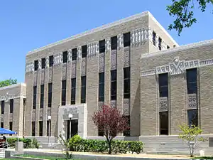 Lea County Courthouse |
December 7, 1987 (#87000880) |
100 block of Main St. 32°56′46″N 103°20′51″W |
Lovington | |
| 3 | Lea Theater | January 17, 2007 (#06001251) |
106 E. Central St. 32°56′59″N 103°20′54″W |
Lovington | ||
| 4 | Lovington Fire Department Building | July 2, 2008 (#08000574) |
209 S Love St. 32°56′49″N 103°20′51″W |
Lovington | part of the New Deal in New Mexico Multiple Property Submission | |
| 5 | Pyburn House | December 13, 1995 (#95001429) |
203 4th St. 32°56′58″N 103°21′13″W |
Lovington | ||
| 6 | Mathew Elmore Sewalt House | July 19, 2006 (#06000634) |
121 E. Jefferson Ave. 32°57′12″N 103°20′52″W |
Lovington |
See also
| Wikimedia Commons has media related to National Register of Historic Places in Lea County, New Mexico. |
References
- The latitude and longitude information provided in this table was derived originally from the National Register Information System, which has been found to be fairly accurate for about 99% of listings. Some locations in this table may have been corrected to current GPS standards.
- "National Register of Historic Places: Weekly List Actions". National Park Service, United States Department of the Interior. Retrieved on January 29, 2021.
- Numbers represent an alphabetical ordering by significant words. Various colorings, defined here, differentiate National Historic Landmarks and historic districts from other NRHP buildings, structures, sites or objects.
- "National Register Information System". National Register of Historic Places. National Park Service. July 9, 2010.
- The eight-digit number below each date is the number assigned to each location in the National Register Information System database, which can be viewed by clicking the number.
| Topics | |
|---|---|
| Lists by state |
|
| Lists by insular areas | |
| Lists by associated state | |
| Other areas | |
| Related | |
| |
Municipalities and communities of Lea County, New Mexico, United States | ||
|---|---|---|
| Cities | Map of New Mexico highlighting Lea County | |
| Town | ||
| CDPs | ||
| Other unincorporated communities | ||
| ||
This article is issued from Wikipedia. The text is licensed under Creative Commons - Attribution - Sharealike. Additional terms may apply for the media files.