Puli Alam
Puli Alam (Pashto/Persian: پل علم), also spelled Pul-i-Alam or Pol-e Alam, is the provincial capital of Logar Province, Afghanistan as well as of Puli Alam District. The population of Puli Alam is estimated to be around 108,000, which is composed of ethnic Pashtuns and Tajiks. The city of Puli Alam has a population of 22,914 (in 2015).[2] it has 4 districts and a total land area of 3,752 Hectares.[3] The total number of dwellings in this city are 2,546.[4]
Puli Alam
پل علم | |
|---|---|
City | |
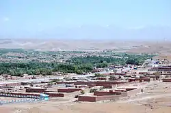 Puli Alam in 2007 | |
 Puli Alam | |
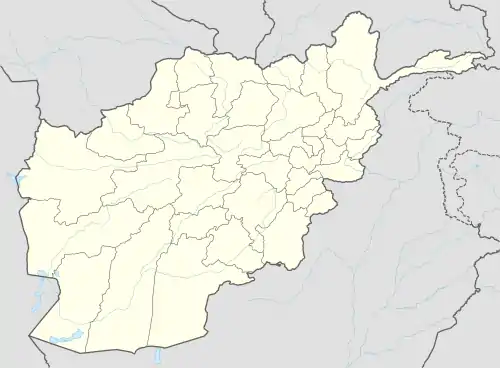
| Coordinates: 33°58′51″N 69°02′06″E | |
| Country | |
| Province | Logar |
| Elevation | 1,922 m (6,306 ft) |
| Population (2015) | |
| • Total | 22,914[1] |
| Time zone | UTC+4:30 |
Puli Alam has undergone massive reconstruction work after the fall of Taliban government.
A provincial reconstruction team PRT Logar of the Czech Republic was based in Puli Alam.
Climate
With a cold and temperate climate, Puli Alam features a warm-summer humid continental climate (Dsa) under the Köppen climate classification. It has warm, dry summers and cold, snowy winters. The average temperature in Puli Alam is 11.0 °C, while the annual precipitation averages 291 mm.
July is the hottest month of the year with an average temperature of 24.7 °C. The coldest month January has an average temperature of -6.8 °C.
| Climate data for Puli Alam | |||||||||||||
|---|---|---|---|---|---|---|---|---|---|---|---|---|---|
| Month | Jan | Feb | Mar | Apr | May | Jun | Jul | Aug | Sep | Oct | Nov | Dec | Year |
| Average high °C (°F) | −0.4 (31.3) |
6.9 (44.4) |
10.9 (51.6) |
18.6 (65.5) |
23.1 (73.6) |
30.9 (87.6) |
32.8 (91.0) |
32.2 (90.0) |
27.8 (82.0) |
20.4 (68.7) |
13.4 (56.1) |
5.5 (41.9) |
18.5 (65.3) |
| Daily mean °C (°F) | −6.8 (19.8) |
0.8 (33.4) |
5.0 (41.0) |
12.1 (53.8) |
15.3 (59.5) |
22.3 (72.1) |
24.7 (76.5) |
23.8 (74.8) |
18.7 (65.7) |
11.6 (52.9) |
5.5 (41.9) |
−1.3 (29.7) |
11.0 (51.8) |
| Average low °C (°F) | −13.2 (8.2) |
−5.3 (22.5) |
−0.9 (30.4) |
5.6 (42.1) |
7.6 (45.7) |
13.8 (56.8) |
16.6 (61.9) |
15.5 (59.9) |
9.7 (49.5) |
2.8 (37.0) |
−2.3 (27.9) |
−8.1 (17.4) |
3.5 (38.3) |
| Source: Climate-Data.org[5] | |||||||||||||
Land use
Puli Alam is an urban village in eastern Afghanistan.[6] Agriculture is the dominant land use, accounting for 49% of total land. Only 19% of land is classified as built-up, and 48% of this area is described as vacant plots.[7] In Districts 1–3, the majority of the dwellings are regular houses.[8]
Notable people
References
- "The State of Afghan Cities report 2015". Archived from the original on 31 October 2015. Retrieved 21 October 2015.
- "The State of Afghan Cities report2015". Archived from the original on 31 October 2015. Retrieved 21 October 2015.
- "The State of Afghan Cities report 2015". Archived from the original on 31 October 2015. Retrieved 21 October 2015.
- "The State of Afghan Cities report2015". Archived from the original on 31 October 2015. Retrieved 21 October 2015.
- "Climate: Pul-i-Alam - Climate-Data.org". Retrieved 9 September 2016.
- "The State of Afghan Cities report 2015". Archived from the original on 31 October 2015. Retrieved 21 October 2015.
- "The State of Afghan Cities report 2015". Archived from the original on 31 October 2015. Retrieved 21 October 2015.
- "The State of Afghan Cities report 2015". Archived from the original on 31 October 2015. Retrieved 21 October 2015.