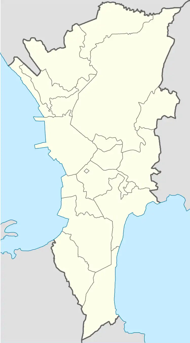
Putatan, Muntinlupa
Putatan is a barangay in Muntinlupa, Philippines. The total land area of the barangay is 6.746 km2. According to the 2010 census, it has a population of 82,015.
Putatan | |
|---|---|
 Putatan | |
| Coordinates: 14°23′54.12″N 121°2′10.96″E | |
| Country | Philippines |
| Region | National Capital Region |
| City | Muntinlupa |
| District | 1st Legislative district of Muntinlupa |
| Government | |
| • Type | Barangay |
| • Barangay Captain | Danilo R. Teves |
| Area | |
| • Total | 6.746 km2 (2.605 sq mi) |
| Population (2010) | |
| • Total | 82,015[1] |
| Time zone | UTC+8 (PST) |
| Range | Marikina Valley Fault Ridge |
Putatan is located at the south of the City of Manila. It is bounded by barangays Alabang and Bayanan on the north, the Laguna de Bay on the east, the Muntinlupa Poblacion on the south; and barangay Ayala Alabang on the west.
The barangay is also home to the city hall of Muntinlupa and its several departments.
History
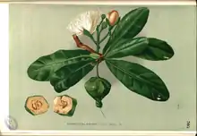
Putatan got its name from a plant, the Putat a species of Barringtonia native to mangrove habitats on the tropical coasts and islands of the Indian Ocean and western Pacific Ocean from Zanzibar east to Taiwan, the Philippines, Fiji, New Caledonia, Solomon Islands, the Cook Islands, Wallis and Futuna and French Polynesia.
Subdivisions
While barangays are the administrative divisions of the city, and are legally part of the addresses of establishments and homes, residents also include their subdivision. Listed below are subdivisions in this barangay.[2]
- Agro Homes Subdivision
- Bayfair Subdivision
- Bruger Subdivision
- Camella Townhomes 1
- Camella Townhomes 2
- Camella Homes 1
- Camella Homes 2
- Camella Homes 2-D
- Camella Homes 2-E
- Country Homes
- Express View Subdivision
- Freedom Hills
- Freewill Subdivision
- God's Will Homes
- Gruenville Subdivision
- Jayson Ville
- Joasmerray Subdivision
- La Charina Homes
- Lakeview Homes 1
- Lakeview Homes 2
- Multiland/Midland Subdivision
- Mutual Homes Ph1 & 2
- Mutual Homes Ph3
- Neuwrain Subdivision
- PUPA Homes
- RCE Homes
- Segundina Townhomes
- SMB Hills
- Soldiers Hills Subdivision
- South Greenheights Subdivision
- South Superville Subdivision
- Summitville Subdivision
- Treelane Subdivision
- V.M. Townhomes
- Hillsview Homes
References
- "Population Counts - National Capital Region" (PDF). 2010 Census and Housing Population. National Statistics Office. Retrieved 2015-08-21.
- "List of Subdivisions in the City of Muntinlupa". Archived from the original on 2016-01-14.