Navotas
Navotas, officially the City of Navotas (Tagalog: Lungsod ng Navotas), is a 1st class highly urbanized city in Metropolitan Manila, Philippines. According to the 2015 census, it has a population of 249,463 people. [3]
Navotas | |
|---|---|
| City of Navotas | |
 Aerial view of Navotas | |
 Seal | |
| Nickname(s): Commercial Fishing Hub of the Philippines | |
| Motto(s): Itaas ang antas ng Buhay-Navoteño (Raise the Level of the Navoteño Life) | |
| Anthem: Himno ng Navotas; English: Navotas Hymn | |
 Map of Metro Manila with Navotas highlighted | |
OpenStreetMap 
| |
.svg.png.webp) Navotas Location within the Philippines | |
| Coordinates: 14°40′00″N 120°56′30″E | |
| Country | |
| Region | National Capital Region (NCR) |
| Province | none |
| District | Lone district |
| Chartered | December 20, 1827 |
| Cityhood and HUC | June 24, 2007 |
| Barangays | 18 (see Barangays) |
| Government | |
| • Type | Sangguniang Panlungsod |
| • Mayor | Tobias Reynald M. Tiangco (Partido Navoteño/HNP) |
| • Vice Mayor | Clint Nicolas B. Geronimo (Partido Navoteño/PDP-Laban) |
| • Representative | John Reynald M. Tiangco (Partido Navoteño/HNP) |
| • Councilors | List
|
| • Electorate | 145,806 voters (2019) |
| Area | |
| • Total | 10.77 km2 (4.16 sq mi) |
| Area rank | 144th out of 145 |
| Elevation | 19 m (62 ft) |
| Population | |
| • Total | 249,463 |
| • Density | 23,000/km2 (60,000/sq mi) |
| • Households | 56,260 |
| Demonym(s) | Navoteño |
| Economy | |
| • Income class | 1st city income class |
| • Poverty incidence | 5.5% (2015)[4] |
| • Revenue | ₱941,848,230.31 (2016) |
| Time zone | UTC+8 (PST) |
| ZIP code | 1409, 1411–1413, 1485, 1489–1490 |
| PSGC | |
| IDD : area code | +63 (0)2 |
| Climate type | tropical monsoon climate |
| Native languages | Tagalog |
| Website | www |
It is known as the Commercial Fishing Hub of the Philippines, for the city has the third largest fish port in Asia and the largest in Southeast Asia. Although it was established on December 20, 1827, Navotas celebrates its foundation day every January 16. Navotas became a highly urbanized city on June 24, 2007.[5]
Etymology
The entire region of Navotas was once part of Malabon. According to one legend, the long and narrow delta extended unbroken from north to south along the seashore. The strip of land between the former district of Tondo, Manila and this town was eaten away by the sea until an opening was made. Water began to flow through the opening. The geographical change prompted the people to refer to the place as "butas", "nayon ng butas", or "nabutas", a Tagalog word that means breached or pierced through. What began as a natural channel developed into a regular waterway, now known as the Navotas River. In later years, the place came to be known as "Nabotas", then "Navotas".
It was also known as Hacienda de Navotas; it was once owned by the Dominican friars until it was sold to the Pascual family during the early days of the American regime and developed into a residential estate.
San Jose de Navotas was the name given to the locality after its patron saint, Saint Joseph. On June 11, 1859, a "Superior Decreto" established a new parish and municipality under the supervision of Friar Matias Navoa. The populace was divided into two distinct groups, the naturales (locals) and the mestizos. Mariano Estrellas was the gobernadorcillo (petty governor) of the naturales and Mariano Israel, of the mestizos. Today, because records are incomplete, recognition is only given to the gobernadorcillos for the mestizos. A school in honor of San Jose was built and known as "San Jose Academy."
History
—Unknown writer, Relation on Conquest of the Island of Luzon (1572)[6]
Historical timeline
- December 20, 1827 – The movement for separation of Navotas which was then a part of Malabon (Tambobong).
- February 16, 1859 – The date when the barrios of San Jose, Navotas and Bangculasi were separated from Malabon.
- 1859 – Cavada, the year when Navotas became an independent town.
- August 6, 1898 – Navotas joined the revolutionary government of General Emilio Aguinaldo.
- June 11, 1901 – Navotas was eventually incorporated into the newly created province of Rizal enacted Act. No. 137.
- 1904 – the town was again merged with Malabon. Bernardo Dagala, a native of Navotas, was elected municipal president.
- January 16, 1906 – Navotas finally became an independent municipality with the enactment of Act No. 1442 which separated it from Malabon.
- November 7, 1975 – Navotas was transferred from the Province of Rizal to the newly formed National Capital Region or Metro Manila, by virtue of Presidential Decree No. 824.[7]
- June 24, 2007 – Navotas became a highly urbanized city by virtue of Republic Act No. 9387 dated March 10, 2007, after a plebiscite was conducted.
- March 15, 2020 – the city and the entire metropolitan Manila was placed under community quarantine for one month due to the 2020 coronavirus pandemic.
Geography
Topography
Navotas is a coastal town in the northwest part of Metro Manila. It is a narrow strip of land with an aggregated shoreline of approximately 4.5 km. In the north, Navotas shares a common border with the town of Obando, Bulacan, along Sukol Creek which separates it from Balt. Along the eastern border runs the Binuangan River, the Daang Cawayan River, the Dampalit River, the Batasan River, the Navotas River, the Bangculasi Channel, the Malabon Channel and the Estero de Maypajo.
It is bordered on the north by Obando, Bulacan along Sukol Creek; on the south by the city of Manila; on the east by Daang Binuangan River, Bangkulasi Channel, Malabon Channel and Estero de Maypajo; and on the west by Manila Bay.
Climate
| Climate data for Navotas City | |||||||||||||
|---|---|---|---|---|---|---|---|---|---|---|---|---|---|
| Month | Jan | Feb | Mar | Apr | May | Jun | Jul | Aug | Sep | Oct | Nov | Dec | Year |
| Average high °C (°F) | 29 (84) |
30 (86) |
32 (90) |
34 (93) |
33 (91) |
31 (88) |
30 (86) |
29 (84) |
29 (84) |
30 (86) |
30 (86) |
29 (84) |
31 (87) |
| Average low °C (°F) | 20 (68) |
20 (68) |
21 (70) |
23 (73) |
24 (75) |
25 (77) |
24 (75) |
24 (75) |
24 (75) |
23 (73) |
22 (72) |
21 (70) |
23 (73) |
| Average precipitation mm (inches) | 7 (0.3) |
7 (0.3) |
9 (0.4) |
21 (0.8) |
101 (4.0) |
152 (6.0) |
188 (7.4) |
170 (6.7) |
159 (6.3) |
115 (4.5) |
47 (1.9) |
29 (1.1) |
1,005 (39.7) |
| Average rainy days | 3.3 | 3.5 | 11.1 | 8.1 | 18.9 | 23.5 | 26.4 | 25.5 | 24.5 | 19.6 | 10.4 | 6.4 | 181.2 |
| Source: Meteoblue [8] | |||||||||||||

Navotas is politically subdivided into 2 districts, with a total of 18 barangays:
Barangays
| Barangays of Navotas | ||||||
|---|---|---|---|---|---|---|
| Administration | Population | Miscellany | ||||
| Barangay[9] | District | Barangay Captain[10] | 2010 | 2015 [3] | 5 year Change | Zip Code |
| Bagumbayan North | 1st | Normita S. Santiago | 2,579 | 2,652 | −2.75% | |
| Bagumbayan South | 1st | Gregorio C. Dela Cruz | 5,051 | 4,524 | +11.65% | |
| Bangkulasi (Bangculasi)[lower-alpha 1] | 1st | Virginia S. Gatbunton | 7,954 | 8,263 | −3.74% | |
| Daanghari | 2nd | Rolando B. Trinidad | 16,894 | 19,179 | −11.91% | |
| Navotas East | 1st | Danilo O. Dela Cruz | 2,214 | 2,241 | −1.20% | |
| Navotas West | 1st | Carlito R. Kangken | 6,108 | 8,698 | −29.78% | |
| NBBS Dagat-dagatan (Northbay Boulevard South) | 1st | |||||
| NBBS Kaunlaran (Northbay Boulevard South)[lower-alpha 2] | 1st | Elvis A. Ayuda | 70,934 | 68,375 | +3.74% | |
| NBBS Proper (Northbay Boulevard South) | 1st | |||||
| Northbay Boulevard North | 1st | Melvin F. Manalo | 14,134 | 16,201 | −12.76% | |
| San Jose (Poblacion) | 2nd | Amos Rey C. Hechanova | 25,581 | 28,153 | −9.14% | 1485 |
| San Rafael Village | 1st | George U. So | 3,595 | 3,530 | +1.84% | |
| San Roque | 2nd | Bernildo P. Ocampo | 19,641 | 17,916 | +9.63% | |
| Sipac-Almacen | 1st | Antonio Brainardo P. Linang | 8,635 | 11,541 | −25.18% | |
| Tangos North | 2nd | 1489 | ||||
| Tangos South[lower-alpha 3] | 2nd | Armando C. Roque | 36,926 | 32,941 | +12.10% | 1489 |
| Tanza 1[lower-alpha 4] | 2nd | Carlito M. De Guzman | 29,217 | 24,917 | +17.26% | 1490 |
| Tanza 2 | 2nd | |||||
| City of Navotas | 249,463 | 249,131 | +0.13% | |||
| Source: Philippine Statistics Authority – Philippine Standard Geographic Code – City of Navotas – Barangays | ||||||
Navotas East
Navotas East is bounded by Barangay Sipac-Almacen to the north, Barangay Tañong of Malabon (via Estrella Bridge over Navotas River) to the east, Barangay Navotas West to the west, and Brgy. Bagumbayan North to the south. Their patron saint is San Ildefonso.
San Jose

The name of Barangay San Jose was derived from San Jose de Navotas Parish, the first place of worship in the town.
San Roque
Barangay San Roque is bounded by Tangos South to the northwest and north, Tangos North and Tanza, Navotas (via Badeo 5) to the northeast, Brgy. Hulong Duhat, Malabon and Brgy. Flores, Malabon in Malabon City to the east (via Navotas River, Badeo 4), Manila Bay to the west and Brgy. Daanghari to the south. Its name is derived from San Roque de Navotas Parish, the first place of worship in the town.
It is famous for its annual fiesta, every last Saturday and Sunday of the month of January. Every fiesta the whole barangay (including Brgy's Tangos North and Tangos South) is filled with stalls and stores. Also every fiesta of San Roque, A. Dela Cruz St. is full of stalls which sell kalamay, from Batangas.
Sipac-Almacen
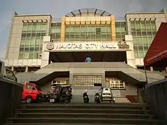
Barangay Sipac-Almacen is famous for the location of the Navotas City Hall and some points of interest like Navotas National High School, the main high school of Navotas, Navotas Playground, Jollibee, McDonald's and others.
Former barangays
Until 2018 Navotas had 14 barangays.
Northbay Boulevard South
In accordance with Republic Act No. 10933,[11] approved by President Rodrigo Duterte on August 23, 2017 and ratified in a plebiscite on January 5, 2018, Northbay Boulevard South was divided into Barangays NBBS Kaunlaran, NBBS Dagat-dagatan, and NBBS Proper.
Tangos
Pursuant to Republic Act No. 10934,[14] approved by President Rodrigo Duterte on August 23, 2017 and ratified in a plebiscite on January 5, 2018, Tangos was divided into Barangays Tangos North and Tangos South.
Tanza
Barangay Tanza occupied the northernmost portion of the city, including Isla Pulo which is separated from the city proper, and was bounded by Barangay Binuangan and Salambao in Obando, Bulacan to the north, Manila Bay and Barangay San Roque to the west, Barangay Hulong Duhat and Dampalit, Malabon to the east, and Barangay Tangos to the south.
By virtue of Republic Act No. 10935,[15] approved by President Rodrigo Duterte on August 23, 2017 and ratified in a plebiscite on January 5, 2018, Tanza was divided into Barangays Tanza 1 and Tanza 2.
Both Tanza 1 and Tanza 2 are accessible via Badeo 5 in Barangay San Roque, Navotas and the Tanza-Malabon Bridge in Barangay Hulong Duhat in Malabon.
Demographics
|
| ||||||||||||||||||||||||||||||||||||||||||||||||
| Source: Philippine Statistics Authority [3] [16] [17][18] | |||||||||||||||||||||||||||||||||||||||||||||||||
Economy
Shipbuilding and repair
In the ship repair sector, the Navotas complex in Metro Manila is expected to accommodate 96 vessels for repair.[21]
City government
Political profile
With regards to the separation of Navotas from Malabon in 1859 and the organization thereof as a distinct municipality or "pueblo" with its own government and church, this town was headed by the governadorcillos who exercised executive and judicial functions. However, as this locality was composed of two groups the naturales and the mestizos, each of which had its own governadorcillo appointed by the governor-general who was the supreme authority in all local matters, since the inhabitants did not allow choosing their officials. This political system was somehow revoked at the end of the Spanish Regime through the Maura Law of 1883, which guided some of the selected officials to the supervision of an insular authority. During the revolutionary period (from 1898–1902), as the democratic system of local governance was being established via the First Philippines Republic and Malolos Constitution, people of Navotas with high character, social position and honorable conduct gathered in a meeting and elected the chief of the town, the headman of the barrio (barangay) and three officials viz., for police and internal order, justice and civil registry, and taxes and property. In this situation, these elected officials constitute an assembly wherein the chief of the town was the president, the headman, the vice-president, and the justice officer the secretary. In this period, the name of Navotas LGU and its head were changed from "pueblo to municipality" and from "President to Mayor". Philippine Commission, which exercised supervision over local government, appointed the first local official. Gradually, election of officials was allowed.
During the period of the Philippine Commonwealth (from 1935–1945), the 1935 constitution ushered. This provided that the President of the Philippines should exercise general supervision over all local governments. This allowed Navotas to have three leaders. This trend from 1946 to 1972 (during the second Philippine Republic) was toward decentralization. Congress passed laws giving more autonomy to Local Government Units through the grant of additional powers and lessening of national control affairs. This created four (4) Mayors of Navotas. During the Martial Law Period, President Marcos had changed the structure and functions of LGU's, thus decentralization suffered the set back with the concentration of power on his hands. After December 31, 1975 (expiration of tenure of office of the local elective officials), the President assumed the power of appointment of the officials as authorized by the people in a referendum held on February 27, 1975. During the Marcos Regime, Navotas had two Mayors.
Navotas was proclaimed as a full-fledged city by virtue of RA 9387[22] that converted the municipality of Navotas into a highly urbanized city. A plebiscite was held on June 24, 2007 which was ratified the conversion of Navotas into a highly urbanized city.
Education
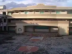
Navotas has 15 public elementary schools and 6 public secondary schools including Navotas National High School and Kaunlara High School.[23] The Navotas Polytechnic College located at the North Bay Boulevard South in Kaunlaran Village is owned and operated by the city.
Transportation
Transportation in Navotas are composed of different vehicles.
Notable people/groups
- Froilan Baguion, professional basketball player
- Engracia Cruz-Reyes, chef and entrepreneur
- Jorella Marie de Jesus, professional volleyball player
- Gerald Santos, singer and actor
- Wendy Valdez, beauty queen, and an actress.
- Jelo Acosta, rapper & actor
Twin towns / Sister cities
Notes
- The official website of the City of Navotas spells the barangay's name as "Bangkulasi" (which is also depicted in the barangay's seal that is shown by the website), while the Philippine Statistics Authority spells the name as "Bangculasi."
- Population figures refer to the former barangay of Northbay Boulevard South, which was divided into NBBS Dagat-dagatan, NBBS Kaunlaran, and NBBS Proper in 2018.
- Population figures refer to the former barangay of Tangos, which was divided into Tangos North and Tangos South in 2018.
- Population figures refer to the former barangay of Tanza, which was divided into Tanza 1 and Tanza 2 in 2018.
References
- City of Navotas | (DILG)
- "Province: NCR, THIRD DISTRICT (Not a Province)". PSGC Interactive. Quezon City, Philippines: Philippine Statistics Authority. Retrieved November 12, 2016.
- Census of Population (2015). "National Capital Region (NCR)". Total Population by Province, City, Municipality and Barangay. PSA. Retrieved June 20, 2016.
- "PSA Releases the 2015 Municipal and City Level Poverty Estimates". Quezon City, Philippines. Retrieved January 1, 2020.
- "Navotas Becomes Metro Manila's Newest City". Inquirer.net. Archived from the original on June 28, 2007. Retrieved June 24, 2007.
- Blair, Emma (1906). The Philippine Islands, 1493–1898. 3. Arthur H. Clark Company. p. 135.
- "Presidential Decree No. 824 November 7, 1975. Creating the Metropolitan Manila and the Metropolitan Manila Commission and for Other Purposes". lawphil.net. Arellano Law Foundation. November 7, 1975. Archived from the original on March 12, 2016. Retrieved July 10, 2020.
- "Navotas: Average Temperatures and Rainfall". Meteoblue. Retrieved May 13, 2020.
- "Our Barangays". City of Navotas official website. Retrieved May 22, 2020.
- "Baranggay Officials Database". bod.ncr.dilg.gov.ph.
- "REPUBLIC ACT NO. 10933, August 23, 2017". Chan Robles Virtual Law Library. Retrieved May 22, 2020.
- "REPUBLIC ACT NO. 10934, August 23, 2017". Chan Robles Virtual Law Library. Retrieved May 22, 2020.
- "REPUBLIC ACT NO. 10935, August 23, 2017". Chan Robles Virtual Law Library. Retrieved March 17, 2020.
- Census of Population and Housing (2010). "National Capital Region (NCR)". Total Population by Province, City, Municipality and Barangay. NSO. Retrieved June 29, 2016.
- Censuses of Population (1903–2007). "National Capital Region (NCR)". Table 1. Population Enumerated in Various Censuses by Province/Highly Urbanized City: 1903 to 2007. NSO.
- "Province of Metro Manila, 3rd (Not a Province)". Municipality Population Data. Local Water Utilities Administration Research Division. Retrieved December 17, 2016.
- Mongaya, Candeze (July 27, 2017). "Bulungan at the Navotas Fish Complex". Archived from the original on July 27, 2017.
- Lumaque, Leonard Brian L.; Lopez, Ahvie A.; Comedis, Emily (2015). Navotas: Sharing their Fishing Culture (PDF). Proceedings of the DLSU Research Congress. 3.
- De Leon, Max V. (November 22, 2012). "Filipino Firm Invests P259M for Shipyard in Navotas". Business Mirror. Archived from the original on December 16, 2012. Retrieved January 12, 2013.
- "Republic Act No. 9387: An Act Conventing the Municipality of Navotas into a Highly Urbanized City to be Known as the City of Navotas". The Corpus Juris. The Corpus Juris. Retrieved March 9, 2016.
- "Schools List" (PDF). Navotas City Website. Retrieved January 23, 2015.
External links
| Wikivoyage has a travel guide for Navotas. |
 Media related to Navotas City at Wikimedia Commons
 Geographic data related to Navotas at OpenStreetMap
- Navotas Profile at PhilAtlas.com
- Philippine Standard Geographic Code