San Juan, Metro Manila
San Juan, officially the City of San Juan (Tagalog: Lungsod ng San Juan), is a 1st class highly urbanized city in Metropolitan Manila, Philippines. According to the 2015 census, it has a population of 122,180 people. [4] It is geographically located at Metro Manila's approximate center and is also the country's smallest city in terms of land area.
San Juan
San Juan del Monte | |
|---|---|
| City of San Juan | |
.jpg.webp) .jpg.webp) 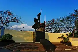 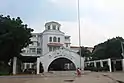 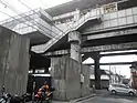 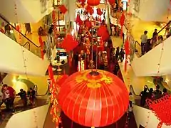 (From top, left to right: Sanctuario de Santo Cristo • Greenhills Shopping Center • Pinaglabanan Shrine • San Juan City Hall • LRT 2 J.Ruiz station • V Mall) | |
 Flag  Seal | |
| Nickname(s): Dakilang Lungsód ng San Juan (Great City of San Juan) | |
| Motto(s): Diwa ng 1896 ("Spirit of 1896") Makabagong San Juan (Modern San Juan) | |
| Anthem: San Juan, Sagisag ng Kalayaan (English: San Juan, Symbol of Freedom) | |
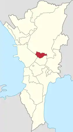 Map of Metro Manila with San Juan highlighted | |
OpenStreetMap 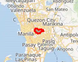
| |
.svg.png.webp) San Juan Location within the Philippines | |
| Coordinates: 14°36′N 121°02′E | |
| Country | |
| Region | National Capital Region (NCR) |
| Province | none |
| District | Lone district |
| Founded | 1623 |
| Cityhood and HUC | 17 June 2007 |
| Named for | St. John the Baptist |
| Barangays | 21 (see Barangays) |
| Government | |
| • Type | Sangguniang Panlungsod |
| • Mayor | Francisco Javier M. Zamora (PDP–Laban) |
| • Vice Mayor | José Warren P. Villa (PDP–Laban) |
| • Representative | Ronaldo B. Zamora (PDP–Laban) |
| • Councilors | List[2]
|
| • Electorate | 82,977 voters (2019) |
| Area | |
| • Total | 5.95 km2 (2.30 sq mi) |
| Area rank | 145th out of 145 |
| Elevation | 24 m (79 ft) |
| Population | |
| • Total | 122,180 |
| • Density | 21,000/km2 (53,000/sq mi) |
| • Households | 26,768 |
| Demonym(s) | San Juaneño (Male) San Juaneña (Female) |
| Economy | |
| • Income class | 1st city income class |
| • Poverty incidence | 2.35% (2015)[5] |
| • Revenue | ₱1,423,198,181.30 (2016) |
| Time zone | UTC+8 (PST) |
| ZIP code | 1500–1504 |
| PSGC | |
| IDD : area code | +63 (0)02 |
| Climate type | tropical monsoon climate |
| Native languages | Tagalog |
| Website | www |
The city is known historically for the site of the first battle of the Katipunan, the organization which led the 1896 Philippine Revolution against the Spanish Empire. Notable landmarks today such as Pinaglabanan Shrine and heritage homes are located in the city. Other locations include Greenhills and Santolan Town Plaza, making the city a major shopping hub with a range of upscale, boutique and bargain retail.[6]
Etymology
"San Juan City" is a contraction of the city's traditional name of "San Juan del Monte" (lit. 'Saint John of the Mountain'). As with numerous other places in the Philippines, the name combines a patron saint and a toponym; in this case Saint John the Baptist with the locale's hilly terrain and relatively higher elevation compared to surrounding areas.
The city's official name is "Dakilang Lungsód ng San Juan" (lit. 'Great City of San Juan').
History
During the pre-Hispanic period, the area of what is now San Juan was a part of the Kingdom of Namayan, whose last recorded rulers were King Lacantagean and his consort, Bouan. After the kingdom and other polities in the islands were absorbed into the Spanish Crown in the late 16th century, the realm of Namayan was christened Santa Ana de Sapa. The present area of San Juan was meanwhile re-classified as a barrio, becoming a small encomienda by 1590.
In 1602, the Dominicans built a retreat house in the vicinity for their immediate use, where ageing or convalescing friars stayed. Later, the Order constructed a convent and stone church dedicated to the Holy Cross. To this day, the thrice-rebuilt Santuario del Santo Cristo stands on the same site, adjacent to Aquinas School and Dominican College.

In 1783, San Juan was partitioned from Santa Ana but was still a barrio within the Province of Manila. The El Deposito reservoir was historically known as the site where the onset of the Philippine Revolution through the Battle of San Juan del Monte took place in 1896.[7] The opening salvo against Spain took place in San Juan in 1897 when the Katipunan attacked the alamacén (armoury) or polvorín (gunpowder magazine) of the Spanish East Indies colonial government. The town was later incorporated into the Province of Rizal in 1901 under American military rule.
On 7 November 1975, President Ferdinand Marcos signed Presidential Decree No. 824 that established the National Capital Region, and San Juan was among the towns excised from Rizal Province. Residents ratified the conversion of the municipality into a highly urbanised city on 17 June 2007, pursuant to Republic Act No. 9388 ("An Act Converting the Municipality of San Juan into a Highly Urbanized City to be known as the City of San Juan"). Then Representative Ronaldo B. Zamora sponsored the Cityhood Bill in the House of Representatives and worked for its approval.[8]
In 2020, San Juan and the entire metropolitan Manila was placed under community quarantine for one month starting March 15 due to the 2020 coronavirus pandemic.
Presidential ties
Although not officially designated as such, San Juan is noted to be the "City of Philippine Presidents." Four presidents since the Third Republic were official residents of San Juan when they assumed office. They were the Macapagal père et fille, Diosdado Sr. (1961–1965) and Gloria Arroyo (2001–2010); Ferdinand Marcos (1965–1986); and Joseph Estrada (1998–2001), who also served as Mayor when San Juan was still a municipality.
Geography
San Juan is the least-extensive city in the Philippines with a total area of just 595 hectares (2.30 sq mi).
San Juan is bounded by Quezon City on the north and east, Mandaluyong on the south, and the City of Manila in the west.
The territory of San Juan was once much larger than it is now, extending all the way to what is now Caloocan City. Parts of the present-day Districts 1, 4 and 6 of Quezon City as well as areas of Mandaluyong were originally within the town's colonial-era borders. This also explains why San Juan Reservoir is in nearby Horseshoe Village, a subdivision now part of Quezon City.
Climate
| Climate data for San Juan City | |||||||||||||
|---|---|---|---|---|---|---|---|---|---|---|---|---|---|
| Month | Jan | Feb | Mar | Apr | May | Jun | Jul | Aug | Sep | Oct | Nov | Dec | Year |
| Average high °C (°F) | 29 (84) |
30 (86) |
32 (90) |
34 (93) |
33 (91) |
31 (88) |
30 (86) |
29 (84) |
29 (84) |
30 (86) |
30 (86) |
29 (84) |
31 (87) |
| Average low °C (°F) | 20 (68) |
20 (68) |
21 (70) |
23 (73) |
24 (75) |
25 (77) |
24 (75) |
25 (77) |
24 (75) |
23 (73) |
22 (72) |
21 (70) |
23 (73) |
| Average precipitation mm (inches) | 7 (0.3) |
7 (0.3) |
9 (0.4) |
21 (0.8) |
101 (4.0) |
152 (6.0) |
188 (7.4) |
170 (6.7) |
159 (6.3) |
115 (4.5) |
47 (1.9) |
29 (1.1) |
1,005 (39.7) |
| Average rainy days | 3.3 | 3.5 | 11.1 | 8.1 | 18.9 | 23.5 | 26.4 | 25.5 | 24.5 | 19.6 | 10.4 | 6.4 | 181.2 |
| Source: Meteoblue [9] | |||||||||||||
Barangays
San Juan is politically subdivided into 21 barangays:
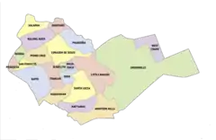
| District 1 | District 2 |
|---|---|
|
|
Demographics
|
| ||||||||||||||||||||||||||||||||||||||||||||||||
| Source: Philippine Statistics Authority [4] [10] [11][12] | |||||||||||||||||||||||||||||||||||||||||||||||||
Religion
The city also has several notable places of worship. Saint John the Baptist Parish, more commonly known as "Pinaglabanan Church", is where the city's patron saint, John the Baptist, is enshrined. The Santuario del Santo Cristo is the settlement's oldest existing church, while Mary the Queen Parish in West Greenhills serves the local Filipino-Chinese community.
From 1925–1971, the Iglesia ni Cristo once headquartered in the town at its former Central Office Complex, now known as the Locale of F. Manalo. It features Art-Deco designed ensembles, crafted by National Artist for Architecture Juan Nakpil. The Chapel is the centerpiece of the Complex, which also contains the old Central Office and Pastoral House which was the home of the church's first Executive Minister, Ka Felix Manalo, along with other Ministers and Evangelical Workers. When Manalo died in 1963, a mausoleum was constructed on the grounds of the Complex by architect Carlos Santos-Viola.
San Juan also has a number of Evangelical churches. Through the APOI ( Association of Pastors for Outreach and Intercession), they have contributed to the spiritual atmosphere of the city. Every January, the city celebrates the National Bible Week, where the reading of the Scripture happens during the flag raising ceremony in the City Hall. Through the blessing of the mayor, a bible was planted in the heart of the new city hall during its construction.
Major evangelical churches like Jesus is Lord, Victory Greenhills are also found in the city of San Juan.
Transportation
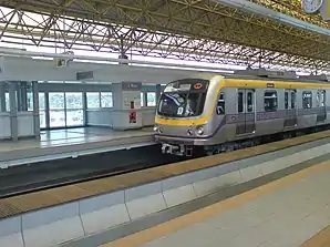
Modes of public transportation in San Juan include jeepneys and buses. Jeepney routes ply the Aurora Boulevard (R-6). The city is serviced by the Line 2. The only Line 2 station in San Juan is the J. Ruiz station. The C-3 (Araneta Avenue) also passes through San Juan. Secondary routes include Nicanor Domingo (abbreviated N. Domingo), which heads towards Cubao in Quezon City, and Pinaglabanan/Santolan Road, which leads towards Ortigas Avenue and eventually the southern reaches of Quezon City near Camp Crame, the headquarters of the Philippine National Police.
Education
The Polytechnic University of the Philippines maintains a campus in San Juan.
Notable people
- Joseph Estrada, former San Juan Mayor, former Manila Mayor, former President of the Philippines, actor
- Arturo Tolentino, former Vice President of the Philippines
- Paul Artadi, basketball player and District 1 councilor
- Edu Manzano, actor and former US Military officer
- JV Ejercito, former San Juan Mayor and former senator
- Eraño Manalo, former Iglesia ni Cristo Executive Minister from 1963-2009
- Jinggoy Estrada, former San Juan Mayor, former senator, actor
- Gabby Concepcion, actor
- Franklin Drilon, senator
- Jaymee Joaquin, former TV host
- Luis Manzano, actor and TV host
- Joross Gamboa, actor
- Janella Salvador, actress singer artist
- Grace Poe, senator and former MTRCB chairwoman
- Alfred Vargas, actor and Quezon City congressman
- Ericka Villongco, singer and actress
- Krissy Villongco, singer
- Don Allado, basketball player and coach
- Philip Cezar, PBA Player aka "Tapal King", vice mayor (1992-2001) and current basketball coach
- Francis Zamora, former Vice Mayor and incumbent Mayor (since 2019)
Sister cities
International

 San Juan, Puerto Rico, United States
- Maui, Hawaii, United States[15]
- Santa Barbara, California, United States[16][17]
Gallery
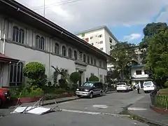
.jpg.webp) City of San Juan Government Center
City of San Juan Government Center- Pinaglabanan Shrine
- Santuario del Santo Cristo
 Sn. Juan Del Monte Presidencia, San Juan Medical Center
- V-Mall
.jpg.webp) Inside of Greenhills Shopping Center
Inside of Greenhills Shopping Center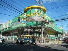 PureGold Agora Market
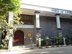 Museo ng Katipunan
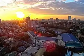 Panoramic view of San Juan from Xavier School Greenhills
References
- City of San Juan | (DILG)
- Councilors of San Juan, Metro Manila.
- "Province: NCR, SECOND DISTRICT (Not a Province)". PSGC Interactive. Quezon City, Philippines: Philippine Statistics Authority. Retrieved 12 November 2016.
- Census of Population (2015). "National Capital Region (NCR)". Total Population by Province, City, Municipality and Barangay. PSA. Retrieved 20 June 2016.
- "PSA releases the 2015 Municipal and City Level Poverty Estimates". Quezon City, Philippines. Retrieved 1 January 2020.
- "A short and sweet historical tour of San Juan City". The Manila Times. Retrieved 2018-07-26.
- "National Historical Commission of the Philippines official website". Pinaglabanan Memorial Shrine.
- Republic Act No. 9388 - Charter of the City of San Juan
- "San Juan: Average Temperatures and Rainfall". Meteoblue. Retrieved 13 May 2020.
- Census of Population and Housing (2010). "National Capital Region (NCR)". Total Population by Province, City, Municipality and Barangay. NSO. Retrieved 29 June 2016.
- Censuses of Population (1903–2007). "National Capital Region (NCR)". Table 1. Population Enumerated in Various Censuses by Province/Highly Urbanized City: 1903 to 2007. NSO.
- "Province of Metro Manila, 2nd (Not a Province)". Municipality Population Data. Local Water Utilities Administration Research Division. Retrieved 17 December 2016.
- sunstar.com.ph, Davao, San Juan cities ink sisterhood pact Archived 2008-10-08 at the Wayback Machine
- Tayona, Glenda; Silubrico, Ruby (25 August 2018). "Iloilo to showcase culture to 'sister cities' tonight". Panay News. Archived from the original on 9 April 2019. Retrieved 9 April 2019.
- "San Juan, Philippines & Maui, Hawaii". Washington, DC: Sister Cities International. Retrieved 2015-02-04.
- "Socal Sister Cities Directory". Southern California Sister Cities Directory. SoCal Chapter Inc. Retrieved 2015-02-05.
- "San Juan, Philippines & Santa Barbara, California". Washington, DC: Sister Cities International. Retrieved 2015-02-04.
External links
| Wikivoyage has a travel guide for San Juan (Metro Manila). |
| Wikimedia Commons has media related to San Juan City. |
- Official website
- San Juan Profile at PhilAtlas.com
- Philippine Standard Geographic Code
 Geographic data related to San Juan, Metro Manila at OpenStreetMap
Places adjacent to San Juan, Metro Manila | ||||||||||
|---|---|---|---|---|---|---|---|---|---|---|
| ||||||||||