Saint Ouen, Jersey
St Ouen (Jèrriais: St Ouën) is one of the twelve parishes of Jersey in the Channel Islands. It is around 8.8 kilometres (5.5 mi) north-west of St Helier.[lower-alpha 1] It has a population of 4,097.[3] The parish is the largest parish by surface area, covering 8,525 vergées (15 km2),[4] and is located in part on a peninsula.
Saint Ouen
Saint Ouën (Jèrriais) | |
|---|---|
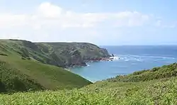 Cliffs at Plémont | |
.svg.png.webp) Coat of arms | |
 Location of Saint Ouen in Jersey | |
| Crown Dependency | Jersey, Channel Islands |
| Government | |
| • Connétable | Richard Buchanan |
| Area | |
| • Total | 15 km2 (6 sq mi) |
| Area rank | Ranked 1st |
| Population (2011)[2] | |
| • Total | 4,097 |
| • Density | 270/km2 (710/sq mi) |
| Time zone | GMT |
| • Summer (DST) | UTC+01 |
| Postcode district | |
| Postcode sector | 2 |
The parish is largely agricultural. There is no single centre as the church, parish hall and school are separated, however St Ouen's Village is the most significant settlement in the parish.
It is a highly distinct parish culturally. Being the farthest from St Helier, there are many differences between it and the rest of the island, for example having its own dialect of Jèrriais.
Its manor, Saint Ouen's Manor - the seat of the de Carteret family for over eight centuries - is the senior fief in the island, and the influence of that family has also been a factor in the parish's independent-minded approach to its affairs.[5]
History
The Jersey parish system has been in place for centuries. By Norman times, the parish boundaries were firmly fixed and remain largely unchanged since.[6]
St Ouen's name, as with most of the parishes of Jersey, originates from Saint Ouen de Rouen (Audaenus).
In 1180 Jersey was divided by the Normans into three ministeria for administrative purposes. St Ouen was part of Crapoudoit. Crapoudoit likely refers to the stream running through St Peter's Valley.[6]
The original parish school was St Ouen's Parochial School, next to the parish hall in the village and was originally opened in 1862 and closed in 1922. It became the St Ouen Youth and Community Centre in 1978.[7]
The parish hall was built in 1882 by architects Hayward and Son, of Exeter. The parish memorial is located in front of the hall, which includes the names of those involved in many interesting and trafic stories. For example, Sapper Philip Luce and Edward Luce were killed in action during the First World War.[7]
The parish church is located outside of the village in Ville de l'Eglise. Its origins date back to before 1066. A major restoration was instigated by Canon George Clement in 1865. The coffin of Sir Philippe de Cateret, who died in the English Civil War in 1643, was found in the church in 1869.[7]
Governance
The Parish forms an electoral district of the States Assembly, the legislature of Jersey. It elects one Connétable and one deputy, as well as eight senators (islandwide). Under the new proposed electoral reform, it will form part of the North West electoral district consisting of St Mary, St Ouen and St Peter, which will collectively elect 4 representatives.[8]
The present elected officials of the parish are Connétable Richard Buchannan and Deputy Richard Renouf.
Unlike the other parishes of Jersey, the subdivisions of this parish are not named vingtaines, but cueillettes (Jèrriais: tchilliettes). Vingteniers are still elected, however, in the cueillettes.
- La Petite Cueillette
- La Grande Cueillette
- La Cueillette de Grantez
- La Cueillette de Millais
- La Cueillette de Vinchelez
- La Cueillette de Léoville
Geography
St Ouen | ||||||||||
|---|---|---|---|---|---|---|---|---|---|---|
| ||||||||||
St Ouen is in the north-west of the island of Jersey, part of the Channel Islands archipelago. It borders St Mary and St Peter and is located 8.5 km (5 miles) from St Helier. Part of the parish forms a peninsula known as Grosnez. The northern and western boundaries of the island are entirely coastal, with notable bays including Grève de Lecq, Plémont and St Ouen's Bay. The Val de la Mare Valley and Reservoir are located in the south of the parish, along its border with St Peter.
The parish is mostly rural, with only 14% being built-up.[4] The primary settlement is St Ouen's Village, located in the east of the parish, which has the parish hall, a community centre, a pub, a number of shops and a village green. The rest of the population is dispersed in small developed pockets around the rural areas of the parish. The A12 road links the parish to the airport and St Helier, and part of the Five Mile Road is also located in the parish. The parish is served by three bus routes, the number 8, 9 and 22/x22.[9]
Demography
| Year | Pop. | ±% |
|---|---|---|
| 1991 | 3,612 | — |
| 1996 | 3,685 | +2.0% |
| 2001 | 3,803 | +3.2% |
| 2011 | 4,097 | +7.7% |
Culture
A number of the most influential writers of Jersey have been St. Ouennais. George F. Le Feuvre (1891–1984), who wrote under the pseudonym "George d'la Forge", was one of the most prolific authors of Jèrriais literature of the 20th century. Frank Le Maistre (1910–2002), compiler of the Dictionnaire Jersiais-Français (1966), did much to standardise the St. Ouennais dialect of Jèrriais as a literary language. Edward Le Brocq (1877–1964) wrote a weekly newspaper column from 1946 to 1964 recounting the lives and opinions of two St. Ouennais characters, Ph'lip and Merrienne.
The traditional nickname for St. Ouennais is Gris Ventres (grey bellies) - a reference to the custom of men from the parish to wear jerseys of undyed wool, which distinguished them from men from other parishes who generally wore blue.
Language
Ouennais influence can be seen in nearby Sark. Sark was recolonised by St. Ouennais. Helier de Carteret, the seigneur of the parish, received a charter from Queen Elizabeth I to colonise Sark with 40 families from the parish on condition that he maintain the island free of pirates. Sercquiais is therefore a very old offshoot of St Ouennais Jèrriais. The St. Ouennais origins of Sercquiais can be seen in the 2nd and 3rd person plural forms of the preterite. Sercquiais uses an ending -dr which is typical of the St. Ouennais dialect of Jèrriais, but generally not used elsewhere in Jersey (nor nowadays by younger speakers in St. Ouen).
| Sercquiais | Jèrriais (St. Ouennais) |
standard Jèrriais | English |
|---|---|---|---|
| i vuliidr | i' voulîdrent | i' voulîtent | they wanted |
| uu paaliidr | ou pâlîdres | ou pâlîtes | you spoke |
| i füüdr | i' fûdrent | i' fûtent | they were |
| uu prẽẽdr | ou prîndres | ou prîntes | you took |
Landmarks
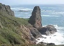

A number of prehistoric sites are located in St. Ouen, including the dolmen des Monts Grantez, located at Le Chemin des Monts;[10] the dolmen des Geonnais;[3] and the prehistoric site at Le Pinacle,[11] which also contains one of the very few identifiable Gallo-Roman sites to be seen in Jersey, the foundations of a fanum (small temple).
In the north west, the ruins of Grosnez Castle are a landmark which also features on the Jersey 50 pence coin (see coins of the Jersey pound).
The Island's racecourse is also to be found at Les Landes.
Education
St Ouen is split into two primary school catchments, Les Landes School and St Mary's School, and one secondary school, Les Quennevais. Students can also attend islandwide schools such as Hautlieu and Victoria College.
Les Landes School is a primary school, run by the States of Jersey, and located on La Rue des Cosnets, in Saint Ouen.[12]
Sport
Saint Ouen's local football team is St. Ouen F.C.[13]
Gallery
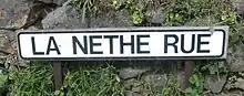 Road sign in La Néthe Rue (the black road in Jèrriais)
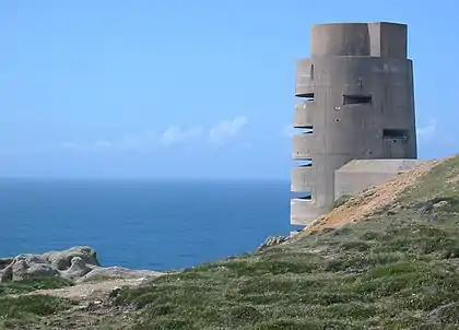 German Occupation observation tower situated at Les Landes
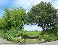 A field entrance in St. Ouen
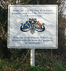
- Saint Ouen bilingual sign
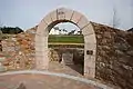 Le Don Hacquoil
Notes
- Measured from the Parish Hall to the Royal Square
References
- "Members". Statesassembly.gov.je. Retrieved 2012-10-13.
- "Archived copy" (PDF). Archived from the original (PDF) on March 1, 2014. Retrieved October 3, 2012.CS1 maint: archived copy as title (link)
- Jeremy Percival. "Dolmen des Geonnais". Prehistoricjersey.net. Retrieved 2012-10-03.
- Jersey, States of. "Government of Jersey". gov.je. Retrieved 2020-12-11.
- "Saint Ouen - theislandwiki". www.theislandwiki.org. Retrieved 2020-12-11.
- Syvret, Marguerite (2011). Balleine's History of Jersey. The History Press. ISBN 978-1860776502.
- "A history of St Ouen's Village - theislandwiki". www.theislandwiki.org. Retrieved 2020-12-11.
- https://statesassembly.gov.je/assemblypropositions/2020/p.139-2020.pdf
- "Route Planning".
|first=missing|last=(help) - Jeremy Percival. "Les Mont de Grantez". Prehistoricjersey.net. Retrieved 2012-10-03.
- Jeremy Percival. "Le Pinacle". Prehistoricjersey.net. Retrieved 2012-10-03.
- "Primary schools". Gov.je. 2012-08-30. Retrieved 2012-10-03.
- "Jersey - Sport - St. Ouen". BBC. 2014-11-27. Retrieved 2016-04-11.