Anor
Anor is a commune in the Nord department in northern France. It lies about forty kilometres (twenty-five miles) south-south-east of Maubeuge.
Anor | |
|---|---|
_mairie.jpg.webp) The town hall in Anor | |
.svg.png.webp) Coat of arms | |
Location of Anor 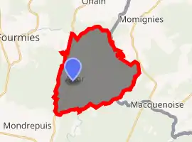
| |
 Anor  Anor | |
| Coordinates: 49°59′24″N 4°05′57″E | |
| Country | France |
| Region | Hauts-de-France |
| Department | Nord |
| Arrondissement | Avesnes-sur-Helpe |
| Canton | Fourmies |
| Intercommunality | Communauté de communes du Sud Avesnois |
| Government | |
| • Mayor (2014-2020) | Jean-Luc Pérat |
| Area 1 | 22.24 km2 (8.59 sq mi) |
| Population (2017-01-01)[1] | 3,220 |
| • Density | 140/km2 (370/sq mi) |
| Time zone | UTC+01:00 (CET) |
| • Summer (DST) | UTC+02:00 (CEST) |
| INSEE/Postal code | 59012 /59186 |
| Elevation | 200–271 m (656–889 ft) (avg. 238 m or 781 ft) |
| 1 French Land Register data, which excludes lakes, ponds, glaciers > 1 km2 (0.386 sq mi or 247 acres) and river estuaries. | |
- For the legal abbreviation, see List of legal abbreviations
Population
| Year | Pop. | ±% |
|---|---|---|
| 1793 | 1,552 | — |
| 1800 | 1,783 | +14.9% |
| 1806 | 1,907 | +7.0% |
| 1821 | 1,608 | −15.7% |
| 1831 | 2,552 | +58.7% |
| 1836 | 2,670 | +4.6% |
| 1841 | 2,866 | +7.3% |
| 1846 | 2,965 | +3.5% |
| 1851 | 3,066 | +3.4% |
| 1856 | 2,967 | −3.2% |
| 1861 | 2,929 | −1.3% |
| 1866 | 2,844 | −2.9% |
| 1872 | 3,637 | +27.9% |
| 1876 | 4,500 | +23.7% |
| 1881 | 4,539 | +0.9% |
| 1886 | 4,902 | +8.0% |
| 1891 | 4,663 | −4.9% |
| 1896 | 4,578 | −1.8% |
| 1901 | 4,610 | +0.7% |
| 1906 | 4,604 | −0.1% |
| 1911 | 4,412 | −4.2% |
| 1921 | 4,119 | −6.6% |
| 1926 | 4,528 | +9.9% |
| 1931 | 4,160 | −8.1% |
| 1936 | 3,938 | −5.3% |
| 1946 | 3,300 | −16.2% |
| 1954 | 3,700 | +12.1% |
| 1962 | 3,794 | +2.5% |
| 1968 | 3,622 | −4.5% |
| 1975 | 3,373 | −6.9% |
| 1982 | 3,109 | −7.8% |
| 1990 | 3,099 | −0.3% |
| 1999 | 3,091 | −0.3% |
| 2006 | 3,213 | +3.9% |
| 2009 | 3,242 | +0.9% |
| 2012 | 3,347 | +3.2% |
| 2015 | 3,315 | −1.0% |
See also
References
- "Populations légales 2017". INSEE. Retrieved 6 January 2020.
| Wikimedia Commons has media related to Anor. |
| Authority control |
|---|
This article is issued from Wikipedia. The text is licensed under Creative Commons - Attribution - Sharealike. Additional terms may apply for the media files.