Wattignies-la-Victoire
Wattignies-la-Victoire is a commune in the Nord department of northern France. It is close to the site of the Battle of Wattignies, fought in 1793 during the French Revolutionary Wars, in which the French scored a victory over Austria.
Wattignies-la-Victoire | |
|---|---|
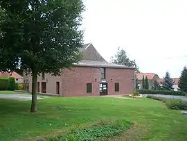 The town hall in Wattignies-la-Victoire | |
.svg.png.webp) Coat of arms | |
Location of Wattignies-la-Victoire 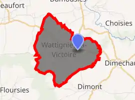
| |
 Wattignies-la-Victoire  Wattignies-la-Victoire | |
| Coordinates: 50°12′05″N 4°00′48″E | |
| Country | France |
| Region | Hauts-de-France |
| Department | Nord |
| Arrondissement | Avesnes-sur-Helpe |
| Canton | Fourmies |
| Intercommunality | Cœur de l'Avesnois |
| Government | |
| • Mayor (2014-2020) | Jean Lévêque |
| Area 1 | 6.31 km2 (2.44 sq mi) |
| Population (2017-01-01)[1] | 243 |
| • Density | 39/km2 (100/sq mi) |
| Time zone | UTC+01:00 (CET) |
| • Summer (DST) | UTC+02:00 (CEST) |
| INSEE/Postal code | 59649 /59680 |
| Elevation | 147–205 m (482–673 ft) (avg. 206 m or 676 ft) |
| 1 French Land Register data, which excludes lakes, ponds, glaciers > 1 km2 (0.386 sq mi or 247 acres) and river estuaries. | |
Heraldry
Arms of Wattignies-la-Victoire |
The arms of Wattignies-la-Victoire are blazoned : Gules, a bend vair. (Neuf-Mesnil and Wattignies-la-Victoire use the same arms.) |
Population
| Year | Pop. | ±% |
|---|---|---|
| 2006 | 261 | — |
| 2007 | 270 | +3.4% |
| 2008 | 269 | −0.4% |
| 2009 | 263 | −2.2% |
| 2010 | 258 | −1.9% |
| 2011 | 254 | −1.6% |
| 2012 | 250 | −1.6% |
| 2013 | 244 | −2.4% |
| 2014 | 243 | −0.4% |
| 2015 | 241 | −0.8% |
| 2016 | 244 | +1.2% |
See also
References
- "Populations légales 2017". INSEE. Retrieved 6 January 2020.
| Wikimedia Commons has media related to Wattignies-la-Victoire. |
| Authority control |
|
|---|
This article is issued from Wikipedia. The text is licensed under Creative Commons - Attribution - Sharealike. Additional terms may apply for the media files.