Strazeele
Strazeele (from Flemish; Strazele in modern Dutch spelling) is a commune in the Nord department in northern France.
Strazeele
Strazele | |
|---|---|
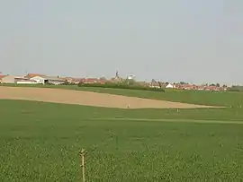 A general view of Strazeele | |
_Nord-france.svg.png.webp) Coat of arms | |
Location of Strazeele 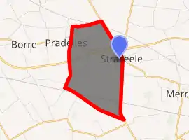
| |
 Strazeele  Strazeele | |
| Coordinates: 50°43′39″N 2°37′55″E | |
| Country | France |
| Region | Hauts-de-France |
| Department | Nord |
| Arrondissement | Dunkerque |
| Canton | Bailleul |
| Intercommunality | Communauté de communes de Flandre Intérieure |
| Government | |
| • Mayor (2014-2020) | Élisabeth Gressier |
| Area 1 | 4.69 km2 (1.81 sq mi) |
| Population (2017-01-01)[1] | 945 |
| • Density | 200/km2 (520/sq mi) |
| Demonym(s) | Strazeelois(es) |
| Time zone | UTC+01:00 (CET) |
| • Summer (DST) | UTC+02:00 (CEST) |
| INSEE/Postal code | 59582 /59270 |
| Elevation | 17–61 m (56–200 ft) (avg. 51 m or 167 ft) |
| 1 French Land Register data, which excludes lakes, ponds, glaciers > 1 km2 (0.386 sq mi or 247 acres) and river estuaries. | |
Politics
Presidential Elections 2nd Round
| Election | Winning Candidate | Party | % | |
|---|---|---|---|---|
| 2017 | Marine Le Pen | FN | 50.44 | |
| 2012 | Nicolas Sarkozy | UMP | 57.91 | |
| 2007 | Nicolas Sarkozy | UMP | 53.86 | |
| 2002 | Jacques Chirac | RPR | 74.38 | |
Heraldry
.svg.png.webp) Arms of Strazeele |
The arms of Strazeele are blazoned : Gules, a bend, between in orle 6 mullets of six points Or. |
See also
References
- "Populations légales 2017". INSEE. Retrieved 6 January 2020.
- http://www.lemonde.fr/data/france/presidentielle-2017//
| Wikimedia Commons has media related to Strazeele. |
| Authority control |
|
|---|
This article is issued from Wikipedia. The text is licensed under Creative Commons - Attribution - Sharealike. Additional terms may apply for the media files.