Montigny-en-Ostrevent
Montigny-en-Ostrevent is a commune in the Nord department in northern France.
Montigny-en-Ostrevent | |
|---|---|
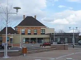 The town hall in Montigny-en-Ostrevent | |
_-Nord-France.svg.png.webp) Coat of arms | |
Location of Montigny-en-Ostrevent 
| |
 Montigny-en-Ostrevent  Montigny-en-Ostrevent | |
| Coordinates: 50°22′03″N 3°11′16″E | |
| Country | France |
| Region | Hauts-de-France |
| Department | Nord |
| Arrondissement | Douai |
| Canton | Aniche |
| Intercommunality | Communauté de communes Cœur d'Ostrevent |
| Government | |
| • Mayor (2014-2020) | Jean-Luc Coquerelle |
| Area 1 | 5.42 km2 (2.09 sq mi) |
| Population (2017-01-01)[1] | 4,801 |
| • Density | 890/km2 (2,300/sq mi) |
| Time zone | UTC+01:00 (CET) |
| • Summer (DST) | UTC+02:00 (CEST) |
| INSEE/Postal code | 59414 /59182 |
| Elevation | 18–40 m (59–131 ft) |
| 1 French Land Register data, which excludes lakes, ponds, glaciers > 1 km2 (0.386 sq mi or 247 acres) and river estuaries. | |
Heraldry
Arms of Montigny-en-Ostrevent |
The arms of Montigny-en-Ostrevent are blazoned : Quarterly 1&4: barry gules and vair; 2&3: Gules, 10 lozenges conjoined argent 3,3,3,1. |
See also
References
- "Populations légales 2017". INSEE. Retrieved 6 January 2020.
| Wikimedia Commons has media related to Montigny-en-Ostrevent. |
| Authority control |
|
|---|
This article is issued from Wikipedia. The text is licensed under Creative Commons - Attribution - Sharealike. Additional terms may apply for the media files.