Saint-Aubert, Nord
Saint-Aubert is a commune in the Nord department in northern France.
Saint-Aubert | |
|---|---|
 The church in Saint-Aubert | |
_Nord-France.svg.png.webp) Coat of arms | |
Location of Saint-Aubert 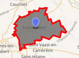
| |
 Saint-Aubert  Saint-Aubert | |
| Coordinates: 50°12′30″N 3°25′02″E | |
| Country | France |
| Region | Hauts-de-France |
| Department | Nord |
| Arrondissement | Cambrai |
| Canton | Caudry |
| Intercommunality | Communauté d'agglomération du Caudrésis - Catésis |
| Government | |
| • Mayor (2020-2026) | Pascal Gérard |
| Area 1 | 8.12 km2 (3.14 sq mi) |
| Population (2017-01-01)[1] | 1,570 |
| • Density | 190/km2 (500/sq mi) |
| Time zone | UTC+01:00 (CET) |
| • Summer (DST) | UTC+02:00 (CEST) |
| INSEE/Postal code | 59528 /59188 |
| Elevation | 58–97 m (190–318 ft) |
| 1 French Land Register data, which excludes lakes, ponds, glaciers > 1 km2 (0.386 sq mi or 247 acres) and river estuaries. | |
History
Private A S Bullock in his World War I memoir recalls spending a night on the brick floor of an abandoned house in St Aubert on 24 October 1928, waking at 5 am to heavy artillery bombardment. He provides a dramatic description of the battle that ensued, with horses carrying guns into battle and men stripped to the waist 'working like demons loading the guns'. He recalled, 'the shells were falling so thick and at such speed that the flash of their bursting seemed to cover the hill with a sheet of fire. It was incredible that anything could survive there.'[2]
Heraldry
Arms of Saint-Aubert |
The arms of Saint-Aubert are blazoned : Or, 3 chevrons gules. (Ivry-la-Bataille, Lesdain, Saint-Aubert and Tilloy-lez-Cambrai use the same arms.) |
See also
References
- "Populations légales 2017". INSEE. Retrieved 6 January 2020.
- Bullock, A S, Gloucestershire Between the Wars: A Memoir, The History Press, 2009, pages 79-80
| Wikimedia Commons has media related to Saint-Aubert (Nord). |
| Authority control |
|---|
This article is issued from Wikipedia. The text is licensed under Creative Commons - Attribution - Sharealike. Additional terms may apply for the media files.