Mons-en-Barœul
Mons-en-Barœul is a commune in the Nord department in northern France.
Mons-en-Barœul | |
|---|---|
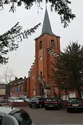 The church in Mons-en-Barœul | |
 Coat of arms | |
Location of Mons-en-Barœul 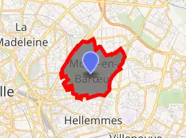
| |
 Mons-en-Barœul  Mons-en-Barœul | |
| Coordinates: 50°38′13″N 3°06′37″E | |
| Country | France |
| Region | Hauts-de-France |
| Department | Nord |
| Arrondissement | Lille |
| Canton | Lille-3 |
| Intercommunality | Métropole Européenne de Lille |
| Government | |
| • Mayor (2020–2026) | Rudy Elegeest[1] |
| Area 1 | 2.88 km2 (1.11 sq mi) |
| Population | 20,782 |
| • Density | 7,200/km2 (19,000/sq mi) |
| Time zone | UTC+01:00 (CET) |
| • Summer (DST) | UTC+02:00 (CEST) |
| INSEE/Postal code | 59410 /59370 |
| Elevation | 22–47 m (72–154 ft) (avg. 31 m or 102 ft) |
| 1 French Land Register data, which excludes lakes, ponds, glaciers > 1 km2 (0.386 sq mi or 247 acres) and river estuaries. | |
It is a suburb of the city of Lille, and is adjacent to it on the northeast. The name Mons-en-Barœul means mount in the Barœul, the city is built on a slight hill; the Barœul was a former territory (see also Marcq-en-Barœul). Before the sixteenth century, little is known of this county, which was only rural. Plans of the eighteenth century show Mons-en-Barœul as a small village without a church, with farms scattered along the high road from Lille to Roubaix. It is a former dependency of Fives, a district which is now part of Lille.
Heraldry
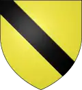
Arms of Mons-en-Barœul |
The arms of Mons-en-Barœul are blazoned : Or, a bend sable. (Flesquières, Gonnelieu, Mons-en-Barœul and Viesly use the same arms.) |
People
- Michel Butor was born in Mons-en-Barœul.
See also
References
- "Répertoire national des élus: les maires". data.gouv.fr, Plateforme ouverte des données publiques françaises (in French). 2 December 2020. Retrieved 11 December 2020.
- "Populations légales 2017". INSEE. Retrieved 6 January 2020.
External links
| Wikimedia Commons has media related to Mons-en-Barœul. |
.svg.png.webp)
| Authority control |
|---|
This article is issued from Wikipedia. The text is licensed under Creative Commons - Attribution - Sharealike. Additional terms may apply for the media files.