Aubers
Aubers is a commune in the Nord department in northern France. It is 15 km (9.3 mi) west of Lille.
Aubers | |
|---|---|
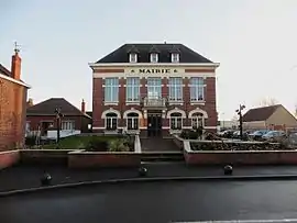 The town hall in Aubers | |
_Nord-france.svg.png.webp) Coat of arms | |
Location of Aubers 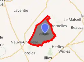
| |
 Aubers  Aubers | |
| Coordinates: 50°35′46″N 2°49′33″E | |
| Country | France |
| Region | Hauts-de-France |
| Department | Nord |
| Arrondissement | Lille |
| Canton | Annœullin |
| Intercommunality | Métropole Européenne de Lille |
| Government | |
| • Mayor (2014-2020) | Alain Leclercq |
| Area 1 | 10.14 km2 (3.92 sq mi) |
| Population (2017-01-01)[1] | 1,651 |
| • Density | 160/km2 (420/sq mi) |
| Time zone | UTC+01:00 (CET) |
| • Summer (DST) | UTC+02:00 (CEST) |
| INSEE/Postal code | 59025 /59249 |
| Elevation | 18–41 m (59–135 ft) (avg. 29 m or 95 ft) |
| 1 French Land Register data, which excludes lakes, ponds, glaciers > 1 km2 (0.386 sq mi or 247 acres) and river estuaries. | |
Population
| Year | Pop. | ±% |
|---|---|---|
| 1793 | 1,209 | — |
| 1800 | 1,292 | +6.9% |
| 1806 | 1,385 | +7.2% |
| 1821 | 1,431 | +3.3% |
| 1831 | 1,457 | +1.8% |
| 1836 | 1,558 | +6.9% |
| 1841 | 1,660 | +6.5% |
| 1846 | 1,704 | +2.7% |
| 1851 | 1,766 | +3.6% |
| 1856 | 1,740 | −1.5% |
| 1861 | 1,840 | +5.7% |
| 1866 | 1,963 | +6.7% |
| 1872 | 1,942 | −1.1% |
| 1876 | 1,945 | +0.2% |
| 1881 | 1,835 | −5.7% |
| 1886 | 1,812 | −1.3% |
| 1891 | 1,824 | +0.7% |
| 1896 | 1,730 | −5.2% |
| 1901 | 1,758 | +1.6% |
| 1906 | 1,702 | −3.2% |
| 1911 | 1,566 | −8.0% |
| 1921 | 747 | −52.3% |
| 1926 | 826 | +10.6% |
| 1931 | 871 | +5.4% |
| 1936 | 868 | −0.3% |
| 1946 | 855 | −1.5% |
| 1954 | 873 | +2.1% |
| 1962 | 847 | −3.0% |
| 1968 | 891 | +5.2% |
| 1975 | 908 | +1.9% |
| 1982 | 1,311 | +44.4% |
| 1990 | 1,571 | +19.8% |
| 1999 | 1,583 | +0.8% |
| 2006 | 1,527 | −3.5% |
| 2009 | 1,521 | −0.4% |
| 2011 | 1,535 | +0.9% |
| 2015 | 1,586 | +3.3% |
See also
References
- "Populations légales 2017". INSEE. Retrieved 6 January 2020.
| Wikimedia Commons has media related to Aubers. |
.svg.png.webp)
| Authority control |
|
|---|
This article is issued from Wikipedia. The text is licensed under Creative Commons - Attribution - Sharealike. Additional terms may apply for the media files.