Bazuel
Bazuel is a commune in the Nord department in northern France.
Bazuel | |
|---|---|
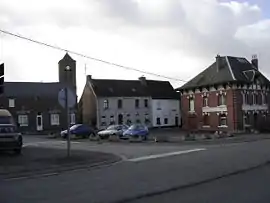 A view within Bazuel | |
_Nord-France.svg.png.webp) Coat of arms | |
Location of Bazuel 
| |
 Bazuel  Bazuel | |
| Coordinates: 50°05′30″N 3°35′21″E | |
| Country | France |
| Region | Hauts-de-France |
| Department | Nord |
| Arrondissement | Cambrai |
| Canton | Le Cateau-Cambrésis |
| Intercommunality | Communauté d'agglomération du Caudrésis - Catésis |
| Government | |
| • Mayor (2020-2026) | Jean-Félix Macarez |
| Area 1 | 11.81 km2 (4.56 sq mi) |
| Population (2017-01-01)[1] | 525 |
| • Density | 44/km2 (120/sq mi) |
| Time zone | UTC+01:00 (CET) |
| • Summer (DST) | UTC+02:00 (CEST) |
| INSEE/Postal code | 59055 /59360 |
| Elevation | 112–158 m (367–518 ft) |
| 1 French Land Register data, which excludes lakes, ponds, glaciers > 1 km2 (0.386 sq mi or 247 acres) and river estuaries. | |
It is 4 km (2.5 mi) southeast of Le Cateau-Cambrésis, and 25 km (16 mi) southeast of Cambrai.
Population
| Year | Pop. | ±% |
|---|---|---|
| 1793 | 550 | — |
| 1800 | 703 | +27.8% |
| 1806 | 848 | +20.6% |
| 1821 | 959 | +13.1% |
| 1831 | 1,112 | +16.0% |
| 1836 | 1,167 | +4.9% |
| 1841 | 1,216 | +4.2% |
| 1846 | 1,243 | +2.2% |
| 1851 | 1,299 | +4.5% |
| 1856 | 1,239 | −4.6% |
| 1861 | 1,256 | +1.4% |
| 1866 | 1,288 | +2.5% |
| 1872 | 1,245 | −3.3% |
| 1876 | 1,153 | −7.4% |
| 1881 | 1,056 | −8.4% |
| 1886 | 1,026 | −2.8% |
| 1891 | 966 | −5.8% |
| 1896 | 931 | −3.6% |
| 1901 | 940 | +1.0% |
| 1906 | 941 | +0.1% |
| 1911 | 881 | −6.4% |
| 1921 | 689 | −21.8% |
| 1926 | 753 | +9.3% |
| 1931 | 770 | +2.3% |
| 1936 | 710 | −7.8% |
| 1946 | 713 | +0.4% |
| 1954 | 762 | +6.9% |
| 1962 | 788 | +3.4% |
| 1968 | 801 | +1.6% |
| 1975 | 795 | −0.7% |
| 1982 | 726 | −8.7% |
| 1990 | 674 | −7.2% |
| 1999 | 571 | −15.3% |
| 2006 | 602 | +5.4% |
| 2009 | 578 | −4.0% |
| 2011 | 553 | −4.3% |
| 2015 | 540 | −2.4% |
Heraldry
Arms of Basuel |
The arms of Bazuel are blazoned : Gules, a rose slipped and leaved argent. (Bazuel, Maretz and Saint-Benin use the same arms.) |
See also
References
- "Populations légales 2017". INSEE. Retrieved 6 January 2020.
| Wikimedia Commons has media related to Bazuel. |
| Authority control |
|
|---|
This article is issued from Wikipedia. The text is licensed under Creative Commons - Attribution - Sharealike. Additional terms may apply for the media files.