Beaurieux, Nord
Beaurieux is a commune in the Nord department in northern France. It is about 1.5 km from the Belgian border, and about 25 km from Charleroi.
Beaurieux | |
|---|---|
_monument_aux_morts_(%C3%A9glise%252C_ch%C3%A2teau).jpg.webp) A view within Beaurieux | |
.svg.png.webp) Coat of arms | |
Location of Beaurieux 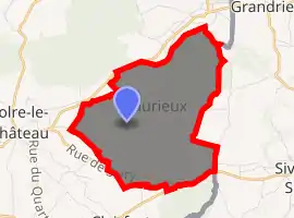
| |
 Beaurieux  Beaurieux | |
| Coordinates: 50°10′40″N 4°07′40″E | |
| Country | France |
| Region | Hauts-de-France |
| Department | Nord |
| Arrondissement | Avesnes-sur-Helpe |
| Canton | Fourmies |
| Intercommunality | Communauté de communes du Cœur de l'Avesnois |
| Government | |
| • Mayor (2014-2020) | Emmanuel Dursent |
| Area 1 | 7.39 km2 (2.85 sq mi) |
| Population (2017-01-01)[1] | 165 |
| • Density | 22/km2 (58/sq mi) |
| Time zone | UTC+01:00 (CET) |
| • Summer (DST) | UTC+02:00 (CEST) |
| INSEE/Postal code | 59062 /59740 |
| Elevation | 176–243 m (577–797 ft) (avg. 200 m or 660 ft) |
| 1 French Land Register data, which excludes lakes, ponds, glaciers > 1 km2 (0.386 sq mi or 247 acres) and river estuaries. | |
Population
| Year | Pop. | ±% |
|---|---|---|
| 1793 | 192 | — |
| 1800 | 179 | −6.8% |
| 1806 | 205 | +14.5% |
| 1821 | 220 | +7.3% |
| 1831 | 276 | +25.5% |
| 1836 | 306 | +10.9% |
| 1841 | 332 | +8.5% |
| 1846 | 340 | +2.4% |
| 1851 | 337 | −0.9% |
| 1856 | 311 | −7.7% |
| 1861 | 305 | −1.9% |
| 1866 | 288 | −5.6% |
| 1872 | 262 | −9.0% |
| 1876 | 256 | −2.3% |
| 1881 | 236 | −7.8% |
| 1886 | 232 | −1.7% |
| 1891 | 228 | −1.7% |
| 1896 | 239 | +4.8% |
| 1901 | 236 | −1.3% |
| 1906 | 229 | −3.0% |
| 1911 | 236 | +3.1% |
| 1921 | 225 | −4.7% |
| 1926 | 245 | +8.9% |
| 1931 | 238 | −2.9% |
| 1936 | 240 | +0.8% |
| 1946 | 224 | −6.7% |
| 1954 | 214 | −4.5% |
| 1962 | 215 | +0.5% |
| 1968 | 207 | −3.7% |
| 1975 | 191 | −7.7% |
| 1982 | 176 | −7.9% |
| 1990 | 182 | +3.4% |
| 1999 | 178 | −2.2% |
| 2005 | 175 | −1.7% |
| 2006 | 171 | −2.3% |
| 2009 | 168 | −1.8% |
| 2010 | 168 | +0.0% |
| 2015 | 163 | −3.0% |
See also
References
- "Populations légales 2017". INSEE. Retrieved 6 January 2020.
| Wikimedia Commons has media related to Beaurieux (Nord). |
| Authority control |
|
|---|
This article is issued from Wikipedia. The text is licensed under Creative Commons - Attribution - Sharealike. Additional terms may apply for the media files.