Antler Lake
Antler Lake is a hamlet in Alberta, Canada within Strathcona County.[2] It is located on the shores of Antler Lake on Range Road 211 and 211A just north of Wye Road, approximately 18 km (11 mi) east of Sherwood Park and 25 km (16 mi) northwest of Tofield.
Antler Lake | |
|---|---|
Hamlet | |
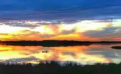 Canoe on Antler Lake | |
 Antler Lake Location of Antler Lake in Alberta | |
| Coordinates: 53°29′20″N 112°58′29″W | |
| Country | |
| Province | |
| Region | Edmonton Region |
| Census division | 11 |
| Specialized municipality | Strathcona County |
| Settled | 1975 |
| Government | |
| • Type | Unincorporated |
| • Mayor | Rod Frank |
| • Governing body | Strathcona County Council
|
| Area | |
| • Land | 0.89 km2 (0.34 sq mi) |
| Elevation | 739 m (2,425 ft) |
| Population (2016)[1] | |
| • Total | 442 |
| Time zone | UTC-7 (MST) |
| • Summer (DST) | UTC-6 (MDT) |
| Area code(s) | +1-780 |
| Highways | Highway 630 |
| Website | Strathcona County |
Antler Lake consists of residences developed on the eastern and southern shores of the lake, with some also developed on Hazelnut Island. It also has two playgrounds and access to outdoor recreation opportunities in the surrounding area.
The hamlet is near the Strathcona Wilderness Centre, Cooking Lake - Blackfoot Grazing, Wildlife and Provincial Recreation Area, and the Elk Island National Park of Canada. Antler Lake is also situated within 5 km (3.1 mi) of the Uncas Elementary School, which many of the local children attend.[3]
Demographics
As a designated place in the 2016 Census of Population conducted by Statistics Canada, Antler Lake recorded a population of 442 living in 180 of its 193 total private dwellings, a change of -2.6% from its 2011 population of 454. With a land area of 0.89 km2 (0.34 sq mi), it had a population density of 496.6/km2 (1,286.3/sq mi) in 2016.[1]
The population of Antler Lake according to Strathcona County's 2015 municipal census is 469.[4]
As a designated place in the 2011 Census, Statistics Canada originally reported that Antler Lake had a population of 0.[5] Statistics Canada subsequently amended Antler Lake's 2011 census results to a population of 454 living in 184 of its 191 total dwellings,[6] a 5.3% change from its 2006 population of .[5] With a land area of 0.89 km2 (0.34 sq mi),[5] it had a population density of 510/km2 (1,321/sq mi) in 2011.[6]
See also
References
- "Population and dwelling counts, for Canada, provinces and territories, and designated places, 2016 and 2011 censuses – 100% data (Alberta)". Statistics Canada. February 8, 2017. Retrieved February 13, 2017.
- Alberta Municipal Affairs (2010-04-01). "Specialized and Rural Municipalities and Their Communities" (PDF). Archived from the original (PDF) on 2012-02-29. Retrieved 2010-07-04.
- Antler Lake Archived May 17, 2008, at the Wayback Machine
- "Census 2015: Overall Results" (PDF). Strathcona County. p. 4. Retrieved June 1, 2016.
- "Population and dwelling counts, for Canada, provinces and territories, and designated places, 2011 and 2006 censuses (Alberta)". Statistics Canada. 2012-02-08. Retrieved 2012-04-06.
- "Corrections and updates: Population and dwelling count amendments, 2011 Census". Statistics Canada. February 14, 2013. Retrieved February 15, 2013.