Red Earth Creek
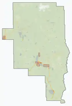
Red Earth Creek is a hamlet in Alberta, Canada within the Municipal District of Opportunity No. 17.[2] It is located east of Highway 88, between the Town of Slave Lake and the Hamlet of Fort Vermilion, and has an elevation of 520 metres (1,710 ft).
Red Earth Creek | |
|---|---|
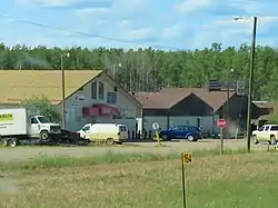 Businesses along Highway 88 | |
 Red Earth Creek  Red Earth Creek | |
| Coordinates: 56.5406°N 115.2853°W | |
| Country | Canada |
| Province | Alberta |
| Municipal district | Opportunity No. 17 |
| Government | |
| • Type | Unincorporated |
| • Governing body | M.D. of Opportunity No. 17 Council |
| Area | |
| • Total | 38.68 km2 (14.93 sq mi) |
| Elevation | 520 m (1,710 ft) |
| Population (2011)[1] | |
| • Total | 337 |
| • Density | 8.7/km2 (23/sq mi) |
| • Dwellings | 214 |
| Time zone | UTC-7 (MST) |
This hamlet is in census division No. 17 and in the federal riding of Fort McMurray-Athabasca. It is also the administrative centre of the Loon River First Nation reserve.
Demographics
As a designated place in the 2016 Census of Population conducted by Statistics Canada, Red Earth Creek recorded a population of 294 living in 111 of its 200 total private dwellings, a change of -12.8% from its 2011 population of 337. With a land area of 38.66 km2 (14.93 sq mi), it had a population density of 7.6/km2 (19.7/sq mi) in 2016.[3]
As a designated place in the 2011 Census, Red Earth Creek had a population of 337 living in 135 of its 214 total dwellings, a 26.2% change from its 2006 population of 267. With a land area of 38.68 km2 (14.93 sq mi), it had a population density of 8.713/km2 (22.57/sq mi) in 2011.[1]
The population according to the M.D. of Opportunity No. 17's 2007 municipal census was 398.[4]
Climate
| Climate data for Red Earth Creek | |||||||||||||
|---|---|---|---|---|---|---|---|---|---|---|---|---|---|
| Month | Jan | Feb | Mar | Apr | May | Jun | Jul | Aug | Sep | Oct | Nov | Dec | Year |
| Record high °C (°F) | 1.0 (33.8) |
8.0 (46.4) |
13.0 (55.4) |
30.0 (86.0) |
33.0 (91.4) |
32.8 (91.0) |
33.0 (91.4) |
33.0 (91.4) |
31.7 (89.1) |
22.2 (72.0) |
6.0 (42.8) |
1.0 (33.8) |
33.0 (91.4) |
| Average high °C (°F) | −9.4 (15.1) |
−5.9 (21.4) |
0.6 (33.1) |
10.0 (50.0) |
16.1 (61.0) |
19.6 (67.3) |
21.4 (70.5) |
20.3 (68.5) |
14.7 (58.5) |
10.5 (50.9) |
−5.0 (23.0) |
−7.8 (18.0) |
7.1 (44.8) |
| Daily mean °C (°F) | −15.3 (4.5) |
−11.0 (12.2) |
−6.6 (20.1) |
2.5 (36.5) |
9.8 (49.6) |
13.7 (56.7) |
15.5 (59.9) |
14.2 (57.6) |
9.0 (48.2) |
4.6 (40.3) |
−10.6 (12.9) |
−13.9 (7.0) |
1.0 (33.8) |
| Average low °C (°F) | −21.1 (−6.0) |
−16.1 (3.0) |
−13.8 (7.2) |
−5.1 (22.8) |
3.3 (37.9) |
7.7 (45.9) |
9.6 (49.3) |
8.1 (46.6) |
3.3 (37.9) |
−1.4 (29.5) |
−16.4 (2.5) |
−19.8 (−3.6) |
−5.1 (22.8) |
| Record low °C (°F) | −41.0 (−41.8) |
−30.5 (−22.9) |
−24.5 (−12.1) |
−20.5 (−4.9) |
−10.0 (14.0) |
−2.5 (27.5) |
1.0 (33.8) |
−3.0 (26.6) |
−14.4 (6.1) |
−13.3 (8.1) |
−31.0 (−23.8) |
−37.0 (−34.6) |
−41.0 (−41.8) |
| Average precipitation cm (inches) | 1.7 (0.7) |
0.9 (0.4) |
1.1 (0.4) |
1.3 (0.5) |
5.3 (2.1) |
8.8 (3.5) |
9.2 (3.6) |
6.5 (2.6) |
4.3 (1.7) |
2.0 (0.8) |
2.5 (1.0) |
1.8 (0.7) |
45.4 (18) |
| Average rainfall cm (inches) | 0.0 (0.0) |
0.0 (0.0) |
0.0 (0.0) |
0.3 (0.1) |
4.9 (1.9) |
8.8 (3.5) |
9.2 (3.6) |
6.5 (2.6) |
4.0 (1.6) |
0.9 (0.4) |
0.0 (0.0) |
0.0 (0.0) |
34.6 (13.7) |
| Average snowfall cm (inches) | 22 (8.7) |
14 (5.5) |
19 (7.5) |
18 (7.1) |
4 (1.6) |
0 (0) |
0 (0) |
0 (0) |
3 (1.2) |
8 (3.1) |
25 (9.8) |
18 (7.1) |
131 (51.6) |
| Average precipitation days (≥ 0.02cm) | 10 | 9 | 6 | 3 | 11 | 14 | 15 | 13 | 10 | 6 | 12 | 8 | 117 |
| Source: http://www.farmzone.com/statistics/summary/cl3075491/na020 | |||||||||||||
See also
References
- "Population and dwelling counts, for Canada, provinces and territories, and designated places, 2011 and 2006 censuses (Alberta)". Statistics Canada. 2012-02-08. Retrieved 2012-04-07.
- Alberta Municipal Affairs (2010-04-01). "Specialized and Rural Municipalities and Their Communities" (PDF). Retrieved 2010-07-03.
- "Population and dwelling counts, for Canada, provinces and territories, and designated places, 2016 and 2011 censuses – 100% data (Alberta)". Statistics Canada. February 8, 2017. Retrieved February 13, 2017.
- Prairie Wind Consulting Inc. (November 2009). "M.D. of Opportunity No. 17 Profile". Archived from the original on 2013-01-12. Retrieved February 10, 2010.