Cadomin
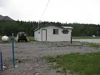
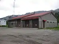
Cadomin /ˈkædəmɪn/ is a hamlet in the west-central Alberta, Canada within Yellowhead County.[2] It is located along the McLeod River in the foothills of the Rocky Mountains, approximately 50 kilometres (31 mi) south of Hinton near the Bighorn Highway. It is served by a spur of the Canadian National Railway.[3]
Cadomin | |
|---|---|
 Location of Cadomin in Alberta | |
| Coordinates: 53.03246°N 117.32652°W | |
| Country | |
| Province | |
| Census division | No. 14 |
| Municipal district | Yellowhead County |
| Government | |
| • Type | Unincorporated |
| • Mayor | Jim Eglinski |
| • Governing body | Yellowhead County Council
|
| Area | |
| • Total | 1.02 km2 (0.39 sq mi) |
| Elevation | 1,520 m (4,990 ft) |
| Population (2016)[1] | |
| • Total | 40 |
| • Density | 39.2/km2 (102/sq mi) |
| • Dwellings | 92 |
| Time zone | UTC−7 (MST) |
| • Summer (DST) | UTC−6 (MDT) |
Statistics Canada recognizes Cadomin as a designated place.[1] It is located in census division No. 14 and in the riding of Yellowhead. It is administered by Yellowhead County.[4]
History
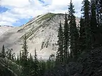
Cadomin's name is an acronym for 'Canadian Dominion Mining',[5][6] and the town gives its name to the Cadomin Formation, which forms a prominent outcrop near the settlement.
Cadomin is one of many towns in the Alberta Coal Branch area that thrived from the 1920s to the 1950s. During the early 1930s, Cadomin's population peaked at 1,800.[7] Other Coal Branch towns included Mountain Park, Luscar, Mercoal, and farther to the east, Robb, Embarras, Coalspur, Coal Valley, Lovett, and Foothills.[8]
Mining
The Cadomin Coal Company began operations in 1917 and four underground mines were eventually developed, as well as a surface mine that operated from 1944 to 1950. The main coal seam, called the No. 1 Seam, averaged 33 feet (10 m) in thicknesses. The strata in the area are strongly folded and faulted, and the seam is strongly inclined to overturned, so a variety of methods were employed to work it.[9] The coal was sold primarily as steam coal for railroad use, and the Cadomin coal mines closed in 1952 due to declining markets as the railroads replaced steam locomotives with diesel.[10]
Cadomin Quarry, operated by the Lehigh Cement Company (formerly Inland Cement), continues to employ a small number of local residents.[11]
Demographics
As a designated place in the 2016 Census of Population conducted by Statistics Canada, Cadomin recorded a population of 40 living in 21 of its 92 total private dwellings, a change of 11.1% from its 2011 population of 36. With a land area of 1.02 km2 (0.39 sq mi), it had a population density of 39.2/km2 (101.6/sq mi) in 2016.[1]
In the 2011 Census, Cadomin had a population of 36 living in 22 of its 96 total dwellings, a -35.7% change from its 2006 population of 56. With a land area of 1.14 km2 (0.44 sq mi), it had a population density of 31.6/km2 (81.8/sq mi) in 2011.[12]
Attractions
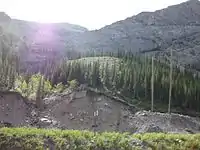
Cadomin Cave, located several kilometres to the south, used to attract a number of tourists during the summer months, although it remains undeveloped. The caves have been closed since 2010 due to the fungus growth the bats developed.[13]
In the area around Cadomin, there are extensive trails for horse back riding, all-terrain vehicles and dirt biking. Mountain biking is becoming increasingly popular as well. Bird watching is a popular hobby, and there are also regular butterfly counts every year.
The scientific and naturalist communities spend a great deal of time studying the extensive wildlife including bighorn sheep, grizzly bears, moose, elk, and other mountain species.
The fall provides numerous big game hunting opportunities for deer, moose and bighorn sheep.
See also
References
- "Population and dwelling counts, for Canada, provinces and territories, and designated places, 2016 and 2011 censuses – 100% data (Alberta)". Statistics Canada. February 8, 2017. Retrieved February 13, 2017.
- Alberta Municipal Affairs (2010-04-01). "Specialized and Rural Municipalities and Their Communities" (PDF). Archived from the original (PDF) on 2012-02-29. Retrieved 2010-07-10.
- Atlas of Alberta Railways. The Coal Branch
- Alberta Municipal Affairs. "Yellowhead County - Municipal district Profile". Archived from the original on 2009-04-26. Retrieved 2008-06-27.
- Temple, Robert D. Edge Effects: The Border-Name Places, (2nd edition, 2009), iUniverse, page 324.
- Alberta Speleological Society, Cadomin Cave Archived 2009-04-18 at the Wayback Machine
- Ghost Towns. Cadomin
- When Coal Was King: Coal Mining in Western Canada Archived 2007-09-27 at the Wayback Machine
- Melnyk, N. 1942. Lower level operations in a thick steeply pitching seam at Cadomin Coal Mine, Cadomin, Alberta. Canadian Institute of Mining and Metallurgy, Transactions, vol. XLV, p. 208-223.
- Kyba, Daniel and Jane Ross (2001). Exploring the historic Coal Branch. Calgary, Alberta: Rocky Mountain Books, 336 p. ISBN 0-921102-83-6.
- Alberta Source. Rockies, Coal Branch and Nordegg: Overview
- "Population and dwelling counts, for Canada, provinces and territories, and designated places, 2011 and 2006 censuses (Alberta)". Statistics Canada. 2012-02-08. Retrieved 2012-04-06.
- "Cadomin Cave | Alberta Speleological Society". www.caving.ab.ca. Retrieved 2020-09-25.
Places adjacent to Cadomin | |
|---|---|
