Priddis, Alberta
Priddis is a hamlet in Alberta, Canada within Foothills County.[1] It is located in the foothills of the Canadian Rockies at an elevation of 1,160 metres (3,810 ft). The hamlet is located southwest of the intersection of the Cowboy Trail (Highway 22) and Highway 22X, approximately 10 kilometres (6.2 mi) west of Calgary's city limits.
Priddis | |
|---|---|
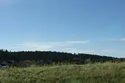 Panorama of Priddis from the Cowboy Trail | |
 Location of Priddis in Alberta | |
| Coordinates: 50.8861°N 114.3294°W | |
| Country | |
| Province | |
| Census division | No. 6 |
| Municipal district | Foothills County |
| Government | |
| • Type | Unincorporated |
| • Governing body | Foothills County Council |
| Elevation | 1,160 m (3,810 ft) |
| Time zone | UTC-7 (MST) |
The hamlet is located in census division No. 6 and in the federal riding of Macleod.
It was named for Charles Priddis, who homesteaded along the Fish Creek in 1886.[2]
References
- Alberta Municipal Affairs (2010-04-01). "Specialized and Rural Municipalities and Their Communities" (PDF). Archived from the original (PDF) on 2012-02-29. Retrieved 2010-06-24.
- Aphrodite Karamitsanis. Place Names of Alberta Volume 2: Southern Alberta
Places adjacent to Priddis, Alberta | |
|---|---|
This article is issued from Wikipedia. The text is licensed under Creative Commons - Attribution - Sharealike. Additional terms may apply for the media files.