Atmore, Alberta
Atmore is a hamlet in Alberta, Canada within Athabasca County.[3] It is located 1km east of the junction of Highway 55 and Highway 63, 43 kilometres (27 mi) west of Lac La Biche, 54 km (34 mi) east of Athabasca and 250 km (160 mi) south of Fort McMurray.
Atmore | |
|---|---|
Hamlet | |
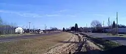 Highway 55 through the community | |
 Atmore Location of Atmore in Alberta | |
| Coordinates: 54°49′9″N 112°33′1″W | |
| Country | |
| Province | |
| Region | Northern Alberta |
| Census division | 13 |
| Municipal district | Athabasca County |
| Government | |
| • Reeve | Doris Splane |
| • Governing body | Athabasca County Council
|
| Area | |
| • Land | 0.54 km2 (0.21 sq mi) |
| Population (2016)[2] | |
| • Total | 35 |
| Time zone | UTC-7 (MST) |
| • Summer (DST) | UTC-6 (MDT) |
| Website | www |
The hamlet lies on the south-western shore of Charron Lake and has an elevation of 585 m (1,919 ft).
Demographics
As a designated place in the 2016 Census of Population conducted by Statistics Canada, Atmore recorded a population of 35 living in 14 of its 16 total private dwellings, a change of 75% from its 2011 population of 20. With a land area of 0.54 km2 (0.21 sq mi), it had a population density of 64.8/km2 (167.9/sq mi) in 2016.[2]
As a designated place in the 2011 Census, Atmore had a population of 20 living in 12 of its 13 total dwellings, a 0% change from its 2006 population of 20. With a land area of 0.53 km2 (0.20 sq mi), it had a population density of 38/km2 (98/sq mi) in 2011.[4]
See also
References
- "Municipal Officials Search". Alberta Municipal Affairs. September 22, 2017. Retrieved September 25, 2017.
- "Population and dwelling counts, for Canada, provinces and territories, and designated places, 2016 and 2011 censuses – 100% data (Alberta)". Statistics Canada. February 8, 2017. Retrieved February 13, 2017.
- Alberta Municipal Affairs (2010-04-01). "Specialized and Rural Municipalities and Their Communities" (PDF). Archived from the original (PDF) on 2012-02-29. Retrieved 2010-06-20.
- "Population and dwelling counts, for Canada, provinces and territories, and designated places, 2011 and 2006 censuses (Alberta)". Statistics Canada. 2012-02-08. Retrieved 2012-04-06.
Places adjacent to Atmore, Alberta | |
|---|---|