Ardillières
Ardillières is a commune in the Charente-Maritime department in the Nouvelle-Aquitaine region of southwestern France.
Ardillières | |
|---|---|
.JPG.webp) The road into Ardillières | |
Location of Ardillières 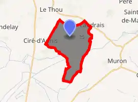
| |
 Ardillières  Ardillières | |
| Coordinates: 46°03′32″N 0°53′29″W | |
| Country | France |
| Region | Nouvelle-Aquitaine |
| Department | Charente-Maritime |
| Arrondissement | Rochefort |
| Canton | Surgères |
| Intercommunality | Aunis Sud |
| Government | |
| • Mayor (2020–2026) | Olivier Denechaud |
| Area 1 | 15.7 km2 (6.1 sq mi) |
| Population (2017-01-01)[1] | 849 |
| • Density | 54/km2 (140/sq mi) |
| Time zone | UTC+01:00 (CET) |
| • Summer (DST) | UTC+02:00 (CEST) |
| INSEE/Postal code | 17018 /17290 |
| Elevation | 0–31 m (0–102 ft) (avg. 17 m or 56 ft) |
| 1 French Land Register data, which excludes lakes, ponds, glaciers > 1 km2 (0.386 sq mi or 247 acres) and river estuaries. | |
The inhabitants of the commune are known as Ardilliérois or Ardilliéroises[2]
Geography
Ardillières is located some 25 km south-east of La Rochelle and 20 km east of Châtelaillon-Plage. Access to the commune is by the D111 road from Ciré-d'Aunis in the west passing through the commune and the village and continuing to the east. The D208 road also goes north-east from the village to join the D939 at Le Cher. The D205E2 also goes north-west from the village to Le Thou. Apart from the village there are also the hamlets of Les Perrieres, Toucherit, Villeneuve, and Bois des Mottes. The commune is entirely farmland apart from a few small patches of forest.[3]
The southern portion of the commune is covered with a network of canals which link to the Charras Canal which crosses the south of the commune from west to east.[3]
Neighbouring communes and villages
Places adjacent to Ardillières | ||||||||||
|---|---|---|---|---|---|---|---|---|---|---|
| ||||||||||
Administration
.JPG.webp)
List of Successive Mayors[4]
| From | To | Name | Party | Position |
|---|---|---|---|---|
| 1826 | 1830 | Etienne Martin | ||
| 1971 | 2001 | Guy Caquineau | SE | |
| 2001 | 2020 | Jean-Marie Targé | SE |
(Not all data is known)
Demography
In 2017 the commune had 849 inhabitants.
|
| ||||||||||||||||||||||||||||||||||||||||||||||||||||||||||||||||||||||||||||||||||||||||||||||||||||||||||||||||||
| Source: EHESS[5] and INSEE[6] | |||||||||||||||||||||||||||||||||||||||||||||||||||||||||||||||||||||||||||||||||||||||||||||||||||||||||||||||||||
Distribution of Age Groups
The population of the town is younger than the departmental average.
Percentage Distribution of Age Groups in Ardillières and Charente-Maritime Department in 2017
| Ardillières | Charente-Maritime | |||
|---|---|---|---|---|
| Age Range | Men | Women | Men | Women |
| 0 to 14 Years | 23.0 | 21.0 | 16.3 | 14.3 |
| 15 to 29 Years | 13.3 | 15.2 | 15.4 | 13.1 |
| 30 to 44 Years | 21.6 | 22.6 | 16.7 | 16.1 |
| 45 to 59 Years | 23.2 | 22.9 | 20.2 | 19.9 |
| 60 to 74 Years | 14.7 | 12.9 | 21.1 | 22.0 |
| 75 to 89 Years | 3.7 | 5.2 | 9.4 | 12.3 |
| 90 Years+ | 0.5 | 0.2 | 1.0 | 2.4 |
Culture and heritage
Civil heritage
The commune has several sites and buildings that are registered as historical monuments:
- The Château d'Ardillières (14th century).
 [9] There are two round towers. The 17th century lodging is surrounded by farm buildings of the same period and recent constructions. The medieval cellar is remarkable.
 - The Pierre Levée Dolmen (Neolithic)[10]
- The Pierre-Fouquerée Dolmen (Neolithic)[11]
- Other sites of interest
- The Charras Canal
- A Mill (Charles Goumard built it in the early 16th century). It contains a Lintel (1508)
 which is registered as an historical object.[12]
 - A Wind Farm
- Rural cottages
Religious heritage
The Parish Church of Saint Peter (11th century)![]() is registered as an historical monument.[13] The Church has a Bronze Bell (1635)
is registered as an historical monument.[13] The Church has a Bronze Bell (1635)![]() which is registered as an historical object.[14]
which is registered as an historical object.[14]
Ardillières Picture Gallery
 The Church of Saint Peter
.JPG.webp) The entrance to the church
The entrance to the church.JPG.webp) The side of the church
The side of the church.JPG.webp) The War Memorial
The War Memorial
Notable people linked to the commune
- Pierre Le Moyne d'Iberville, Squire of Iberville and Ardillières, founder of the Louisiana colony in 1700 where he built the Fort of Biloxi.
See also
External links
- Ardillières on the National Geographic Institute website (in French)
- Ardillières on Lion1906
- Ardillières on Géoportail, National Geographic Institute (IGN) website (in French)
- Ardillières on the 1750 Cassini Map
References
- "Populations légales 2017". INSEE. Retrieved 6 January 2020.
- Inhabitants of Charente-Maritime (in French)
- Google Maps
- List of Mayors of France
- Données Cassini, EHESS
- Population en historique depuis 1968, INSEE
- Évolution et structure de la population en 2017: Commune d'Ardillières (17018)
- Évolution et structure de la population en 2017: Département de la Charente-Maritime (17)
- Ministry of Culture, Mérimée IA17006687 Château d'Ardillières (in French)

- Ministry of Culture, Mérimée PA00104598 Pierre Levée Dolmen (in French)
- Ministry of Culture, Mérimée PA00104597 Pierre-Fouquerée Dolmen (in French)
- Ministry of Culture, Palissy PM17000014 Lintel (in French)
- Ministry of Culture, Mérimée IA17006695 Parish Church of Saint Peter (in French)
- Ministry of Culture, Palissy PM17000013 Bronze Bell (in French)
| Wikimedia Commons has media related to Ardillières. |
| Authority control |
|---|