Blanzac-lès-Matha
Blanzac-lès-Matha is a commune in the Charente-Maritime department in the Nouvelle-Aquitaine region in southwestern France.
Blanzac-lès-Matha | |
|---|---|
 The town hall in Blanzac-lès-Matha | |
Location of Blanzac-lès-Matha 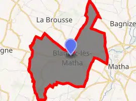
| |
 Blanzac-lès-Matha  Blanzac-lès-Matha | |
| Coordinates: 45°52′25″N 0°21′03″W | |
| Country | France |
| Region | Nouvelle-Aquitaine |
| Department | Charente-Maritime |
| Arrondissement | Saint-Jean-d'Angély |
| Canton | Matha |
| Government | |
| • Mayor (2008–2014) | Pierre Arnaud |
| Area 1 | 9.42 km2 (3.64 sq mi) |
| Population (2017-01-01)[1] | 328 |
| • Density | 35/km2 (90/sq mi) |
| Time zone | UTC+01:00 (CET) |
| • Summer (DST) | UTC+02:00 (CEST) |
| INSEE/Postal code | 17048 /17160 |
| Elevation | 23–76 m (75–249 ft) (avg. 45 m or 148 ft) |
| 1 French Land Register data, which excludes lakes, ponds, glaciers > 1 km2 (0.386 sq mi or 247 acres) and river estuaries. | |
Population
| Year | Pop. | ±% |
|---|---|---|
| 1793 | 397 | — |
| 1800 | 451 | +13.6% |
| 1806 | 419 | −7.1% |
| 1821 | 398 | −5.0% |
| 1831 | 557 | +39.9% |
| 1836 | 477 | −14.4% |
| 1841 | 491 | +2.9% |
| 1846 | 497 | +1.2% |
| 1851 | 535 | +7.6% |
| 1856 | 551 | +3.0% |
| 1861 | 547 | −0.7% |
| 1866 | 556 | +1.6% |
| 1872 | 528 | −5.0% |
| 1876 | 526 | −0.4% |
| 1881 | 495 | −5.9% |
| 1886 | 493 | −0.4% |
| 1891 | 461 | −6.5% |
| 1896 | 481 | +4.3% |
| 1901 | 409 | −15.0% |
| 1906 | 376 | −8.1% |
| 1911 | 347 | −7.7% |
| 1921 | 307 | −11.5% |
| 1926 | 292 | −4.9% |
| 1931 | 295 | +1.0% |
| 1936 | 259 | −12.2% |
| 1946 | 247 | −4.6% |
| 1954 | 273 | +10.5% |
| 1962 | 277 | +1.5% |
| 1968 | 263 | −5.1% |
| 1975 | 281 | +6.8% |
| 1982 | 268 | −4.6% |
| 1990 | 308 | +14.9% |
| 1999 | 296 | −3.9% |
| 2008 | 330 | +11.5% |
References
- "Populations légales 2017". INSEE. Retrieved 6 January 2020.
| Wikimedia Commons has media related to Blanzac-lès-Matha. |
| Authority control |
|---|
This article is issued from Wikipedia. The text is licensed under Creative Commons - Attribution - Sharealike. Additional terms may apply for the media files.