Blanzay-sur-Boutonne
Blanzay-sur-Boutonne is a commune in the Charente-Maritime department in the Nouvelle-Aquitaine region in southwestern France.
Blanzay-sur-Boutonne | |
|---|---|
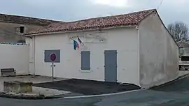 The town hall in Blanzay-sur-Boutonne | |
Location of Blanzay-sur-Boutonne 
| |
 Blanzay-sur-Boutonne  Blanzay-sur-Boutonne | |
| Coordinates: 46°03′02″N 0°25′42″W | |
| Country | France |
| Region | Nouvelle-Aquitaine |
| Department | Charente-Maritime |
| Arrondissement | Saint-Jean-d'Angély |
| Canton | Matha |
| Intercommunality | Vals de Saintonge |
| Government | |
| • Mayor (2008–2014) | Jean-Luc Duguy |
| Area 1 | 5.75 km2 (2.22 sq mi) |
| Population (2017-01-01)[1] | 82 |
| • Density | 14/km2 (37/sq mi) |
| Time zone | UTC+01:00 (CET) |
| • Summer (DST) | UTC+02:00 (CEST) |
| INSEE/Postal code | 17049 /17470 |
| Elevation | 26–57 m (85–187 ft) |
| 1 French Land Register data, which excludes lakes, ponds, glaciers > 1 km2 (0.386 sq mi or 247 acres) and river estuaries. | |
Geography
The Boutonne forms the commune's northwestern and western borders.
Population
|
|
References
- "Populations légales 2017". INSEE. Retrieved 6 January 2020.
| Wikimedia Commons has media related to Blanzay-sur-Boutonne. |
| Authority control |
|---|
This article is issued from Wikipedia. The text is licensed under Creative Commons - Attribution - Sharealike. Additional terms may apply for the media files.