Saint-Léger, Charente-Maritime
Saint-Léger is a commune in the Charente-Maritime department in southwestern France.
Saint-Léger | |
|---|---|
_mairie%252C_%C3%A9cole%252C_monument_aux_morts.JPG.webp) Town hall and war memorial | |
Location of Saint-Léger 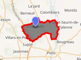
| |
 Saint-Léger  Saint-Léger | |
| Coordinates: 45°37′20″N 0°34′54″W | |
| Country | France |
| Region | Nouvelle-Aquitaine |
| Department | Charente-Maritime |
| Arrondissement | Jonzac |
| Canton | Pons |
| Government | |
| • Mayor (2008–2014) | Michel Geneau |
| Area 1 | 15.88 km2 (6.13 sq mi) |
| Population (2017-01-01)[1] | 632 |
| • Density | 40/km2 (100/sq mi) |
| Time zone | UTC+01:00 (CET) |
| • Summer (DST) | UTC+02:00 (CEST) |
| INSEE/Postal code | 17354 /17800 |
| Elevation | 7–67 m (23–220 ft) (avg. 52 m or 171 ft) |
| 1 French Land Register data, which excludes lakes, ponds, glaciers > 1 km2 (0.386 sq mi or 247 acres) and river estuaries. | |
Geography
The commune is traversed by the Seugne River.
Population
| Year | Pop. | ±% |
|---|---|---|
| 1962 | 402 | — |
| 1968 | 402 | +0.0% |
| 1975 | 375 | −6.7% |
| 1982 | 402 | +7.2% |
| 1990 | 461 | +14.7% |
| 1999 | 465 | +0.9% |
| 2008 | 571 | +22.8% |
References
- "Populations légales 2017". INSEE. Retrieved 6 January 2020.
| Wikimedia Commons has media related to Saint-Léger (Charente-Maritime). |
| Authority control |
|---|
This article is issued from Wikipedia. The text is licensed under Creative Commons - Attribution - Sharealike. Additional terms may apply for the media files.