Ashland County, Ohio
Ashland County is a county located in the northeastern portion of the U.S. state of Ohio. As of the 2010 census, the population was 53,139.[2] Its county seat is Ashland.[3] The county is named for "Ashland", the home of Senator Henry Clay near Lexington, Kentucky.[4] It was formed in 1846 from parts of Huron, Lorain, Richland and Wayne Counties.
Ashland County | |
|---|---|
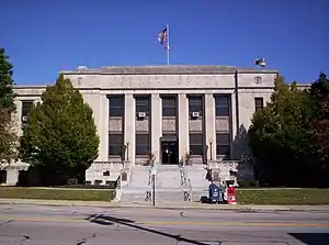 Ashland County Courthouse | |
 Seal | |
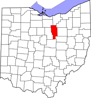 Location within the U.S. state of Ohio | |
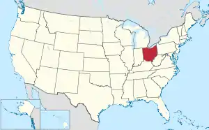 Ohio's location within the U.S. | |
| Coordinates: 40°50′N 82°16′W | |
| Country | |
| State | |
| Founded | February 24, 1846[1] |
| Named for | "Ashland", Henry Clay's home |
| Seat | Ashland |
| Largest city | Ashland |
| Area | |
| • Total | 427 sq mi (1,110 km2) |
| • Land | 423 sq mi (1,100 km2) |
| • Water | 3.8 sq mi (10 km2) 0.9%% |
| Population | |
| • Estimate (2019) | 53,484 |
| • Density | 126/sq mi (49/km2) |
| Time zone | UTC−5 (Eastern) |
| • Summer (DST) | UTC−4 (EDT) |
| Congressional district | 7th |
| Website | www |
Ashland County comprises the Ashland, OH Metropolitan Statistical Area, which is also included in the Mansfield-Ashland-Bucyrus, OH Combined Statistical Area.
History
Ashland County was formed on February 24, 1846, from portions of Huron, Lorain, Richland, and Wayne counties. Like the county seat, it was named after Ashland, the Lexington, Kentucky-area home of Henry Clay, a Kentucky senator.[5]
Geography
According to the U.S. Census Bureau, the county has a total area of 427 square miles (1,110 km2), of which 423 square miles (1,100 km2) is land and 3.8 square miles (9.8 km2) (0.9%) is water.[6]
Adjacent counties
- Lorain County (north)
- Medina County (northeast)
- Wayne County (east)
- Holmes County (southeast)
- Knox County (southwest)
- Richland County (west)
- Huron County (northwest)
Demographics
| Historical population | |||
|---|---|---|---|
| Census | Pop. | %± | |
| 1850 | 23,813 | — | |
| 1860 | 22,951 | −3.6% | |
| 1870 | 21,933 | −4.4% | |
| 1880 | 23,883 | 8.9% | |
| 1890 | 22,223 | −7.0% | |
| 1900 | 21,184 | −4.7% | |
| 1910 | 22,975 | 8.5% | |
| 1920 | 24,627 | 7.2% | |
| 1930 | 26,867 | 9.1% | |
| 1940 | 29,785 | 10.9% | |
| 1950 | 33,040 | 10.9% | |
| 1960 | 38,771 | 17.3% | |
| 1970 | 43,303 | 11.7% | |
| 1980 | 46,178 | 6.6% | |
| 1990 | 47,507 | 2.9% | |
| 2000 | 52,523 | 10.6% | |
| 2010 | 53,139 | 1.2% | |
| 2019 (est.) | 53,484 | [2][7] | 0.6% |
| U.S. Decennial Census[8] 1790-1960[9] 1900-1990[10] 1990-2000[11] 2010-2019[2] | |||
2000 census
As of the census[12] of 2000, there were 52,523 people, 19,524 households, and 14,018 families living in the county. The population density was 124 people per square mile (48/km2). There were 20,832 housing units at an average density of 49 per square mile (19/km2). The racial makeup of the county was 97.54% White, 0.81% Black or African American, 0.11% Native American, 0.55% Asian, 0.03% Pacific Islander, 0.21% from other races, and 0.76% from two or more races. 0.65% of the population were Hispanic or Latino of any race. 36.8% were of German, 17.3% American, 10.1% English and 8.8% Irish ancestry according to Census 2000. 96.1% spoke English, 1.2% German and 1.0% Spanish as their first language.
There were 19,524 households, out of which 32.50% had children under the age of 18 living with them, 59.50% were married couples living together, 8.50% had a female householder with no husband present, and 28.20% were non-families. 24.00% of all households were made up of individuals, and 10.30% had someone living alone who was 65 years of age or older. The average household size was 2.58 and the average family size was 3.06.
In the county, the population was spread out, with 25.70% under the age of 18, 10.80% from 18 to 24, 26.50% from 25 to 44, 23.00% from 45 to 64, and 13.90% who were 65 years of age or older. The median age was 36 years. For every 100 females there were 96.60 males. For every 100 females age 18 and over, there were 92.40 males.
The median income for a household in the county was $39,179, and the median income for a family was $46,306. Males had a median income of $32,585 versus $22,334 for females. The per capita income for the county was $17,308. About 7.10% of families and 9.50% of the population were below the poverty line, including 13.10% of those under age 18 and 7.50% of those age 65 or over.
2010 census
As of the 2010 United States Census, there were 53,139 people, 20,196 households, and 14,017 families living in the county.[13] The population density was 125.6 inhabitants per square mile (48.5/km2). There were 22,141 housing units at an average density of 52.3 per square mile (20.2/km2).[14] The racial makeup of the county was 97.3% white, 0.7% black or African American, 0.5% Asian, 0.2% American Indian, 0.1% Pacific islander, 0.2% from other races, and 1.0% from two or more races. Those of Hispanic or Latino origin made up 0.9% of the population.[13] In terms of ancestry, 32.7% were German, 16.1% were American, 11.2% were Irish, 10.1% were English, and 5.2% were Italian.[15]
Of the 20,196 households, 30.9% had children under the age of 18 living with them, 55.6% were married couples living together, 9.4% had a female householder with no husband present, 30.6% were non-families, and 25.3% of all households were made up of individuals. The average household size was 2.53 and the average family size was 3.02. The median age was 39.3 years.[13]
The median income for a household in the county was $44,542 and the median income for a family was $54,177. Males had a median income of $39,663 versus $31,012 for females. The per capita income for the county was $20,558. About 10.2% of families and 15.6% of the population were below the poverty line, including 26.6% of those under age 18 and 7.9% of those age 65 or over.[16]
Politics
Prior to 1912, Ashland County was a Democratic Party stronghold in presidential elections voting Republicans only once since 1856. The county was a national bellwether from 1912 to 1936, but starting with the 1940 election, the county has become a Republican Party stronghold. Lyndon B. Johnson's win in 1964 is the lone time since then that a Democrat has won the county.
_Clerk_of_Common_Pleas_Court.svg.png.webp)
| Year | Republican | Democratic | Third parties |
|---|---|---|---|
| 2020 | 73.5% 19,407 | 24.8% 6,541 | 1.7% 457 |
| 2016 | 70.7% 17,493 | 23.2% 5,740 | 6.1% 1,504 |
| 2012 | 63.8% 15,519 | 34.0% 8,281 | 2.2% 540 |
| 2008 | 60.2% 15,158 | 36.9% 9,300 | 2.9% 727 |
| 2004 | 64.9% 16,209 | 34.3% 8,576 | 0.8% 194 |
| 2000 | 63.7% 13,533 | 31.5% 6,685 | 4.9% 1,040 |
| 1996 | 52.6% 10,402 | 33.2% 6,573 | 14.2% 2,798 |
| 1992 | 47.3% 9,864 | 28.7% 5,985 | 24.0% 5,006 |
| 1988 | 67.2% 12,726 | 32.1% 6,072 | 0.7% 141 |
| 1984 | 74.4% 14,339 | 24.8% 4,786 | 0.8% 147 |
| 1980 | 62.6% 11,691 | 27.5% 5,142 | 9.9% 1,856 |
| 1976 | 56.3% 9,761 | 41.5% 7,205 | 2.2% 388 |
| 1972 | 73.0% 12,470 | 25.2% 4,302 | 1.8% 302 |
| 1968 | 62.5% 9,745 | 29.0% 4,526 | 8.5% 1,323 |
| 1964 | 46.3% 7,308 | 53.8% 8,493 | |
| 1960 | 69.7% 13,112 | 30.3% 5,700 | |
| 1956 | 73.4% 12,792 | 26.6% 4,634 | |
| 1952 | 70.4% 12,459 | 29.6% 5,244 | |
| 1948 | 56.6% 8,027 | 43.0% 6,095 | 0.5% 69 |
| 1944 | 59.5% 8,994 | 40.5% 6,130 | |
| 1940 | 52.4% 8,624 | 47.6% 7,835 | |
| 1936 | 40.1% 6,154 | 57.4% 8,818 | 2.5% 380 |
| 1932 | 46.5% 6,549 | 51.8% 7,302 | 1.7% 235 |
| 1928 | 72.3% 8,745 | 26.9% 3,256 | 0.8% 96 |
| 1924 | 52.7% 5,777 | 39.9% 4,377 | 7.4% 812 |
| 1920 | 50.6% 5,951 | 48.5% 5,705 | 0.9% 101 |
| 1916 | 37.9% 2,534 | 59.9% 4,000 | 2.2% 145 |
| 1912 | 16.2% 1,017 | 53.5% 3,364 | 30.4% 1,913 |
| 1908 | 42.7% 2,804 | 55.2% 3,627 | 2.2% 142 |
| 1904 | 44.9% 2,747 | 49.0% 2,996 | 6.1% 370 |
| 1900 | 43.1% 2,641 | 55.5% 3,399 | 1.3% 81 |
| 1896 | 42.9% 2,608 | 56.3% 3,422 | 0.8% 50 |
| 1892 | 40.6% 2,256 | 54.8% 3,042 | 4.6% 254 |
| 1888 | 42.3% 2,445 | 54.6% 3,152 | 3.1% 180 |
| 1884 | 43.2% 2,616 | 54.9% 3,325 | 1.9% 113 |
| 1880 | 46.1% 2,752 | 53.9% 3,217 | 0.1% 4 |
| 1876 | 44.1% 2,387 | 55.8% 3,021 | 0.1% 6 |
| 1872 | 47.6% 2,183 | 51.6% 2,368 | 0.8% 35 |
| 1868 | 46.8% 2,205 | 53.2% 2,504 | |
| 1864 | 48.5% 2,144 | 51.5% 2,280 | |
| 1860 | 49.1% 2,166 | 39.0% 1,720 | 12.0% 530 |
| 1856 | 47.3% 1,912 | 51.7% 2,089 | 1.0% 39 |
Transportation
The Ashland County Airport is located three nautical miles (3.5 mi, 5.6 km) northeast of the central business district of the City of Ashland.[18]
Communities

City
- Ashland (county seat)
Census-designated place
Other unincorporated communities
- Albion
- England
- Five Points
- Herefork
- Lake Fork
- McKay
- McZena
- Mohicanville
- Nankin
- Nova
- Paradise Hill
- Redhaw
- Rowsburg
- Ruggles
- Spreng
- Sullivan
- Widowville
References
- "Ohio County Profiles: Ashland County" (PDF). Ohio Department of Development. Archived from the original (PDF) on 8 May 2007. Retrieved 2007-04-28.
- "QuickFacts - Ashland County, Ohio". United States Census Bureau. Retrieved 8 April 2020.
- "Find a County". National Association of Counties. Archived from the original on 2011-05-31. Retrieved 2011-06-07.
- Taylor, William Alexander (1899). Ohio Statesmen and Annals of Progress. Press of the Westbote Company. pp. 243.
- "Ashland County". Ohio History Central. Retrieved 12 March 2014.
- "2010 Census Gazetteer Files". United States Census Bureau. August 22, 2012. Archived from the original on May 4, 2014. Retrieved February 7, 2015.
- "Population and Housing Unit Estimates". Retrieved March 26, 2020.
- "U.S. Decennial Census". United States Census Bureau. Retrieved February 7, 2015.
- "Historical Census Browser". University of Virginia Library. Retrieved February 7, 2015.
- Forstall, Richard L., ed. (March 27, 1995). "Population of Counties by Decennial Census: 1900 to 1990". United States Census Bureau. Retrieved February 7, 2015.
- "Census 2000 PHC-T-4. Ranking Tables for Counties: 1990 and 2000" (PDF). United States Census Bureau. April 2, 2001. Retrieved February 7, 2015.
- "U.S. Census website". United States Census Bureau. Retrieved 2008-01-31.
- "DP-1 Profile of General Population and Housing Characteristics: 2010 Demographic Profile Data". United States Census Bureau. Archived from the original on 2020-02-13. Retrieved 2015-12-27.
- "Population, Housing Units, Area, and Density: 2010 - County". United States Census Bureau. Archived from the original on 2020-02-13. Retrieved 2015-12-27.
- "DP02 SELECTED SOCIAL CHARACTERISTICS IN THE UNITED STATES – 2006-2010 American Community Survey 5-Year Estimates". United States Census Bureau. Archived from the original on 2020-02-13. Retrieved 2015-12-27.
- "DP03 SELECTED ECONOMIC CHARACTERISTICS – 2006-2010 American Community Survey 5-Year Estimates". United States Census Bureau. Archived from the original on 2020-02-13. Retrieved 2015-12-27.
- Leip, David. "Dave Leip's Atlas of U.S. Presidential Elections". uselectionatlas.org. Retrieved 2018-05-01.
- FAA Airport Form 5010 for 3G4 PDF. Federal Aviation Administration. effective 30 June 2011.
External links
| Wikivoyage has a travel guide for Ashland County (Ohio). |
Places adjacent to Ashland County, Ohio | ||||||||||
|---|---|---|---|---|---|---|---|---|---|---|
| ||||||||||
Municipalities and communities of Ashland County, Ohio, United States | ||
|---|---|---|
| City | Map of Ohio highlighting Ashland County | |
| Villages | ||
| Townships | ||
| CDP | ||
| Unincorporated communities | ||
| Footnotes | ‡This populated place also has portions in an adjacent county or counties | |
| ||
.svg.png.webp)
| Authority control |
|---|