Logan County, Ohio
Logan County is a county located in the west central portion of the U.S. state of Ohio. As of the 2010 census, the population was 45,858.[2] The county seat is Bellefontaine.[3] The county is named for Benjamin Logan, who fought Native Americans in the area.[4]
Logan County | |
|---|---|
 | |
 Flag  Seal | |
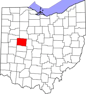 Location within the U.S. state of Ohio | |
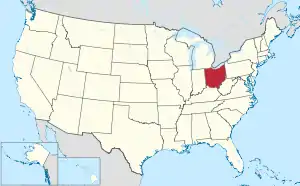 Ohio's location within the U.S. | |
| Coordinates: 40°23′N 83°46′W | |
| Country | |
| State | |
| Founded | March 1, 1818[1] |
| Named for | Benjamin Logan |
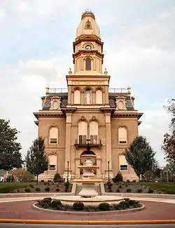
| Seat | Bellefontaine |
| Largest city | Bellefontaine |
| Area | |
| • Total | 467 sq mi (1,210 km2) |
| • Land | 458 sq mi (1,190 km2) |
| • Water | 8.3 sq mi (21 km2) 1.8%% |
| Population | |
| • Estimate (2019) | 45,672 |
| • Density | 100/sq mi (40/km2) |
| Time zone | UTC−5 (Eastern) |
| • Summer (DST) | UTC−4 (EDT) |
| Congressional district | 4th |
| Website | www |
Logan County comprises the Bellefontaine, OH Micropolitan Statistical Area, which is also included in the Columbus-Marion-Zanesville, OH Combined Statistical Area.
Geography
According to the U.S. Census Bureau, the county has a total area of 467 square miles (1,210 km2), of which 458 square miles (1,190 km2) is land and 8.3 square miles (21 km2) (1.8%) is water.[5] Campbell Hill, the highest natural point in Ohio at 1,549 feet (472 m), is located northeast of Bellefontaine.
Adjacent counties
- Hardin County (north)
- Union County (east)
- Champaign County (south)
- Shelby County (west)
- Auglaize County (northwest)
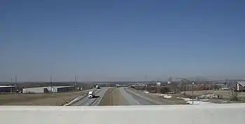
Major highways
 U.S. Route 33
 U.S. Route 68
 State Route 47
 State Route 117
 State Route 235
 State Route 245
 State Route 273
 State Route 274
 State Route 287
 State Route 292
 State Route 347
 State Route 365
 State Route 366
 State Route 368
 State Route 508
 State Route 533
 State Route 540
 State Route 559
 State Route 706
 State Route 708
 State Route 720
Demographics
| Historical population | |||
|---|---|---|---|
| Census | Pop. | %± | |
| 1820 | 3,159 | — | |
| 1830 | 6,440 | 103.9% | |
| 1840 | 14,015 | 117.6% | |
| 1850 | 19,162 | 36.7% | |
| 1860 | 20,996 | 9.6% | |
| 1870 | 23,028 | 9.7% | |
| 1880 | 26,267 | 14.1% | |
| 1890 | 27,386 | 4.3% | |
| 1900 | 30,420 | 11.1% | |
| 1910 | 30,084 | −1.1% | |
| 1920 | 30,104 | 0.1% | |
| 1930 | 28,981 | −3.7% | |
| 1940 | 29,624 | 2.2% | |
| 1950 | 31,329 | 5.8% | |
| 1960 | 34,803 | 11.1% | |
| 1970 | 35,072 | 0.8% | |
| 1980 | 39,155 | 11.6% | |
| 1990 | 42,310 | 8.1% | |
| 2000 | 46,005 | 8.7% | |
| 2010 | 45,858 | −0.3% | |
| 2019 (est.) | 45,672 | [6] | −0.4% |
| U.S. Decennial Census[7] 1790-1960[8] 1900-1990[9] 1990-2000[10] 2010-2019[2] | |||
2000 census
As of the census[11] of 2000, there were 46,005 people, 17,956 households, and 12,730 families living in the county. The population density was 100 people per square mile (39/km2). There were 21,571 housing units at an average density of 47 per square mile (18/km2). The racial makeup of the county was 96.15% White, 1.71% Black or African American, 0.20% Native American, 0.40% Asian, 0.03% Pacific Islander, 0.27% from other races, and 1.24% from two or more races. 0.72% of the population were Hispanic or Latino of any race. 96.8% spoke English, 1.0% German and 1.0% Spanish as their first language.
There were 17,956 households, out of which 33.30% had children under the age of 18 living with them, 57.00% were married couples living together, 9.50% had a female householder with no husband present, and 29.10% were non-families. 24.80% of all households were made up of individuals, and 10.30% had someone living alone who was 65 years of age or older. The average household size was 2.53 and the average family size was 3.01.
In the county, the population was spread out, with 26.70% under the age of 18, 8.20% from 18 to 24, 27.90% from 25 to 44, 23.30% from 45 to 64, and 13.90% who were 65 years of age or older. The median age was 37 years. For every 100 females there were 96.10 males. For every 100 females age 18 and over, there were 93.60 males.
The median income for a household in the county was $41,479, and the median income for a family was $47,516. Males had a median income of $37,134 versus $24,739 for females. The per capita income for the county was $18,984. About 7.10% of families and 9.30% of the population were below the poverty line, including 11.80% of those under age 18 and 8.50% of those age 65 or over.
2010 census
As of the 2010 United States Census, there were 45,858 people, 18,111 households, and 12,569 families living in the county.[12] The population density was 100.0 inhabitants per square mile (38.6/km2). There were 23,181 housing units at an average density of 50.6 per square mile (19.5/km2).[13] The racial makeup of the county was 95.3% white, 1.6% black or African American, 0.5% Asian, 0.3% American Indian, 0.3% from other races, and 1.9% from two or more races. Those of Hispanic or Latino origin made up 1.2% of the population.[12] In terms of ancestry, 30.9% were German, 13.5% were Irish, 11.5% were American, and 9.1% were English.[14]
Of the 18,111 households, 32.9% had children under the age of 18 living with them, 53.9% were married couples living together, 10.5% had a female householder with no husband present, 30.6% were non-families, and 25.5% of all households were made up of individuals. The average household size was 2.51 and the average family size was 2.98. The median age was 39.9 years.[12]
The median income for a household in the county was $46,493 and the median income for a family was $53,601. Males had a median income of $42,702 versus $29,537 for females. The per capita income for the county was $22,974. About 11.0% of families and 14.8% of the population were below the poverty line, including 25.3% of those under age 18 and 7.1% of those age 65 or over.[15]
Politics
Logan County is a strongly Republican county, having only backed Democratic Party presidential candidates twice from 1856 onward in 1912 and 1964.
| Year | Republican | Democratic | Third parties |
|---|---|---|---|
| 2020 | 76.7% 17,964 | 21.6% 5,055 | 1.7% 390 |
| 2016 | 73.5% 15,957 | 21.4% 4,647 | 5.1% 1,108 |
| 2012 | 64.3% 13,633 | 33.3% 7,062 | 2.4% 504 |
| 2008 | 62.2% 13,848 | 35.6% 7,936 | 2.2% 499 |
| 2004 | 67.6% 14,471 | 31.9% 6,825 | 0.5% 102 |
| 2000 | 64.2% 11,849 | 32.2% 5,945 | 3.6% 661 |
| 1996 | 48.6% 8,325 | 37.3% 6,397 | 14.1% 2,423 |
| 1992 | 49.8% 9,364 | 26.0% 4,889 | 24.1% 4,534 |
| 1988 | 70.7% 11,099 | 28.6% 4,484 | 0.7% 114 |
| 1984 | 76.5% 12,230 | 22.8% 3,645 | 0.7% 104 |
| 1980 | 64.9% 9,727 | 28.8% 4,319 | 6.3% 948 |
| 1976 | 59.0% 9,092 | 38.6% 5,949 | 2.3% 361 |
| 1972 | 71.1% 10,938 | 24.6% 3,786 | 4.3% 656 |
| 1968 | 56.1% 8,362 | 32.8% 4,889 | 11.1% 1,648 |
| 1964 | 44.1% 6,683 | 55.9% 8,484 | |
| 1960 | 68.2% 11,311 | 31.8% 5,279 | |
| 1956 | 72.7% 11,229 | 27.3% 4,226 | |
| 1952 | 69.8% 11,084 | 30.2% 4,793 | |
| 1948 | 61.0% 8,118 | 38.7% 5,149 | 0.3% 38 |
| 1944 | 66.7% 9,882 | 33.4% 4,944 | |
| 1940 | 60.8% 9,861 | 39.2% 6,351 | |
| 1936 | 52.6% 8,363 | 46.2% 7,353 | 1.2% 189 |
| 1932 | 52.0% 7,469 | 46.5% 6,678 | 1.4% 205 |
| 1928 | 76.6% 9,602 | 22.8% 2,858 | 0.6% 71 |
| 1924 | 61.0% 7,186 | 27.0% 3,176 | 12.0% 1,412 |
| 1920 | 63.2% 8,521 | 36.4% 4,904 | 0.4% 56 |
| 1916 | 54.8% 4,345 | 43.9% 3,483 | 1.3% 101 |
| 1912 | 27.1% 1,977 | 37.3% 2,727 | 35.6% 2,600 |
| 1908 | 58.4% 4,756 | 39.2% 3,186 | 2.4% 196 |
| 1904 | 69.2% 4,994 | 26.9% 1,939 | 3.9% 283 |
| 1900 | 60.4% 4,806 | 37.1% 2,951 | 2.5% 202 |
| 1896 | 59.6% 4,722 | 39.4% 3,125 | 1.0% 81 |
| 1892 | 57.9% 3,796 | 35.5% 2,332 | 6.6% 434 |
| 1888 | 59.3% 4,115 | 36.5% 2,533 | 4.1% 287 |
| 1884 | 58.8% 3,998 | 38.6% 2,625 | 2.6% 173 |
| 1880 | 59.2% 3,739 | 39.1% 2,468 | 1.8% 113 |
| 1876 | 58.0% 3,259 | 40.7% 2,286 | 1.4% 76 |
| 1872 | 58.7% 2,795 | 41.1% 1,955 | 0.2% 8 |
| 1868 | 61.1% 2,778 | 38.9% 1,770 | |
| 1864 | 61.9% 2,637 | 38.1% 1,626 | |
| 1860 | 59.3% 2,415 | 37.8% 1,542 | 2.9% 117 |
| 1856 | 56.8% 2,093 | 36.0% 1,328 | 7.2% 267 |
Government
Commissioners: John F. Bayliss (R), Dustin A. Wickersham (R), Anthony E. Core (R)
Auditor: Jack Reser (R)
Clerk of Courts: Barb McDonald (R) [18]
Recorder: Pat Myers (R) (Appointed July 2, 2013) [18]
Treasurer: Dara J. Wren (R)
Prosecuting Attorney: Eric Stewart (R)
Sheriff: Randall J. Dodds (R)
Engineer: Scott Coleman (R)
Coroner: Michael E. Failor D.O. (R)
Judge Court of Common Pleas: William T. Goslee (R)
Judge Court of Common Pleas Probate/Juvenile Division: Kim Kellogg-Martin (R)
Judge Court of Common Pleas Domestic Relations-Juv.-Probate Division: Dan W. Bratka (R)
Judge Municipal Court: Ann E. Beck (D)
Communities
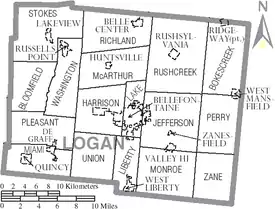
City
- Bellefontaine (county seat)
Villages
Census-designated places
Notable people
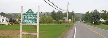
- George Bartholomew - inventor of concrete pavement
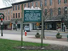
- Blue Jacket (Weyapiersenwah) - Shawnee chief
- Bethany Dillon - singer; nominee for 2004 Gospel Music Association New Artist of the Year award
- Allan W. Eckert - author
- Jim Flora - artist
- Melville J. Herskovits - anthropologist
- Kin Hubbard - cartoonist and journalist
- Samuel Johnston - professional wrestler
- Edward D. Jones - investment banker
- Austin Eldon Knowlton - architect
- William Lawrence - Republican politician involved with the attempt to impeach Andrew Johnson, creating the United States Department of Justice, helping to create the American Red Cross, and ratifying the Geneva Convention
- The Mills Brothers - entertainers
- Raymond Stanton Patton (1882–1937), rear admiral and first flag officer of the United States Coast and Geodetic Survey Corps and second Director of the United States Coast and Geodetic Survey (1929-1937)
- Norman Vincent Peale - minister and author
References
- "Ohio County Profiles: Logan County" (PDF). Ohio Department of Development. Archived from the original (PDF) on June 21, 2007. Retrieved April 28, 2007.
- "State & County QuickFacts". United States Census Bureau. Archived from the original on June 6, 2011. Retrieved February 8, 2015.
- "Find a County". National Association of Counties. Retrieved June 7, 2011.
- Gannett, Henry (1905). The Origin of Certain Place Names in the United States. U.S. Government Printing Office. p. 189.
- "2010 Census Gazetteer Files". United States Census Bureau. August 22, 2012. Archived from the original on May 4, 2014. Retrieved February 8, 2015.
- "Population and Housing Unit Estimates". Retrieved March 26, 2020.
- "U.S. Decennial Census". United States Census Bureau. Retrieved February 8, 2015.
- "Historical Census Browser". University of Virginia Library. Retrieved February 8, 2015.
- Forstall, Richard L., ed. (March 27, 1995). "Population of Counties by Decennial Census: 1900 to 1990". United States Census Bureau. Retrieved February 8, 2015.
- "Census 2000 PHC-T-4. Ranking Tables for Counties: 1990 and 2000" (PDF). United States Census Bureau. April 2, 2001. Retrieved February 8, 2015.
- "U.S. Census website". United States Census Bureau. Retrieved January 31, 2008.
- "DP-1 Profile of General Population and Housing Characteristics: 2010 Demographic Profile Data". United States Census Bureau. Archived from the original on February 13, 2020. Retrieved December 27, 2015.
- "Population, Housing Units, Area, and Density: 2010 - County". United States Census Bureau. Archived from the original on February 13, 2020. Retrieved December 27, 2015.
- "DP02 SELECTED SOCIAL CHARACTERISTICS IN THE UNITED STATES – 2006-2010 American Community Survey 5-Year Estimates". United States Census Bureau. Archived from the original on February 13, 2020. Retrieved December 27, 2015.
- "DP03 SELECTED ECONOMIC CHARACTERISTICS – 2006-2010 American Community Survey 5-Year Estimates". United States Census Bureau. Archived from the original on February 13, 2020. Retrieved December 27, 2015.
- Leip, David. "Dave Leip's Atlas of U.S. Presidential Elections". uselectionatlas.org. Retrieved May 2, 2018.
- "Ohio Historical Election Results". Retrieved January 21, 2021.
- Logan County Board of Elections (PDF) http://www.electionsonthe.net/oh/logan/electoff/county.pdf. Retrieved June 16, 2015. Missing or empty
|title=(help)
External links
Places adjacent to Logan County, Ohio | ||||||||||
|---|---|---|---|---|---|---|---|---|---|---|
| ||||||||||
Municipalities and communities of Logan County, Ohio, United States | ||
|---|---|---|
| City | Map of Ohio highlighting Logan County | |
| Villages | ||
| Townships | ||
| CDPs | ||
| Unincorporated communities | ||
| Ghost towns | ||
| Footnotes | ‡This populated place also has portions in an adjacent county or counties | |
| ||
.svg.png.webp)
| Authority control |
|---|