Rural Municipality of Waverley No. 44
The Rural Municipality of Waverley No. 44 (2016 population: 336) is a rural municipality (RM) in the Canadian province of Saskatchewan within Census Division No. 3 and SARM Division No. 2. Located in the southwest portion of the province, it is adjacent to the United States border, neighbouring Valley County in Montana.
Waverley No. 44 | |
|---|---|
| Rural Municipality of Waverley No. 44 | |
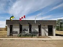 R.M. office in Glentworth | |
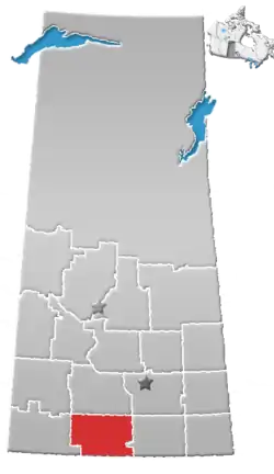
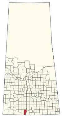 Location of the RM of Waverley No. 44 in Saskatchewan | |
| Coordinates: 49.275°N 106.568°W[1] | |
| Country | Canada |
| Province | Saskatchewan |
| Census division | 3 |
| SARM division | 2 |
| Federal riding | Cypress Hills—Grasslands |
| Provincial riding | Wood River |
| Formed[2] | February 1, 1913 |
| Government | |
| • Reeve | Lloyd Anderson |
| • Governing body | RM of Waverley No. 44 Council |
| • Administrator | Deidre Nelson |
| • Office location | Glentworth |
| Area (2016)[4] | |
| • Land | 1,429.3 km2 (551.9 sq mi) |
| Population (2016)[4] | |
| • Total | 336 |
| • Density | 0.2/km2 (0.5/sq mi) |
| Time zone | CST |
| • Summer (DST) | CST |
| Postal code | S0H 1V0 |
| Area code(s) | 306 and 639 |
History
The RM of Waverley No. 44 incorporated as a rural municipality on February 1, 1913.[2]
Geography
Communities and localities
The following unincorporated communities are within the RM.
- Localities
Demographics
In the 2016 Census of Population conducted by Statistics Canada, the RM of Waverley No. 44 recorded a population of 336 living in 143 of its 160 total private dwellings, a -6.4% change from its 2011 population of 359. With a land area of 1,429.3 km2 (551.9 sq mi), it had a population density of 0.2/km2 (0.6/sq mi) in 2016.[4]
In the 2011 Census of Population, the RM of Waverley No. 44 recorded a population of 359, a -14.9% change from its 2006 population of 422. With a land area of 1,429.3 km2 (551.9 sq mi), it had a population density of 0.3/km2 (0.7/sq mi) in 2011.[7]
Attractions
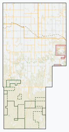
The RM includes the eastern portion (or "East Block") of Grasslands National Park.
Government
The RM of Waverley No. 44 is governed by an elected municipal council and an appointed administrator that meets on the second Tuesday of every month.[3] The reeve of the RM is Lloyd Anderson while its administrator is Deidre Nelson.[3] The RM's office is located in Glentworth.[3]
References
- "Pre-packaged CSV files - CGN, Canada/Province/Territory (cgn_sk_csv_eng.zip)". Government of Canada. July 24, 2019. Retrieved May 23, 2020.
- "Rural Municipality Incorporations (Alphabetical)". Saskatchewan Ministry of Municipal Affairs. Archived from the original on April 21, 2011. Retrieved May 9, 2020.
- "Municipality Details: RM of Waverley No. 44". Government of Saskatchewan. Retrieved May 21, 2020.
- "Population and dwelling counts, for Canada, provinces and territories, and census subdivisions (municipalities), 2016 and 2011 censuses – 100% data (Saskatchewan)". Statistics Canada. February 8, 2017. Retrieved May 1, 2020.
- "Saskatchewan Census Population" (PDF). Saskatchewan Bureau of Statistics. Archived from the original (PDF) on September 24, 2015. Retrieved May 9, 2020.
- "Saskatchewan Census Population". Saskatchewan Bureau of Statistics. Retrieved May 9, 2020.
- "Population and dwelling counts, for Canada, provinces and territories, and census subdivisions (municipalities), 2011 and 2006 censuses (Saskatchewan)". Statistics Canada. June 3, 2019. Retrieved May 1, 2020.
Places adjacent to Rural Municipality of Waverley No. 44 | |
|---|---|