Rural Municipality of Hart Butte No. 11
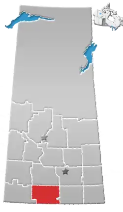
The Rural Municipality of Hart Butte No. 11 (2016 population: 252) is a rural municipality (RM) in the Canadian province of Saskatchewan within Census Division No. 3 and SARM Division No. 2. Located in the south-central portion of the province, it is adjacent to the United States boundary, neighbouring Daniels County in Montana.
Hart Butte No. 11 | |
|---|---|
| Rural Municipality of Hart Butte No. 11 | |
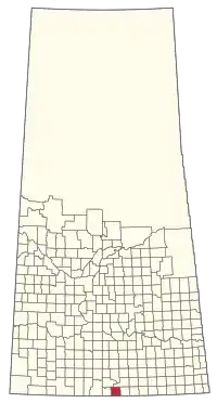 Location of the RM of Hart Butte No. 11 in Saskatchewan | |
| Coordinates: 49.142°N 105.474°W[1] | |
| Country | Canada |
| Province | Saskatchewan |
| Census division | 3 |
| SARM division | 2 |
| Federal riding | Souris--Moose Mountain |
| Provincial riding | Wood River |
| Formed[2] | January 1, 1913 |
| Government | |
| • Reeve | Craig Eger |
| • Governing body | RM of Hart Butte No. 11 Council |
| • Administrator | Leanne Totton |
| • Office location | Coronach |
| Area (2016)[4] | |
| • Land | 841.98 km2 (325.09 sq mi) |
| Population (2016)[4] | |
| • Total | 252 |
| • Density | 0.3/km2 (0.8/sq mi) |
| Time zone | CST |
| • Summer (DST) | CST |
| Postal code | S0H 0Z0 |
| Area code(s) | 306 and 639 |
History
The RM of Hart Butte No. 11 incorporated as a rural municipality on January 1, 1913.[2]
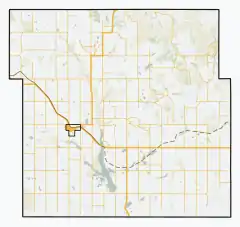
Geography
Communities and localities
The following urban municipalities are surrounded by the RM.
The following unincorporated communities are within the RM.
- Localities
Demographics
In the 2016 Census of Population conducted by Statistics Canada, the RM of Hart Butte No. 11 recorded a population of 252 living in 97 of its 100 total private dwellings, a -4.5% change from its 2011 population of 264. With a land area of 841.98 km2 (325.09 sq mi), it had a population density of 0.3/km2 (0.8/sq mi) in 2016.[4]
In the 2011 Census of Population, the RM of Hart Butte No. 11 recorded a population of 264, a -2.9% change from its 2006 population of 272. With a land area of 841.98 km2 (325.09 sq mi), it had a population density of 0.3/km2 (0.8/sq mi) in 2011.[7]
Government
The RM of Hart Butte No. 11 is governed by an elected municipal council and an appointed administrator that meets on the second Thursday of every month.[3] The reeve of the RM is Craig Eger while its administrator is Leanne Totton.[3] The RM's office is located in Coronach.[3]
Transportation
The RM is a part owner of the Fife Lake Railway.[8]
References
- "Pre-packaged CSV files - CGN, Canada/Province/Territory (cgn_sk_csv_eng.zip)". Government of Canada. July 24, 2019. Retrieved May 23, 2020.
- "Rural Municipality Incorporations (Alphabetical)". Saskatchewan Ministry of Municipal Affairs. Archived from the original on April 21, 2011. Retrieved May 9, 2020.
- "Municipality Details: RM of Hart Butte No. 11". Government of Saskatchewan. Retrieved May 21, 2020.
- "Population and dwelling counts, for Canada, provinces and territories, and census subdivisions (municipalities), 2016 and 2011 censuses – 100% data (Saskatchewan)". Statistics Canada. February 8, 2017. Retrieved May 1, 2020.
- "Saskatchewan Census Population" (PDF). Saskatchewan Bureau of Statistics. Archived from the original (PDF) on September 24, 2015. Retrieved May 9, 2020.
- "Saskatchewan Census Population". Saskatchewan Bureau of Statistics. Retrieved May 9, 2020.
- "Population and dwelling counts, for Canada, provinces and territories, and census subdivisions (municipalities), 2011 and 2006 censuses (Saskatchewan)". Statistics Canada. June 3, 2019. Retrieved May 1, 2020.
- Fife Lake Railway Project Best Practice Report
Places adjacent to Rural Municipality of Hart Butte No. 11 | |
|---|---|