Bagert
Bagert is a commune in the department of Ariège in the Occitanie region of south-western France.
Bagert | |
|---|---|
Location of Bagert 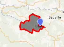
| |
 Bagert  Bagert | |
| Coordinates: 43°04′44″N 1°04′59″E | |
| Country | France |
| Region | Occitanie |
| Department | Ariège |
| Arrondissement | Saint-Girons |
| Canton | Portes du Couserans |
| Intercommunality | Volvestre ariégeois |
| Government | |
| • Mayor (2014–2020) | Jean-Claude Dubois |
| Area 1 | 3.28 km2 (1.27 sq mi) |
| Population | 38 |
| • Density | 12/km2 (30/sq mi) |
| Time zone | UTC+01:00 (CET) |
| • Summer (DST) | UTC+02:00 (CEST) |
| INSEE/Postal code | 09033 /09230 |
| Elevation | 340–563 m (1,115–1,847 ft) (avg. 500 m or 1,600 ft) |
| 1 French Land Register data, which excludes lakes, ponds, glaciers > 1 km2 (0.386 sq mi or 247 acres) and river estuaries. | |
The inhabitants of the commune are known as Bagertois or Bagertoises.[2]
Geography
The commune is situated in the former province of Volvestre some 16 km (9.9 mi) north-west of Saint-Girons and 6 km north of Mercenac. Access to the commune is by the D335 road which branches off the D35 east of Betchat and passes through the heart of the commune then continues south-east to join the D3. The commune is predominantly forest with some farmland.[3]
The Ruisseau de Sournet forms the northern border of the commune as it flows west then north to join the Lens. The Ruisseau de Belloc forms part of the south-eastern border of the commune then flows north-west through the south of the commune to eventually join the Lens.[3]
Neighbouring communes and villages
Places adjacent to Bagert | ||||||||||
|---|---|---|---|---|---|---|---|---|---|---|
| ||||||||||
Administration
| From | To | Name | Party | Position |
|---|---|---|---|---|
| 2001 | 2008 | Alain Talarmin | ||
| 2008 | 2014 | André Marsan | ||
| 2014 | 2020 | Jean-Claude Dubois |
(Not all data is known)
Demography
In 2017 the commune had 38 inhabitants.
|
| ||||||||||||||||||||||||||||||||||||||||||||||||||||||||||||||||||||||||||||||||||||||||||||||||||||||||||||||||||
| Source: EHESS[6] and INSEE[7] | |||||||||||||||||||||||||||||||||||||||||||||||||||||||||||||||||||||||||||||||||||||||||||||||||||||||||||||||||||
See also
External links
- Bagert on Lion1906
- Bagert on Géoportail, National Geographic Institute (IGN) website (in French)
- Bagert on the 1750 Cassini Map
References
- "Populations légales 2017". INSEE. Retrieved 6 January 2020.
- Inhabitants of Ariège (in French)
- Google Maps
- Géoportail, IGN (in French)
- List of Mayors of France (in French)
- Des villages de Cassini aux communes d'aujourd'hui: Commune data sheet Bagert, EHESS. (in French)
- Population en historique depuis 1968, INSEE
| Wikimedia Commons has media related to Bagert. |