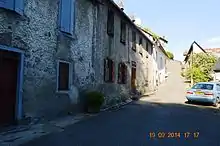
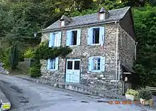
Arrout
Arrout is a commune in the Ariège department in the Occitanie region of south-western France.
Arrout | |
|---|---|
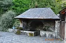
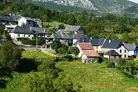 A general view of Arrout | |
.svg.png.webp) Coat of arms | |
Location of Arrout 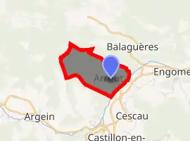
| |
 Arrout  Arrout | |
| Coordinates: 42°56′44″N 1°01′43″E | |
| Country | France |
| Region | Occitanie |
| Department | Ariège |
| Arrondissement | Saint-Girons |
| Canton | Couserans Ouest |
| Intercommunality | CC Couserans - Pyrénées |
| Government | |
| • Mayor (2014-2020) | Christiane Vignau |
| Area 1 | 3.02 km2 (1.17 sq mi) |
| Population (2017-01-01)[1] | 85 |
| • Density | 28/km2 (73/sq mi) |
| Time zone | UTC+01:00 (CET) |
| • Summer (DST) | UTC+02:00 (CEST) |
| INSEE/Postal code | 09018 /09800 |
| Elevation | 480–959 m (1,575–3,146 ft) (avg. 600 m or 2,000 ft) |
| 1 French Land Register data, which excludes lakes, ponds, glaciers > 1 km2 (0.386 sq mi or 247 acres) and river estuaries. | |
The inhabitants of the commune are known as Arrotois or Arrotoises[2]
Geography
Arrout is a commune in the Pyrenees mountains in the former province of Couserans some 12 km south-west of Saint-Girons and 3 km north of Castillon-en-Couserans. Access to the commune is by a country road from the end of the D404, which comes from Cescau in the south-east, to the village or by the Chemin d'Arrout from Audressein in the south. There is also a country road from Alas in the north-east. The commune is rugged and heavily forested throughout.[3]
The Lez river forms the south-eastern border of the commune as it flows north-east to join the Salat at Saint-Girons. The Cayssau stream rises in the north-west and forms the north-western border before joining the Ruisseau de Lachein. The Ruisseau de Lasquert rises in the centre of the commune and flows north-east to join the Ruisseau de Lachein which flows south-west to join the Lez.[3]
Neighbouring communes and villages
Places adjacent to Arrout | ||||||||||
|---|---|---|---|---|---|---|---|---|---|---|
| ||||||||||
Heraldry
Arms of Arrout |
Blazon: Quarterly, 1 and 4 Azure with a roundel of Or; 2 and 3 Argent with an eagle of Sable. |
Administration
List of Successive Mayors[4]
| From | To | Name | Party | Position |
|---|---|---|---|---|
| 2001 | 2010 | Georges Garié | ||
| 2010 | 2020 | Christiane Vignau |
(Not all data is known)
Demography
In 2017 the commune had 85 inhabitants.
|
| ||||||||||||||||||||||||||||||||||||||||||||||||||||||||||||||||||||||||||||||||||||||||||||||||||||||||||||||||||
| Source: EHESS[5] and INSEE[6] | |||||||||||||||||||||||||||||||||||||||||||||||||||||||||||||||||||||||||||||||||||||||||||||||||||||||||||||||||||
Culture and Heritage
Arrout is one of the communes who received the Green Star of Esperanto from Esperanto info, an award given to mayors of communes who take a census of Esperanto speakers.
See also
References
- "Populations légales 2017". INSEE. Retrieved 6 January 2020.
- Inhabitants of Ariège (in French)
- Google Maps
- List of Mayors of France (in French)
- Données Cassini, EHESS
- Population en historique depuis 1968, INSEE
- Ministry of Culture, Palissy PM09000034 Chalice with Paten (in French)

- Ministry of Culture, Palissy PM09000033 Ciborium (in French)
- Ministry of Culture, Palissy PM09000021 Templar door (in French)
External links
- Arrout on the National Geographic Institute website (in French)
- Arrout official website (in French)
- Arrout on Lion1906
- Arrout on Géoportail, National Geographic Institute (IGN) website (in French)
- Arrout on the 1750 Cassini Map
| Wikimedia Commons has media related to Arrout. |