Saint-Lizier
Saint-Lizier (Occitan: Sent Líser) is a commune in the Ariège department in southwestern France, situated on the river Salat.
Saint-Lizier | |
|---|---|
 Saint-Lizier cloister | |
 Coat of arms | |
Location of Saint-Lizier 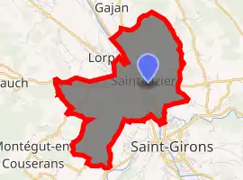
| |
 Saint-Lizier  Saint-Lizier | |
| Coordinates: 43°00′10″N 1°08′15″E | |
| Country | France |
| Region | Occitanie |
| Department | Ariège |
| Arrondissement | Saint-Girons |
| Canton | Portes du Couserans |
| Government | |
| • Mayor (2008–2014) | Étienne Dedieu |
| Area 1 | 9.01 km2 (3.48 sq mi) |
| Population (2017-01-01)[1] | 1,418 |
| • Density | 160/km2 (410/sq mi) |
| Time zone | UTC+01:00 (CET) |
| • Summer (DST) | UTC+02:00 (CEST) |
| INSEE/Postal code | 09268 /09190 |
| Elevation | 368–578 m (1,207–1,896 ft) (avg. 484 m or 1,588 ft) |
| 1 French Land Register data, which excludes lakes, ponds, glaciers > 1 km2 (0.386 sq mi or 247 acres) and river estuaries. | |
History
Saint-Lizier has a rich history stretching back to pre Gallo-Roman times. In 72 BC, Pompey, returning from his triumphs in Spain against Sertorius, stopped here. He gathered together the ancient tribes of the area under the name Consorani. The ramparts seen today date from 3rd century AD and enclose the oppidum.
During the fifth century the citadel became an episcopal see, the oldest in the Ariège area. Its first bishop is thought to have been Saint Valier. The town is named in honor of its 6th Century bishop Lycerius, canonized as Saint Lizier, a bishop who participated in the Council of Agde in 506. The town has two former cathedrals: Saint-Lizier Cathedral (now the parish church) and Notre-Dame-de-la-Sède Cathedral.
Population
Inhabitants of Saint-Lizier are called Licérois.
| Year | Pop. | ±% |
|---|---|---|
| 1962 | 1,635 | — |
| 1968 | 1,695 | +3.7% |
| 1975 | 1,719 | +1.4% |
| 1982 | 1,855 | +7.9% |
| 1990 | 1,646 | −11.3% |
| 1999 | 1,592 | −3.3% |
| 2008 | 1,466 | −7.9% |
See also
References
- "Populations légales 2017". INSEE. Retrieved 6 January 2020.
| Wikimedia Commons has media related to Saint-Lizier. |
| Wikisource has the text of the 1911 Encyclopædia Britannica article St Lizier-de-Couserans. |
| Authority control |
|---|