La Bastide-de-Lordat
La Bastide-de-Lordat is a commune in the Ariège department in the Occitanie region of south-western France.[2]
La Bastide-de-Lordat | |
|---|---|
.svg.png.webp) Coat of arms | |
Location of La Bastide-de-Lordat 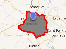
| |
 La Bastide-de-Lordat  La Bastide-de-Lordat | |
| Coordinates: 43°08′41″N 1°42′48″E | |
| Country | France |
| Region | Occitanie |
| Department | Ariège |
| Arrondissement | Pamiers |
| Canton | Portes d'Ariège |
| Intercommunality | Pays de Pamiers |
| Government | |
| • Mayor (2014–2020) | Jacqueline Freyche-Pagiarno |
| Area 1 | 5.97 km2 (2.31 sq mi) |
| Population (2017-01-01)[1] | 286 |
| • Density | 48/km2 (120/sq mi) |
| Time zone | UTC+01:00 (CET) |
| • Summer (DST) | UTC+02:00 (CEST) |
| INSEE/Postal code | 09040 /09700 |
| Elevation | 249–315 m (817–1,033 ft) (avg. 300 m or 980 ft) |
| 1 French Land Register data, which excludes lakes, ponds, glaciers > 1 km2 (0.386 sq mi or 247 acres) and river estuaries. | |
The inhabitants of the commune are known as Bastidiens or Bastidiennes.[3]
Geography
La Bastide-de-Lordat is in the Pamiers urban area some 8 km east by north-east of Pamiers and 5 km north of Les Pujols. Access to the commune is by the D11 road from Pamiers which enters the west of the commune then turns north continuing to Belpech, changing to the D102 at the departmental border. Access to the village is by the D430 from Trémoulet in the north, by the D30 from Saint-Amadou in the south, and by the D6 from Lapenne in the east. The D30 continues past the village north-west to Montaut. The commune is almost entirely farmland with a few small patches of forest.[4][5]
The Hers river forms the whole eastern border of the commune as it flows north to join the Ariege near Cintegabelle. The Estaut stream forms the whole western border of the commune as it flows north to join the Hers north-west of Belpech.[4][5]
Neighbouring communes and villages[4] | ||||||||||
|---|---|---|---|---|---|---|---|---|---|---|
| ||||||||||
History
La Bastide-de-Lordat appears as la Baftide Garderenoud on the 1750 Cassini Map[6] and as la Bastide on the 1790 version.[7]
Heraldry
Arms of La Bastide-de-Lordat |
Blazon: Or, a chevron fracted Sable. |
Administration
| From | To | Name | Party | Position |
|---|---|---|---|---|
| 2001 | 2004 | Francis Olivetti | ||
| 2004 | 2008 | Marie-Claude Pagès | ||
| 2008 | 2014 | Frédéric Eychenne | ||
| 2014 | 2020 | Jacqueline Freyche-Pagiarno |
(Not all data is known)
Demography
In 2017 the commune had 286 inhabitants.
|
| ||||||||||||||||||||||||||||||||||||||||||||||||||||||||||||||||||||||||||||||||||||||||||||||||||||||||||||||||||
| Source: EHESS[9] and INSEE[10] | |||||||||||||||||||||||||||||||||||||||||||||||||||||||||||||||||||||||||||||||||||||||||||||||||||||||||||||||||||
Culture and heritage
The commune has a very large number of items that are registered as historical objects - mostly in the Church of Saint Etienne but with other objects in the Town Hall and the Cemetery. For a complete list of historical objects together with links to descriptions (in French) and a few photos click here.
Civil heritage
The War Memorial (1927)![]() is registered as an historical monument.[11]
is registered as an historical monument.[11]
Religious heritage
The commune has several religious buildings and sites that are registered as historical monuments:
See also
References
- "Populations légales 2017". INSEE. Retrieved 6 January 2020.
- La Bastide-de-Lordat on Lion1906
- Inhabitants of Midi-Pyrénées (in French)
- La Bastide-de-Lordat on Google Maps
- La Bastide-de-Lordat on the Géoportail from National Geographic Institute (IGN) website (in French)
- la Baftide Garderenoud on the 1750 Cassini Map
- la Bastide on the 1790 Cassini Map
- List of Mayors of France (in French)
- Données Cassini, EHESS
- Population en historique depuis 1968, INSEE
- Ministry of Culture, Mérimée IA09000073 War Memorial (in French)
- Ministry of Culture, Mérimée IA09000156 Cemetery (in French)
- Ministry of Culture, Mérimée IA09000271 Delquié Family Funeral Chapel (in French)
- Ministry of Culture, Mérimée IA09000221 Astre Family Funeral Chapel (in French)
- Ministry of Culture, Mérimée IA09000201 Castel-Maury Family Tomb (in French)
- Ministry of Culture, Mérimée IA09000003 Parish Church of Saint-Etienne (in French)
| Wikimedia Commons has media related to La Bastide-de-Lordat. |