Balaguères
Balaguères is a commune in the Ariège department in the Occitanie region of south-western France.
Balaguères | |
|---|---|
Location of Balaguères 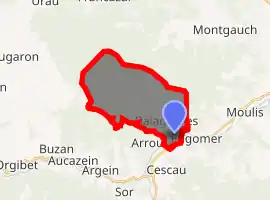
| |
 Balaguères  Balaguères | |
| Coordinates: 42°57′02″N 1°02′40″E | |
| Country | France |
| Region | Occitanie |
| Department | Ariège |
| Arrondissement | Saint-Girons |
| Canton | Couserans Ouest |
| Intercommunality | Couserans-Pyrénées |
| Government | |
| • Mayor (2020–2026) | Jean-Claude Roques |
| Area 1 | 17.84 km2 (6.89 sq mi) |
| Population (2017-01-01)[1] | 197 |
| • Density | 11/km2 (29/sq mi) |
| Time zone | UTC+01:00 (CET) |
| • Summer (DST) | UTC+02:00 (CEST) |
| INSEE/Postal code | 09035 /09800 |
| Elevation | 467–1,253 m (1,532–4,111 ft) (avg. 475 m or 1,558 ft) |
| 1 French Land Register data, which excludes lakes, ponds, glaciers > 1 km2 (0.386 sq mi or 247 acres) and river estuaries. | |
The inhabitants of the commune are known as Balaguérois or Balaguéroises.[2]
Geography
Balaguères is located some 4 km north-east of Audressein and 12 km south-west of Saint-Girons in the Parc naturel régional des Pyrénées ariégeoises. The north-west border of the commune is also the departmental border between Ariège and Haute-Garonne. Access to the commune is by the D618 road from Engomer in the east which passes through the south of the commune and continues south-west to Audressein. Access to the main village of Alas is by the D204A from Engomer and several local roads. The D204 goes north-west from the village through the hamlet of Agert to the hamlet of Balagué in the commune. The commune is farmland in the valley and forested on the mountain slopes.[3]
The Lez river flows through the south of the commune and the village from south-west to east and continues east then north-east to join the Salat at Saint-Girons. The Ruisseau de Lachein flows from the north-west through the commune, gathering several tributaries, to join the Lez at the village.[3]
History
Balagué, Agert, and Alas were all part of the lordship of Aspet in the 12th century together with Engomer, Montgauch, Bareilles, and Mauvezin de Prat. This lordship became a powerful Barony in the Middle Ages. On 12 December 1642 Guy d'Encausse, Lord of Labastide (near Rieucazé) purchased Alas-Balagué and gave it to Jean-Jacques de Solan. By decree in April 1667 King Louis XIV ordered the purchase of 18 parishes that had been committed in 1642 and 1643. They all returned to the Crown lands of France. Later, however, some were sold again (Castelbiague, Pointis-Inard, Alas-Agert-Balagué). Others remained in paréage[Note 1] with the king: Affis (His), Arbas, Ganties, Mauvezin, Montastruc, and Rouède. The rest remained permanently in the hands of the king as sole lord: Aspet, Chein, Escaich, Estadens, Montgauch-Bareilles, and Saleich.
Administration
| From | To | Name |
|---|---|---|
| 1792 | 1793 | François Antras |
| 1793 | 1795 | Joseph Anglade |
| 1795 | 1798 | Raymond Cheil |
| 1798 | 1800 | François Cazale |
| 1800 | 1815 | Joseph de Castet |
| 1815 | 1818 | Raymond Cheil |
| 1818 | 1821 | Raymond Roque |
| 1821 | 1822 | Joseph de Castet |
| 1822 | 1830 | Guillaume Joseph de Castet |
| 1830 | 1835 | Joseph Charles Arnaudi |
| 1835 | 1837 | Joseph Loze |
| 1837 | 1840 | Raymond Arasse |
| 1840 | 1848 | Antoine Cabau |
| 1848 | 1853 | Jean Saint-Martin |
| 1853 | 1861 | Raymond Roque |
| 1861 | 1908 | Maurice Morere |
| 1908 | 1912 | Raymond Anere |
| 1912 | 1914 | Henry Morere |
| 1914 | 1919 | François Gradit |
| 1919 | 1920 | Henry Morere |
| 1920 | 1925 | François Gradit |
| 1925 | 1929 | Pierre Lafont |
| 1929 | 1936 | Joseph Anglade |
- Mayors from 1936
| From | To | Name | Party | Position |
|---|---|---|---|---|
| 1936 | 1944 | Jean Arasse | ||
| 1944 | 1966 | Pierre Founeau | ||
| 1966 | 1977 | Joseph Tignous | ||
| 1977 | 2020 | Henri Anrieu |
(Not all data is known)
Demography
In 2017 the commune had 197 inhabitants.
|
| ||||||||||||||||||||||||||||||||||||||||||||||||||||||||||||||||||||||||||||||||||||||||||||||||||||||||||||||||||
| Source: EHESS[5] and INSEE[6] | |||||||||||||||||||||||||||||||||||||||||||||||||||||||||||||||||||||||||||||||||||||||||||||||||||||||||||||||||||
Culture and heritage
Cultural distinctions
Balaguères is one of the communes that have received the Esperanto Green Star, a distinction awarded to mayors of communes who identify with the speakers of the constructed language of Esperanto.
Balaguères was one of the filming locations for the film: The Return of Martin Guerre in 1982 with Nathalie Baye, Gérard Depardieu, and Bernard-Pierre Donnadieu.
Religious heritage
- The Church of Agert contains two items that are registered as historical objects:
- The Church of Alas contains four items that are registered as historical objects:
Environmental heritage
- The Réseau Paloume, a natural cavity at more than 750 m altitude.
See also
Notes
- A feudal contract between two or more lords giving them equal rights
References
- "Populations légales 2017". INSEE. Retrieved 6 January 2020.
- Inhabitants of Ariège (in French)
- Google Maps
- List of Mayors of France (in French)
- Des villages de Cassini aux communes d'aujourd'hui: Commune data sheet Balaguères, EHESS. (in French)
- Population en historique depuis 1968, INSEE
- Ministry of Culture, Palissy PM09000076 Ciborium (in French)

- Ministry of Culture, Palissy PM09000075 Chalice (in French)
- Ministry of Culture, Palissy PM09000074 Ciborium (in French)
- Ministry of Culture, Palissy PM09000071 Framed Painting: The Virgin and child donating a rosary to Saints Dominic and Catherine of Sienna (in French)
- Ministry of Culture, Palissy PM09000073 Chalice with Paten (in French)
- Ministry of Culture, Palissy PM09000072 Confessional (in French)
External links
- Balaguères on Lion1906
- Balaguères on Géoportail, National Geographic Institute (IGN) website (in French)
- Balagué, Agert, and Alas on the 1750 Cassini Map
| Wikimedia Commons has media related to Balaguères. |